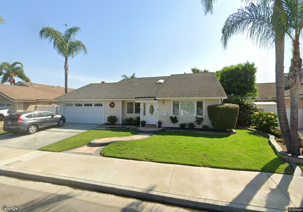
20062 N New Britain Ln Huntington Beach, CA 92646
Southeast NeighborhoodEstimated Value: $1,576,000 - $1,962,000
4
Beds
2
Baths
2,239
Sq Ft
$778/Sq Ft
Est. Value
About This Home
This home is located at 20062 N New Britain Ln, Huntington Beach, CA 92646 and is currently estimated at $1,741,205, approximately $777 per square foot. 20062 N New Britain Ln is a home located in Orange County with nearby schools including S.A. Moffett Elementary School, Isaac L. Sowers Middle School, and Edison High School.
Ownership History
Date
Name
Owned For
Owner Type
Purchase Details
Closed on
Oct 17, 2024
Sold by
Hill Alan R and Hill Kathryn D
Bought by
Hill Family Trust and Hill
Current Estimated Value
Purchase Details
Closed on
Apr 24, 1996
Sold by
Weeks Richard E and Weeks Linda B
Bought by
Hill Alan R and Hill Kathryn D
Home Financials for this Owner
Home Financials are based on the most recent Mortgage that was taken out on this home.
Original Mortgage
$207,000
Interest Rate
5.62%
Purchase Details
Closed on
Mar 15, 1993
Sold by
Weeks Richard E
Bought by
Weeks Richard E and Weeks Linda B
Home Financials for this Owner
Home Financials are based on the most recent Mortgage that was taken out on this home.
Original Mortgage
$189,000
Interest Rate
7.83%
Create a Home Valuation Report for This Property
The Home Valuation Report is an in-depth analysis detailing your home's value as well as a comparison with similar homes in the area
Home Values in the Area
Average Home Value in this Area
Purchase History
| Date | Buyer | Sale Price | Title Company |
|---|---|---|---|
| Hill Family Trust | -- | None Listed On Document | |
| Hill Alan R | $266,500 | Old Republic Title Company | |
| Weeks Richard E | -- | North American Title Company |
Source: Public Records
Mortgage History
| Date | Status | Borrower | Loan Amount |
|---|---|---|---|
| Previous Owner | Hill Alan R | $207,000 | |
| Previous Owner | Weeks Richard E | $189,000 |
Source: Public Records
Tax History Compared to Growth
Tax History
| Year | Tax Paid | Tax Assessment Tax Assessment Total Assessment is a certain percentage of the fair market value that is determined by local assessors to be the total taxable value of land and additions on the property. | Land | Improvement |
|---|---|---|---|---|
| 2025 | $5,152 | $447,554 | $311,439 | $136,115 |
| 2024 | $5,152 | $438,779 | $305,332 | $133,447 |
| 2023 | $5,034 | $430,176 | $299,345 | $130,831 |
| 2022 | $4,900 | $421,742 | $293,476 | $128,266 |
| 2021 | $4,809 | $413,473 | $287,722 | $125,751 |
| 2020 | $4,777 | $409,234 | $284,772 | $124,462 |
| 2019 | $4,720 | $401,210 | $279,188 | $122,022 |
| 2018 | $4,647 | $393,344 | $273,714 | $119,630 |
| 2017 | $4,584 | $385,632 | $268,347 | $117,285 |
| 2016 | $4,384 | $378,071 | $263,085 | $114,986 |
| 2015 | $4,340 | $372,393 | $259,134 | $113,259 |
| 2014 | $4,248 | $365,099 | $254,058 | $111,041 |
Source: Public Records
Map
Nearby Homes
- 20162 S New Britain Ln
- 8472 Norfolk Dr
- 20302 Tidepool Cir Unit 204
- 20251 Lighthouse Ln
- 8401 Dallas Cir
- 8122 Seawater Dr
- 20251 Cape Coral Ln Unit 315
- 8342 Seaport Dr
- 20301 Bluffside Cir Unit D312
- 20301 Bluffside Cir Unit D401
- 20191 Imperial Cove Ln
- 20371 Bluffside Cir Unit B214
- 20331 Bluffside Cir Unit 417
- 20331 Bluffside Cir Unit 411
- 20331 Bluffside Cir Unit 222
- 20331 Bluffside Cir Unit A320
- 20331 Bluffside Cir Unit A108
- 20131 Crown Reef Ln
- 20401 Somerville Ln
- 609 Amber Dr
- 20042 N New Britain Ln
- 20072 N New Britain Ln
- 20051 Cape Cottage Ln
- 20061 Cape Cottage Ln
- 20041 Cape Cottage Ln
- 20082 N New Britain Ln
- 20071 Cape Cottage Ln
- 20061 N New Britain Ln
- 20051 N New Britain Ln
- 20071 N New Britain Ln
- 20031 N New Britain Ln
- 20081 Cape Cottage Ln
- 8281 Northport Dr
- 20092 N New Britain Ln
- 8291 Northport Dr
- 20081 N New Britain Ln
- 20021 N New Britain Ln
- 8301 Northport Dr
- 20091 Cape Cottage Ln
- 20091 N New Britain Ln