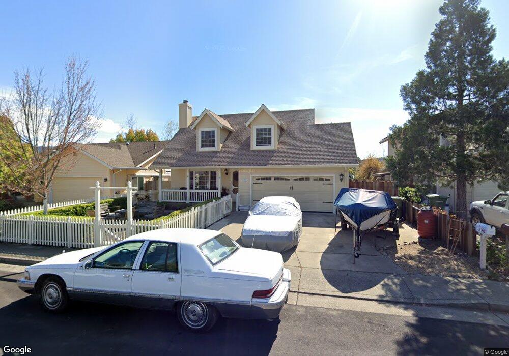
2007 High Rocks Dr Calistoga, CA 94515
Estimated Value: $677,000 - $825,000
3
Beds
3
Baths
1,382
Sq Ft
$536/Sq Ft
Est. Value
About This Home
This home is located at 2007 High Rocks Dr, Calistoga, CA 94515 and is currently estimated at $741,385, approximately $536 per square foot. 2007 High Rocks Dr is a home located in Napa County with nearby schools including Calistoga Elementary School and Calistoga Junior/Senior High School.
Ownership History
Date
Name
Owned For
Owner Type
Purchase Details
Closed on
Jan 4, 1994
Sold by
Simco Partners
Bought by
Murphy Leonard Vincent and Murphy Sonia Roland
Current Estimated Value
Home Financials for this Owner
Home Financials are based on the most recent Mortgage that was taken out on this home.
Original Mortgage
$125,000
Interest Rate
7.38%
Create a Home Valuation Report for This Property
The Home Valuation Report is an in-depth analysis detailing your home's value as well as a comparison with similar homes in the area
Home Values in the Area
Average Home Value in this Area
Purchase History
| Date | Buyer | Sale Price | Title Company |
|---|---|---|---|
| Murphy Leonard Vincent | -- | Napa Land Title Company |
Source: Public Records
Mortgage History
| Date | Status | Borrower | Loan Amount |
|---|---|---|---|
| Closed | Murphy Leonard Vincent | $125,000 | |
| Closed | Murphy Leonard Vincent | $49,500 |
Source: Public Records
Tax History
| Year | Tax Paid | Tax Assessment Tax Assessment Total Assessment is a certain percentage of the fair market value that is determined by local assessors to be the total taxable value of land and additions on the property. | Land | Improvement |
|---|---|---|---|---|
| 2025 | $3,632 | $336,510 | $159,757 | $176,753 |
| 2024 | $3,604 | $329,913 | $156,625 | $173,288 |
| 2023 | $3,604 | $323,445 | $153,554 | $169,891 |
| 2022 | $3,380 | $317,104 | $150,544 | $166,560 |
| 2021 | $3,275 | $310,888 | $147,593 | $163,295 |
| 2020 | $3,237 | $307,701 | $146,080 | $161,621 |
| 2019 | $3,195 | $301,668 | $143,216 | $158,452 |
| 2018 | $3,154 | $295,754 | $140,408 | $155,346 |
| 2017 | $3,088 | $289,955 | $137,655 | $152,300 |
| 2016 | $3,004 | $284,270 | $134,956 | $149,314 |
| 2015 | $2,968 | $280,001 | $132,929 | $147,072 |
| 2014 | $2,918 | $274,518 | $130,326 | $144,192 |
Source: Public Records
Map
Nearby Homes
- 1911 Emerald Dr
- 4025 Lake County Hwy
- 1553 Silverado Trail N Unit 35
- 1710 Reynard Ln
- 1929 Mora Ave
- 33 Brannan St
- 1438 Grant St
- 1559 Silverado Terrace Loop
- 1551 Silverado Terrace Loop
- 1557 Silverado Terrace Loop Unit 37
- 1553 Silverado Terrace Loop
- 1559 Silverado Terrace Loop Unit 38
- 1231 Stevenson St
- 8 Camellia Dr
- 1431 4th St
- 1429 3rd St
- 1411 4th St
- 1307 Spring St
- 320 Chablis N
- 800 Washington St
- 2009 High Rocks Dr
- 2005 High Rocks Dr
- 2011 High Rocks Dr
- 2006 High Rocks Dr
- 2003 High Rocks Dr
- 1834 Money Ln
- 2004 High Rocks Dr
- 2008 High Rocks Dr
- 1820 Money Ln
- 2015 Tablerock Ct
- 2010 High Rocks Dr
- 2001 High Rocks Dr
- 1901 Cinnabar Ct
- 2107 Oat Hill Ct
- 2109 Oat Hill Ct
- 2017 Tablerock Ct
- 2111 Oat Hill Ct
- 1903 Cinnabar Ct
- 2014 Tablerock Ct
- 2019 Tablerock Ct
Your Personal Tour Guide
Ask me questions while you tour the home.