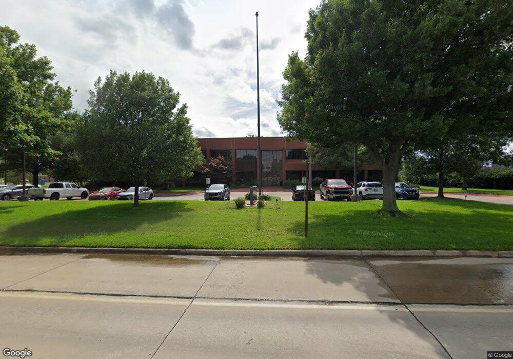
2007 N Commerce St Ardmore, OK 73401
Estimated Value: $5,262,024
--
Bed
--
Bath
35,399
Sq Ft
$149/Sq Ft
Est. Value
About This Home
This home is located at 2007 N Commerce St, Ardmore, OK 73401 and is currently estimated at $5,262,024, approximately $148 per square foot. 2007 N Commerce St is a home located in Carter County with nearby schools including Charles Evans Elementary School, Ardmore Middle School, and Ardmore High School.
Ownership History
Date
Name
Owned For
Owner Type
Purchase Details
Closed on
Jun 30, 2021
Sold by
The Quintin Little Building Llc
Bought by
Leighthouse Behavioral Wellsness Centers
Current Estimated Value
Home Financials for this Owner
Home Financials are based on the most recent Mortgage that was taken out on this home.
Original Mortgage
$2,367,194
Outstanding Balance
$418,717
Interest Rate
2.9%
Mortgage Type
Commercial
Estimated Equity
$4,843,307
Purchase Details
Closed on
Aug 27, 1999
Sold by
Little Carrie Lou
Bought by
Quinton Little Building L
Create a Home Valuation Report for This Property
The Home Valuation Report is an in-depth analysis detailing your home's value as well as a comparison with similar homes in the area
Home Values in the Area
Average Home Value in this Area
Purchase History
| Date | Buyer | Sale Price | Title Company |
|---|---|---|---|
| Leighthouse Behavioral Wellsness Centers | $4,250,000 | Stewart Title Of Ok Inc | |
| Quinton Little Building L | -- | -- |
Source: Public Records
Mortgage History
| Date | Status | Borrower | Loan Amount |
|---|---|---|---|
| Open | Leighthouse Behavioral Wellsness Centers | $2,367,194 |
Source: Public Records
Tax History Compared to Growth
Tax History
| Year | Tax Paid | Tax Assessment Tax Assessment Total Assessment is a certain percentage of the fair market value that is determined by local assessors to be the total taxable value of land and additions on the property. | Land | Improvement |
|---|---|---|---|---|
| 2024 | -- | $0 | $0 | $0 |
| 2023 | $0 | $0 | $0 | $0 |
| 2022 | $48,756 | $510,000 | $84,994 | $425,006 |
| 2021 | $18,782 | $186,160 | $52,869 | $133,291 |
| 2020 | $17,628 | $177,295 | $49,764 | $127,531 |
| 2019 | $16,394 | $168,852 | $49,454 | $119,398 |
| 2018 | $15,875 | $160,812 | $44,277 | $116,535 |
| 2017 | $14,003 | $153,155 | $46,720 | $106,435 |
| 2016 | $13,596 | $145,861 | $43,923 | $101,938 |
| 2015 | $1,453 | $18,915 | $0 | $18,915 |
| 2014 | $945 | $12,300 | $0 | $12,300 |
Source: Public Records
Map
Nearby Homes
- 1496 US Highway 77
- 1620 Shenandoah Dr
- 923 Maxwell St NW
- 912 Elm St
- 1907 Robison St
- 912 Maxwell St NW
- 1029 Northwest Blvd
- 723 Maxwell St NW
- 1111 Prairie Valley Rd
- 1626 N Cedar Loop
- 722 Maxwell St NW
- 809 Campbell St
- 1717 Red Oak Dr
- 715 Ash St
- 800 Cottonwood St
- 0 Veterans Blvd Unit 2542555
- 2805 N Commerce St
- 703 Cottonwood St
- 1206 N Meadow Dr
- 132 Veterans Blvd
- 1412 Stoneridge Place
- 1417 Stoneridge Manor
- 1121 Circle Dr
- 1414 Stoneridge Place
- 1419 Stoneridge Manor
- 1123 Circle Dr
- 1416 Stoneridge Place
- 1418 Stoneridge Manor
- 1421 Stoneridge Manor
- 1125 Circle Dr
- 1418 Stoneridge Place
- 1420 Stoneridge Manor
- 1423 Stoneridge Manor
- 1420 Stoneridge Place
- 1422 Stoneridge Manor
- 1425 Stoneridge Manor
- 1422 Stoneridge Place
- 1424 Stoneridge Manor
- 1424 Stoneridge Place
- 1024 Circle Dr