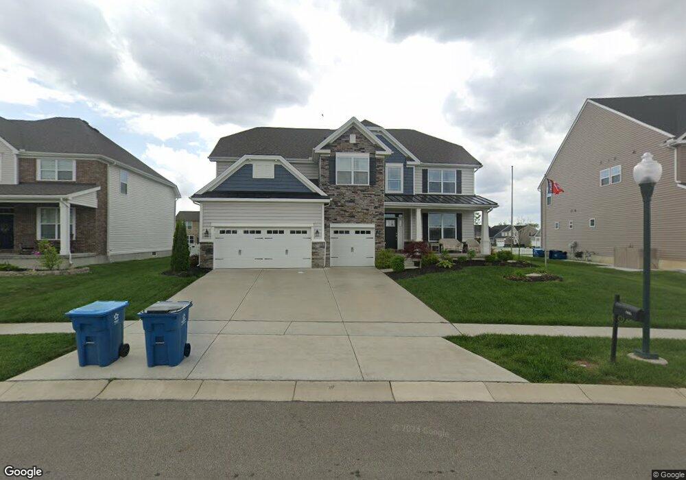
2007 Silver Linden Dr Tipp City, OH 45371
Estimated Value: $543,239 - $676,000
4
Beds
4
Baths
3,814
Sq Ft
$160/Sq Ft
Est. Value
About This Home
This home is located at 2007 Silver Linden Dr, Tipp City, OH 45371 and is currently estimated at $609,310, approximately $159 per square foot. 2007 Silver Linden Dr is a home located in Miami County with nearby schools including Bethel Elementary School, Bethel Middle School, and Bethel High School.
Ownership History
Date
Name
Owned For
Owner Type
Purchase Details
Closed on
Aug 24, 2020
Sold by
Inverness Group Incorporated
Bought by
Blackford Brandon D
Current Estimated Value
Home Financials for this Owner
Home Financials are based on the most recent Mortgage that was taken out on this home.
Original Mortgage
$407,744
Interest Rate
3%
Mortgage Type
New Conventional
Purchase Details
Closed on
Nov 1, 2018
Sold by
Dec Land Co I Llc
Bought by
Inverness Group Inc
Home Financials for this Owner
Home Financials are based on the most recent Mortgage that was taken out on this home.
Original Mortgage
$20,000,000
Interest Rate
4.7%
Mortgage Type
Unknown
Create a Home Valuation Report for This Property
The Home Valuation Report is an in-depth analysis detailing your home's value as well as a comparison with similar homes in the area
Home Values in the Area
Average Home Value in this Area
Purchase History
| Date | Buyer | Sale Price | Title Company |
|---|---|---|---|
| Blackford Brandon D | $449,900 | Ntc | |
| Inverness Group Inc | $62,400 | None Available |
Source: Public Records
Mortgage History
| Date | Status | Borrower | Loan Amount |
|---|---|---|---|
| Previous Owner | Blackford Brandon D | $407,744 | |
| Previous Owner | Inverness Group Inc | $20,000,000 |
Source: Public Records
Tax History Compared to Growth
Tax History
| Year | Tax Paid | Tax Assessment Tax Assessment Total Assessment is a certain percentage of the fair market value that is determined by local assessors to be the total taxable value of land and additions on the property. | Land | Improvement |
|---|---|---|---|---|
| 2024 | $7,237 | $160,510 | $21,000 | $139,510 |
| 2023 | $7,237 | $145,670 | $21,000 | $124,670 |
| 2022 | $7,062 | $145,670 | $21,000 | $124,670 |
| 2021 | $6,877 | $134,330 | $21,000 | $113,330 |
| 2020 | $7,023 | $134,330 | $21,000 | $113,330 |
| 2019 | $3,764 | $74,410 | $21,000 | $53,410 |
| 2018 | $422 | $1,860 | $1,860 | $0 |
Source: Public Records
Map
Nearby Homes
- 3078 White Ash Dr
- 9310 Lakeside St
- 4010 Redbud Way
- 3109 Coneflower Dr
- 7131 Bluestream Dr
- 8133 Bushclover Dr
- 5073 Catalpa Dr
- 3290 Dry Run St
- 1349 Senna St
- 4146 Spicebush Dr
- 8041 Bushclover Dr
- 5195 Buttercup Dr
- 3230 Dry Run St
- 8930 Century Ln
- 5068 Meadowview St
- 5362 Windbrooke Dr
- 4957 Country Park Dr
- 8671 Pinegate Way
- 9091 Jasmine Dr
- 7113 Honeylocust St
- 2013 Silver Linden Dr
- 2001 Silver Linden Dr
- 3012 White Ash Dr
- 2019 Silver Linden Dr
- 3006 White Ash Dr
- 3024 White Ash Dr
- 2010 Silver Linden Dr
- 9409 Lakeside St Unit 36142316
- 9409 Lakeside St Unit 36142317
- 9409 Lakeside St Unit 36142314
- 9409 Lakeside St Unit 36142318
- 9409 Lakeside St Unit 36142315
- 2025 Silver Linden Dr
- 2016 Silver Linden Dr
- 3030 White Ash Dr
- 2022 Silver Linden Dr
- 9391 Lakeside St
- 9397 Lakeside St
- 9403 Lakeside St
- 2031 Silver Linden Dr