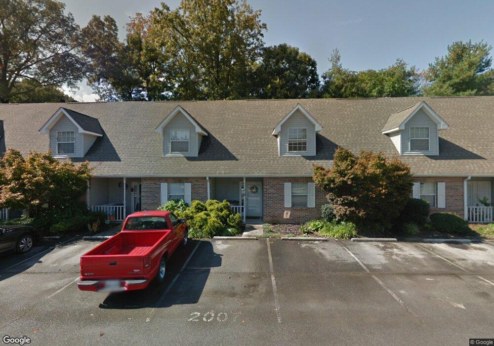
2007 Silverbrook Dr Unit 7D Knoxville, TN 37923
West Knoxville NeighborhoodEstimated Value: $239,000 - $266,032
3
Beds
2
Baths
1,500
Sq Ft
$167/Sq Ft
Est. Value
About This Home
This home is located at 2007 Silverbrook Dr Unit 7D, Knoxville, TN 37923 and is currently estimated at $250,008, approximately $166 per square foot. 2007 Silverbrook Dr Unit 7D is a home located in Knox County with nearby schools including West Hills Elementary School, Bearden Middle School, and Bearden High School.
Ownership History
Date
Name
Owned For
Owner Type
Purchase Details
Closed on
May 13, 2025
Sold by
Herndon Emily K and Thurston Emily K
Bought by
Thurston Clayton Warren
Current Estimated Value
Purchase Details
Closed on
Jun 17, 2003
Sold by
Dalton James E and Dalton Lois E
Bought by
Herndon Emily K
Home Financials for this Owner
Home Financials are based on the most recent Mortgage that was taken out on this home.
Original Mortgage
$72,000
Interest Rate
5.56%
Mortgage Type
Purchase Money Mortgage
Purchase Details
Closed on
May 28, 1996
Sold by
Dalton James E
Bought by
Dalton James E
Purchase Details
Closed on
Apr 26, 1996
Sold by
Dalton James E
Bought by
Dalton James E
Create a Home Valuation Report for This Property
The Home Valuation Report is an in-depth analysis detailing your home's value as well as a comparison with similar homes in the area
Home Values in the Area
Average Home Value in this Area
Purchase History
| Date | Buyer | Sale Price | Title Company |
|---|---|---|---|
| Thurston Clayton Warren | -- | None Listed On Document | |
| Herndon Emily K | $76,900 | Courthouse Title & Escrow Ll | |
| Dalton James E | -- | -- | |
| Dalton James E | -- | -- |
Source: Public Records
Mortgage History
| Date | Status | Borrower | Loan Amount |
|---|---|---|---|
| Previous Owner | Herndon Emily K | $72,000 |
Source: Public Records
Tax History Compared to Growth
Tax History
| Year | Tax Paid | Tax Assessment Tax Assessment Total Assessment is a certain percentage of the fair market value that is determined by local assessors to be the total taxable value of land and additions on the property. | Land | Improvement |
|---|---|---|---|---|
| 2024 | $863 | $40,025 | $0 | $0 |
| 2023 | $863 | $40,025 | $0 | $0 |
| 2022 | $1,485 | $40,025 | $0 | $0 |
| 2021 | $1,311 | $28,600 | $0 | $0 |
| 2020 | $1,311 | $28,600 | $0 | $0 |
| 2019 | $1,311 | $28,600 | $0 | $0 |
| 2018 | $1,311 | $28,600 | $0 | $0 |
| 2017 | $1,311 | $28,600 | $0 | $0 |
| 2016 | $1,229 | $0 | $0 | $0 |
| 2015 | $1,229 | $0 | $0 | $0 |
| 2014 | $1,229 | $0 | $0 | $0 |
Source: Public Records
Map
Nearby Homes
- 2019 Silverbrook Dr Unit 8B
- 2020 Silverbrook Dr Unit 5C
- 2027 Silverbrook Dr Unit 9B
- 2017 Countryhill Ln
- 2106 Silverbrook Dr
- 2121 Silverbrook Dr
- 2002 Countryhill Ln
- 2048 Belle Terra Rd
- 6721 Creekhead Dr
- 1948 Winter Winds Ln
- 2300 Windcastle Ln
- 2121 Windbrook Rd
- 6759 Fox Manor Blvd
- 2005 Hickory Ridge Cove
- 1725 Wynrush Cir
- 6616 Sedgefield Dr
- 1412 Marconi Dr
- 2309 Slate Valley Ln
- 2318 Black Bear Rd
- 8156 Pepperdine Way
- 2005 Silverbrook Dr Unit 70
- 2005 Silverbrook Dr Unit 3
- 2005 Silverbrook Dr Unit 7-C
- 2009 Silverbrook Dr Unit 7E
- 2011 Silverbrook Dr
- 2003 Silverbrook Dr Unit 7B
- 2013 Silverbrook Dr Unit 70
- 2013 Silverbrook Dr Unit 7g
- 2001 Silverbrook Dr
- 2010 Silverbrook Dr Unit 6C
- 2008 Silverbrook Dr Unit 6D
- 2006 Silverbrook Dr
- 2012 Silverbrook Dr Unit 6B
- 2004 Silverbrook Dr
- 2002 Silverbrook Dr Unit 6G
- 2014 Silverbrook Dr
- 2017 Silverbrook Dr Unit 8A
- 2023 Silverbrook Dr Unit 8D
- 1941 Stonebrook Dr
- 2016 Silverbrook Dr Unit 5E