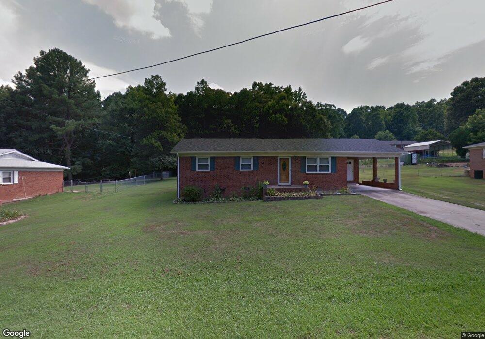
2007 Townview Dr Kannapolis, NC 28081
Estimated Value: $239,700 - $296,000
Studio
2
Baths
1,183
Sq Ft
$228/Sq Ft
Est. Value
About This Home
This home is located at 2007 Townview Dr, Kannapolis, NC 28081 and is currently estimated at $269,675, approximately $227 per square foot. 2007 Townview Dr is a home located in Rowan County with nearby schools including Landis Elementary School, Corriher Lipe Middle School, and South Rowan High School.
Ownership History
Date
Name
Owned For
Owner Type
Purchase Details
Closed on
Dec 7, 2007
Sold by
Harrington Charles W and Harrington Gail P
Bought by
Fisher Betty B
Current Estimated Value
Home Financials for this Owner
Home Financials are based on the most recent Mortgage that was taken out on this home.
Original Mortgage
$116,500
Outstanding Balance
$81,897
Interest Rate
6.29%
Mortgage Type
Unknown
Estimated Equity
$187,778
Purchase Details
Closed on
Sep 25, 2006
Sold by
Us Bank Na
Bought by
Harrington Charles W
Purchase Details
Closed on
Jul 31, 2006
Sold by
Scarborough Becky C
Bought by
Us Bank Na
Create a Home Valuation Report for This Property
The Home Valuation Report is an in-depth analysis detailing your home's value as well as a comparison with similar homes in the area
Home Values in the Area
Average Home Value in this Area
Purchase History
| Date | Buyer | Sale Price | Title Company |
|---|---|---|---|
| Fisher Betty B | $116,500 | Investors Title Ins Co | |
| Harrington Charles W | $73,000 | None Available | |
| Us Bank Na | $72,250 | None Available |
Source: Public Records
Mortgage History
| Date | Status | Borrower | Loan Amount |
|---|---|---|---|
| Open | Fisher Betty B | $116,500 |
Source: Public Records
Tax History
| Year | Tax Paid | Tax Assessment Tax Assessment Total Assessment is a certain percentage of the fair market value that is determined by local assessors to be the total taxable value of land and additions on the property. | Land | Improvement |
|---|---|---|---|---|
| 2025 | $939 | $142,333 | $32,825 | $109,508 |
| 2024 | $939 | $142,333 | $32,825 | $109,508 |
| 2023 | $939 | $142,333 | $32,825 | $109,508 |
| 2022 | $704 | $95,400 | $16,160 | $79,240 |
| 2021 | $704 | $95,400 | $16,160 | $79,240 |
| 2020 | $704 | $95,400 | $16,160 | $79,240 |
| 2019 | $704 | $95,400 | $16,160 | $79,240 |
| 2018 | $619 | $84,582 | $16,160 | $68,422 |
| 2017 | $597 | $81,636 | $16,160 | $65,476 |
| 2016 | $589 | $81,636 | $16,160 | $65,476 |
| 2015 | $598 | $81,636 | $16,160 | $65,476 |
| 2014 | $609 | $84,567 | $16,160 | $68,407 |
Source: Public Records
Map
Nearby Homes
- 1809 W C St
- 1814 W C St
- 0000 Buffalo St
- 1530 Buffalo St
- 113 Hilton Ave
- 0 W C St Unit 2 CAR4255761
- 0 W C St Unit CAR4255556
- 103 Westover Ave
- 1225 W C St
- 110 Franklin Ave
- 500 Echo Ave
- 0 Pump Station Rd
- 411 Brentwood Cir
- 6124 Avalon Dr
- 1408 Westwinds Ct
- 1224 Pump Station Rd
- 2218 Woodcrest Dr
- 132 Glenn Ave
- 117 S Enochville Ave
- 115 Northcrest Dr
- 2009 Townview Dr
- 2005 Townview Dr
- 8-9 Townview Dr Unit 8-9
- 2011 Townview Dr
- 2011 Townview Dr Unit 18
- 2006 Townview Dr
- 1717 Shadowbrook Dr
- 2010 Townview Dr
- 13-14 Townview Dr Unit 13-14
- 0 Rollingwood Dr Unit 53 3816467
- 0 Rollingwood Dr Unit 83 3816459
- 0 Rollingwood Dr
- 2013 Townview Dr
- 2012 Townview Dr
- 1739 Shadowbrook Dr
- 6840 Wrenn Ave
- 2004 Townview Dr
- 1737 Shadowbrook Dr
- 2014 Townview Dr
- 2015 Townview Dr
Your Personal Tour Guide
Ask me questions while you tour the home.