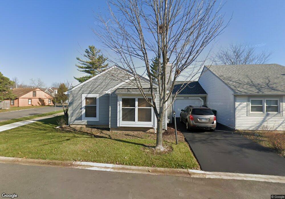
2008 Apache Trail Round Lake Beach, IL 60073
Estimated Value: $178,000 - $223,000
2
Beds
1
Bath
1,160
Sq Ft
$170/Sq Ft
Est. Value
About This Home
This home is located at 2008 Apache Trail, Round Lake Beach, IL 60073 and is currently estimated at $196,779, approximately $169 per square foot. 2008 Apache Trail is a home located in Lake County with nearby schools including Indian Hill Elementary School, Round Lake Middle School, and Round Lake High School.
Ownership History
Date
Name
Owned For
Owner Type
Purchase Details
Closed on
Aug 22, 2016
Sold by
Jones Reese K and Rambo Yvonne
Bought by
Jones Reese K and Rambo Yvonne
Current Estimated Value
Purchase Details
Closed on
Aug 18, 2006
Sold by
Miller Diana L
Bought by
Jones Reese K
Home Financials for this Owner
Home Financials are based on the most recent Mortgage that was taken out on this home.
Original Mortgage
$148,000
Outstanding Balance
$87,985
Interest Rate
6.58%
Mortgage Type
Unknown
Estimated Equity
$108,794
Purchase Details
Closed on
May 3, 1999
Sold by
First State Bank Of Round Lake
Bought by
Miller Diana L
Home Financials for this Owner
Home Financials are based on the most recent Mortgage that was taken out on this home.
Original Mortgage
$79,039
Interest Rate
7.05%
Mortgage Type
FHA
Create a Home Valuation Report for This Property
The Home Valuation Report is an in-depth analysis detailing your home's value as well as a comparison with similar homes in the area
Home Values in the Area
Average Home Value in this Area
Purchase History
| Date | Buyer | Sale Price | Title Company |
|---|---|---|---|
| Jones Reese K | -- | Attorney | |
| Jones Reese K | $149,500 | None Available | |
| Miller Diana L | $81,500 | -- |
Source: Public Records
Mortgage History
| Date | Status | Borrower | Loan Amount |
|---|---|---|---|
| Open | Jones Reese K | $148,000 | |
| Previous Owner | Miller Diana L | $79,039 |
Source: Public Records
Tax History
| Year | Tax Paid | Tax Assessment Tax Assessment Total Assessment is a certain percentage of the fair market value that is determined by local assessors to be the total taxable value of land and additions on the property. | Land | Improvement |
|---|---|---|---|---|
| 2024 | $2,901 | $41,202 | $8,095 | $33,107 |
| 2023 | $3,755 | $37,814 | $7,429 | $30,385 |
| 2022 | $3,755 | $43,784 | $6,500 | $37,284 |
| 2021 | $3,691 | $39,404 | $6,248 | $33,156 |
| 2020 | $3,520 | $37,492 | $5,945 | $31,547 |
| 2019 | $3,406 | $35,971 | $5,704 | $30,267 |
| 2018 | $1,948 | $21,156 | $2,521 | $18,635 |
| 2017 | $1,890 | $19,900 | $2,371 | $17,529 |
| 2016 | $1,767 | $18,370 | $2,189 | $16,181 |
| 2015 | $1,664 | $16,783 | $2,000 | $14,783 |
| 2014 | $3,323 | $28,222 | $4,056 | $24,166 |
| 2012 | $3,344 | $29,475 | $4,236 | $25,239 |
Source: Public Records
Map
Nearby Homes
- 2010 Comanche Trail Unit 2
- 2020 Comanche Trail
- 2011 Westview Ln
- 2053 Westview Ln Unit 5
- 2000 Westview Ln Unit 4
- 452 Meadow Green Ln
- 420 Meadow Green Ln
- 530 Meadow Green Ln
- 435 Meadow Green Ln
- 319 Meadow Green Ln Unit 1
- 1998 N Karen Ln
- 523 Meadow Green Ln
- 1317 N Cedar Lake Rd
- 2289 N Aster Ct
- 641 W Huron Hills Trail
- 2216 N Sunrise Dr
- 1210 Tulip Tree Ct Unit 1
- 67 W Dahlia Ln
- 2138 N Green Valley Ln
- 8 E Rollins Rd
- 2006 Apache Trail
- 2009 Comanche Trail
- 2011 Comanche Trail
- 2004 Apache Trail
- 2007 Comanche Trail
- 2014 Apache Trail
- 2009 Apache Trail
- 2005 Comanche Trail
- 2007 Apache Trail
- 2002 Apache Trail Unit I
- 2015 Comanche Trail
- 2005 Apache Trail
- 0 Comanche Trail Unit 7672257
- 0 Comanche Trail Unit 9576160
- 0 Comanche Trail Unit MRD11673589
- 2013 Apache Trail
- 2016 Apache Trail
- 2000 Apache Trail
- 2003 Apache Trail
- 2008 Comanche Trail
Your Personal Tour Guide
Ask me questions while you tour the home.