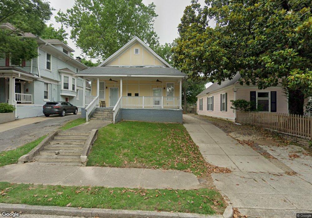
2008 Courtland Place Unit 1 Memphis, TN 38104
Cooper-Young NeighborhoodEstimated Value: $248,000 - $331,000
1
Bed
1
Bath
2,006
Sq Ft
$139/Sq Ft
Est. Value
About This Home
This home is located at 2008 Courtland Place Unit 1, Memphis, TN 38104 and is currently estimated at $279,000, approximately $139 per square foot. 2008 Courtland Place Unit 1 is a home located in Shelby County with nearby schools including Idlewild Elementary School, Central High School, and Compass Community School Midtown Campus.
Ownership History
Date
Name
Owned For
Owner Type
Purchase Details
Closed on
Dec 27, 2017
Sold by
Moore Richard C and Moore C R
Bought by
Ess Investmnets Llc
Current Estimated Value
Home Financials for this Owner
Home Financials are based on the most recent Mortgage that was taken out on this home.
Original Mortgage
$180,000
Interest Rate
3.92%
Mortgage Type
Future Advance Clause Open End Mortgage
Create a Home Valuation Report for This Property
The Home Valuation Report is an in-depth analysis detailing your home's value as well as a comparison with similar homes in the area
Home Values in the Area
Average Home Value in this Area
Purchase History
| Date | Buyer | Sale Price | Title Company |
|---|---|---|---|
| Ess Investmnets Llc | $128,750 | None Available |
Source: Public Records
Mortgage History
| Date | Status | Borrower | Loan Amount |
|---|---|---|---|
| Closed | Ess Investmnets Llc | $180,000 |
Source: Public Records
Tax History Compared to Growth
Tax History
| Year | Tax Paid | Tax Assessment Tax Assessment Total Assessment is a certain percentage of the fair market value that is determined by local assessors to be the total taxable value of land and additions on the property. | Land | Improvement |
|---|---|---|---|---|
| 2025 | $2,755 | $121,760 | $35,200 | $86,560 |
| 2024 | $2,755 | $81,280 | $22,400 | $58,880 |
| 2023 | $4,951 | $81,280 | $22,400 | $58,880 |
| 2022 | $4,951 | $81,280 | $22,400 | $58,880 |
| 2021 | $5,009 | $81,280 | $22,400 | $58,880 |
| 2020 | $3,881 | $53,560 | $22,400 | $31,160 |
| 2019 | $3,881 | $53,560 | $22,400 | $31,160 |
| 2018 | $2,325 | $32,080 | $22,400 | $9,680 |
| 2017 | $1,754 | $42,680 | $22,400 | $20,280 |
| 2016 | $1,746 | $39,960 | $0 | $0 |
| 2014 | $1,746 | $39,960 | $0 | $0 |
Source: Public Records
Map
Nearby Homes
- 2046 Courtland Place
- 1999 Peabody Ave
- 1947 Linden Ave
- 2065 Peabody Ave
- 2060 Carr Ave
- 2092 Linden Ave
- 2096 Linden Ave
- 31 S Morrison St
- 2080 Vinton Ave
- 1971 Vinton Ave
- 506 Peabody Square Unit 506
- 1870 Peabody Green Dr
- 2086 Harbert Ave
- 2092 Harbert Ave
- 2113 Vinton Ave
- 210 S Mclean Blvd
- 210 S Mclean Blvd Unit 1
- 210 S Mclean Blvd Unit 12
- 519 Summitt St
- 521 Summitt St
- 2008 Courtland Place Unit 2
- 2008 Courtland Place
- 2018 Courtland Place
- 2012 Courtland Place
- 2020 Courtland Place
- 2022 Courtland Place
- 1992 Courtland Place
- 2015 Linden Ave
- 2001 Linden Ave
- 1999 Linden Ave
- 2005 Courtland Place
- 2001 Courtland Place
- 2013 Courtland Place
- 1997 Courtland Place
- 2023 Linden Ave
- 2019 Courtland Place
- 2028 Courtland Place
- 1993 Linden Ave
- 1993 Courtland Place Unit 2
- 1994 Peabody Ave Unit 1