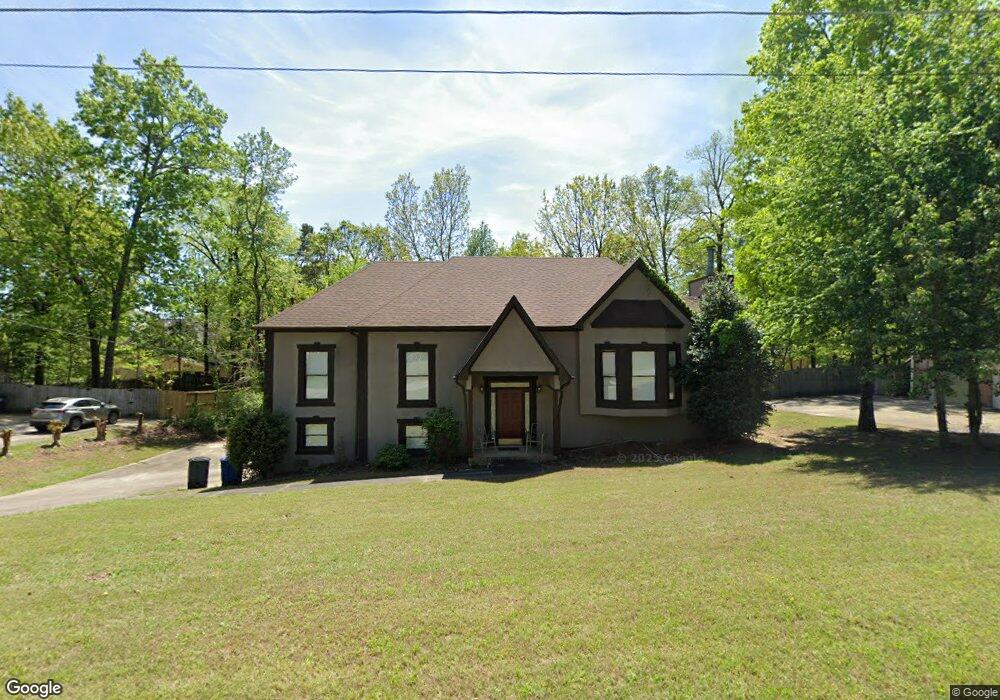
2008 Crosscrest Dr Birmingham, AL 35244
Estimated Value: $360,000 - $422,000
3
Beds
2
Baths
1,812
Sq Ft
$211/Sq Ft
Est. Value
About This Home
This home is located at 2008 Crosscrest Dr, Birmingham, AL 35244 and is currently estimated at $381,659, approximately $210 per square foot. 2008 Crosscrest Dr is a home located in Jefferson County with nearby schools including South Shades Crest Elementary School, Brock's Gap Intermediate School, and Robert F. Bumpus Middle School.
Ownership History
Date
Name
Owned For
Owner Type
Purchase Details
Closed on
Aug 9, 2006
Sold by
Camp Steve M and Camp Janet L
Bought by
Kemp Glenda W
Current Estimated Value
Home Financials for this Owner
Home Financials are based on the most recent Mortgage that was taken out on this home.
Original Mortgage
$200,000
Outstanding Balance
$124,197
Interest Rate
8%
Mortgage Type
Purchase Money Mortgage
Estimated Equity
$257,462
Purchase Details
Closed on
Aug 3, 1998
Sold by
Compass Bank
Bought by
Camp Steve M and Camp Janet L
Home Financials for this Owner
Home Financials are based on the most recent Mortgage that was taken out on this home.
Original Mortgage
$161,400
Interest Rate
6.91%
Purchase Details
Closed on
May 26, 1998
Sold by
Integrity Construction Inc
Bought by
Compass Bank
Create a Home Valuation Report for This Property
The Home Valuation Report is an in-depth analysis detailing your home's value as well as a comparison with similar homes in the area
Home Values in the Area
Average Home Value in this Area
Purchase History
| Date | Buyer | Sale Price | Title Company |
|---|---|---|---|
| Kemp Glenda W | $250,000 | None Available | |
| Camp Steve M | $169,900 | -- | |
| Compass Bank | $148,500 | -- |
Source: Public Records
Mortgage History
| Date | Status | Borrower | Loan Amount |
|---|---|---|---|
| Open | Kemp Glenda W | $200,000 | |
| Closed | Kemp Glenda W | $50,000 | |
| Previous Owner | Camp Steve M | $161,400 |
Source: Public Records
Tax History
| Year | Tax Paid | Tax Assessment Tax Assessment Total Assessment is a certain percentage of the fair market value that is determined by local assessors to be the total taxable value of land and additions on the property. | Land | Improvement |
|---|---|---|---|---|
| 2025 | $2,401 | $33,800 | -- | -- |
| 2024 | $2,423 | $34,100 | -- | -- |
| 2022 | $2,185 | $30,820 | $8,000 | $22,820 |
| 2021 | $1,888 | $26,740 | $8,000 | $18,740 |
| 2020 | $1,625 | $22,970 | $8,000 | $14,970 |
| 2019 | $1,615 | $22,980 | $0 | $0 |
| 2018 | $1,389 | $19,860 | $0 | $0 |
| 2017 | $1,389 | $19,860 | $0 | $0 |
| 2016 | $1,448 | $20,680 | $0 | $0 |
| 2015 | $1,448 | $20,680 | $0 | $0 |
| 2014 | $1,433 | $20,400 | $0 | $0 |
| 2013 | $1,433 | $20,400 | $0 | $0 |
Source: Public Records
Map
Nearby Homes
- 1521 Cypress Cove Cir
- 2020 Crosscrest Dr
- 1309 S Chase Cir
- 2058 Crosscrest Dr
- 5803 Cypress Trace
- 1852 Russet Hill Cir
- 1860 Russet Hill Cir
- 203 Russet Woods Dr
- 5527 Lake Cyrus Ln
- 5629 Park Side Cir
- 5749 Mallard Lake Dr
- 5850 Water Point Ln
- 5593 Park Side Cir
- 600 Crest View Cir
- 230 Russet Woods Dr
- 1669 Russet Crest Ln
- 2412 Fluker Dr
- 1713 Lake Cyrus Club Dr
- 3872 Guyton Rd
- 1737 Russet Crest Cir
- 2012 Crosscrest Dr
- 2004 Crosscrest Dr
- 1525 Cypress Cove Cir
- 1529 Cypress Cove Cir
- 2002 Crosscrest Dr
- 2011 Crosscrest Dr
- 2007 Crosscrest Dr
- 2016 Crosscrest Dr
- 2015 Crosscrest Dr
- 1519 Cypress Cove Cir
- 1994 Cypress Cove Cir
- 2000 Crosscrest Dr
- 1533 Cypress Cove Cir
- 2003 Crosscrest Dr
- 1517 Cypress Cove Cir
- 2001 Crosscrest Dr
- 1532 Cypress Cove Cir
- 4996 Hillary Ln
- 5021 Sandy Cove
- 1524 Cypress Cove Cir
Your Personal Tour Guide
Ask me questions while you tour the home.