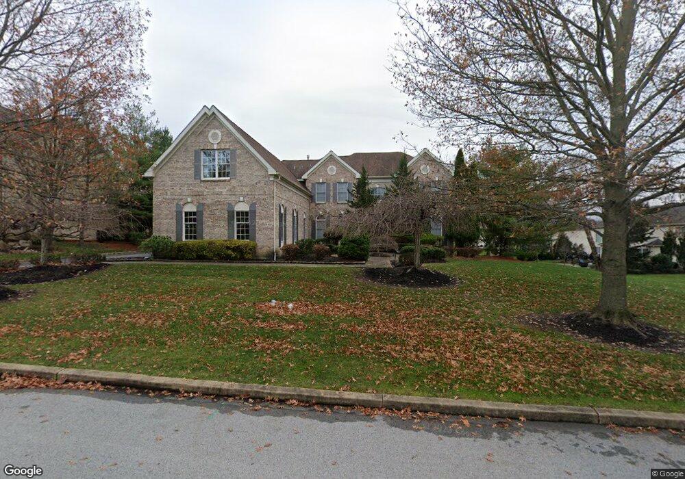
2008 Saint Andrews Dr Berwyn, PA 19312
Estimated Value: $1,558,128 - $1,742,000
4
Beds
4
Baths
4,398
Sq Ft
$373/Sq Ft
Est. Value
About This Home
This home is located at 2008 Saint Andrews Dr, Berwyn, PA 19312 and is currently estimated at $1,639,782, approximately $372 per square foot. 2008 Saint Andrews Dr is a home located in Chester County with nearby schools including Beaumont Elementary School, Tredyffrin-Easttown Middle School, and Conestoga Senior High School.
Ownership History
Date
Name
Owned For
Owner Type
Purchase Details
Closed on
Jan 9, 2003
Sold by
Henein Joseph W
Bought by
Henein Joseph W and Henein Nitocris
Current Estimated Value
Home Financials for this Owner
Home Financials are based on the most recent Mortgage that was taken out on this home.
Original Mortgage
$552,000
Outstanding Balance
$237,033
Interest Rate
6.11%
Estimated Equity
$1,402,749
Purchase Details
Closed on
Jan 31, 2001
Sold by
Greens At Waynesborough Lp
Bought by
Henein Joseph W
Home Financials for this Owner
Home Financials are based on the most recent Mortgage that was taken out on this home.
Original Mortgage
$519,000
Interest Rate
7.01%
Create a Home Valuation Report for This Property
The Home Valuation Report is an in-depth analysis detailing your home's value as well as a comparison with similar homes in the area
Home Values in the Area
Average Home Value in this Area
Purchase History
| Date | Buyer | Sale Price | Title Company |
|---|---|---|---|
| Henein Joseph W | -- | -- | |
| Henein Joseph W | $648,920 | -- |
Source: Public Records
Mortgage History
| Date | Status | Borrower | Loan Amount |
|---|---|---|---|
| Open | Henein Joseph W | $552,000 | |
| Closed | Henein Joseph W | $519,000 | |
| Closed | Henein Joseph W | $103,500 |
Source: Public Records
Tax History Compared to Growth
Tax History
| Year | Tax Paid | Tax Assessment Tax Assessment Total Assessment is a certain percentage of the fair market value that is determined by local assessors to be the total taxable value of land and additions on the property. | Land | Improvement |
|---|---|---|---|---|
| 2025 | $21,106 | $565,840 | $176,880 | $388,960 |
| 2024 | $21,106 | $565,840 | $176,880 | $388,960 |
| 2023 | $19,734 | $565,840 | $176,880 | $388,960 |
| 2022 | $19,194 | $565,840 | $176,880 | $388,960 |
| 2021 | $18,778 | $565,840 | $176,880 | $388,960 |
| 2020 | $18,255 | $565,840 | $176,880 | $388,960 |
| 2019 | $17,747 | $565,840 | $176,880 | $388,960 |
| 2018 | $17,440 | $565,840 | $176,880 | $388,960 |
| 2017 | $17,046 | $565,840 | $176,880 | $388,960 |
| 2016 | -- | $565,840 | $176,880 | $388,960 |
| 2015 | -- | $565,840 | $176,880 | $388,960 |
| 2014 | -- | $565,840 | $176,880 | $388,960 |
Source: Public Records
Map
Nearby Homes
- 2000 Saint Andrews Dr
- 650 Augusta Ct
- 17 Foxchase Rd
- 191 Stony Point Dr
- 1441 Berwyn Paoli Rd
- 1705 Weatherstone Dr
- 206 Yorktown Place Unit 106
- 521 Foxwood Ln
- 2102 Quail Ridge Dr
- 1304 Weatherstone Dr Unit 1304
- 36 Rabbit Run Rd
- 837 Nathan Hale Rd
- 121 Davis Rd
- 5 Kent Ln
- 1179 Beaumont Rd
- 32 Manchester Ct
- 1242 Old Lancaster Rd
- 2490 White Horse Rd
- 709 Newtown Rd
- 91 Central Ave
- 2006 Saint Andrews Dr
- 601 Muirfield Ct
- 603 Muirfield Ct
- 2007 Saint Andrews Dr
- 2004 Saint Andrews Dr
- 2005 Saint Andrews Dr
- 2009 Saint Andrews Dr
- 605 Muirfield Ct
- 610 Cascades Ct
- 2003 Saint Andrews Dr
- 2002 Saint Andrews Dr
- 2011 Saint Andrews Dr
- 607 Muirfield Ct
- 600 Muirfield Ct
- 613 Cascades Ct
- 602 Muirfield Ct
- 612 Cascades Ct
- 2013 Saint Andrews Dr
- 2002 Stanwich Dr
- 534 Annadale Dr