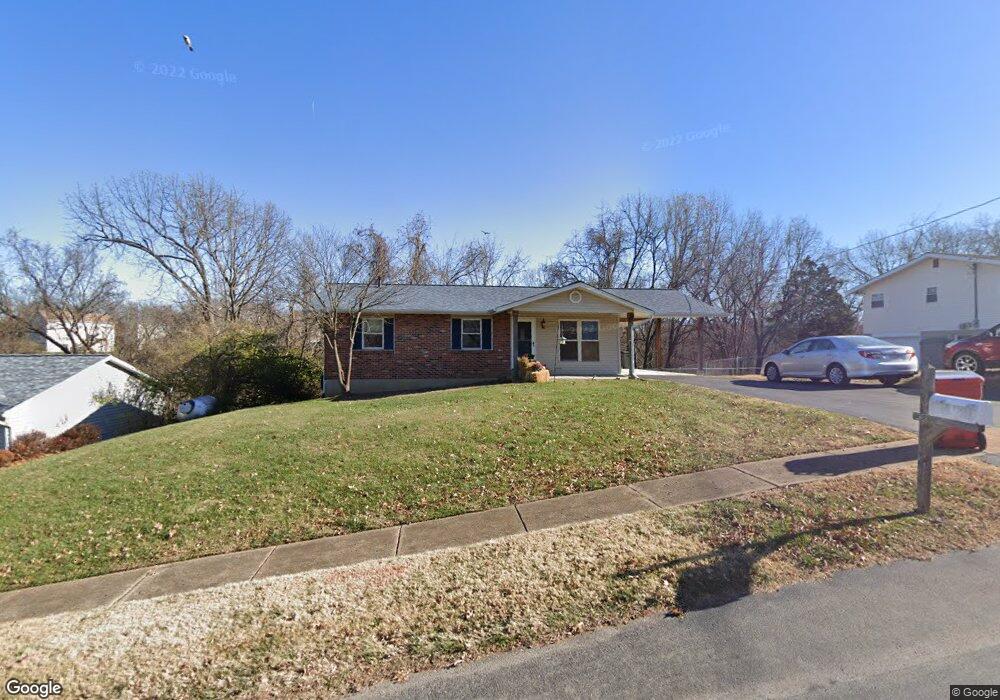
2008 Sunswept Ln High Ridge, MO 63049
Estimated Value: $198,000 - $240,000
4
Beds
3
Baths
950
Sq Ft
$232/Sq Ft
Est. Value
About This Home
This home is located at 2008 Sunswept Ln, High Ridge, MO 63049 and is currently estimated at $220,000, approximately $231 per square foot. 2008 Sunswept Ln is a home located in Jefferson County with nearby schools including Northwest High School, St. Anthony School, and Messenger Christian School.
Ownership History
Date
Name
Owned For
Owner Type
Purchase Details
Closed on
Jul 24, 2009
Sold by
Cornerstone Home Buyers Llc
Bought by
Mccarthy Gail
Current Estimated Value
Home Financials for this Owner
Home Financials are based on the most recent Mortgage that was taken out on this home.
Original Mortgage
$111,600
Interest Rate
5.44%
Mortgage Type
Purchase Money Mortgage
Purchase Details
Closed on
Jan 30, 2009
Sold by
Wisdom Kari A and Wisdom Jason A
Bought by
Cornerstone Home Buyers Llc
Purchase Details
Closed on
Oct 3, 2008
Sold by
Cornerstone Home Buyers Llc
Bought by
Wisdom Kari A and Wisdom Jason A
Home Financials for this Owner
Home Financials are based on the most recent Mortgage that was taken out on this home.
Original Mortgage
$164,000
Interest Rate
6.46%
Mortgage Type
Seller Take Back
Purchase Details
Closed on
Nov 15, 2007
Sold by
Pitts Carl and Pitts Donna M
Bought by
Cornerstone Home Buyers Llc
Create a Home Valuation Report for This Property
The Home Valuation Report is an in-depth analysis detailing your home's value as well as a comparison with similar homes in the area
Home Values in the Area
Average Home Value in this Area
Purchase History
| Date | Buyer | Sale Price | Title Company |
|---|---|---|---|
| Mccarthy Gail | -- | Ust | |
| Cornerstone Home Buyers Llc | -- | Htc | |
| Wisdom Kari A | -- | Htc | |
| Cornerstone Home Buyers Llc | -- | Commonwealth Land Title |
Source: Public Records
Mortgage History
| Date | Status | Borrower | Loan Amount |
|---|---|---|---|
| Closed | Mccarthy Gail | $111,600 | |
| Previous Owner | Wisdom Kari A | $164,000 |
Source: Public Records
Tax History Compared to Growth
Tax History
| Year | Tax Paid | Tax Assessment Tax Assessment Total Assessment is a certain percentage of the fair market value that is determined by local assessors to be the total taxable value of land and additions on the property. | Land | Improvement |
|---|---|---|---|---|
| 2025 | $1,069 | $16,200 | $1,900 | $14,300 |
| 2024 | $1,069 | $14,800 | $1,900 | $12,900 |
| 2023 | $1,069 | $14,800 | $1,900 | $12,900 |
| 2022 | $1,057 | $14,700 | $1,900 | $12,800 |
| 2021 | $1,050 | $14,700 | $1,900 | $12,800 |
| 2020 | $966 | $13,200 | $1,600 | $11,600 |
| 2019 | $965 | $13,200 | $1,600 | $11,600 |
| 2018 | $978 | $13,200 | $1,600 | $11,600 |
| 2017 | $893 | $13,200 | $1,600 | $11,600 |
| 2016 | $833 | $12,200 | $1,700 | $10,500 |
| 2015 | $856 | $12,200 | $1,700 | $10,500 |
| 2013 | -- | $12,000 | $1,700 | $10,300 |
Source: Public Records
Map
Nearby Homes
- 2108 Hillsboro Valley Park Rd
- 2112 Freckles Dr
- 2141 Sunswept Ln
- 2164 Heather Ln
- 2133 Ridgedale Dr
- 0 Mikel Ln
- 2135 Linnus Dr
- 2149 Linnus Dr
- 2276 Appaloosa Trail
- 11 Fox Trotter Ct
- 159 Brandy Mill Cir Unit 28D
- 101 Lipizzan Ct
- 1641 S Golden Cir
- 4856 E Golden Cir
- 2241 Fairway
- 0 Glick Rd Unit MIS25042566
- 2060 Hillsboro Valley Park Rd
- 2240 Fairway
- 1599 Paradise Valley Dr
- 709 Heatherstone Dr
- 2012 Sunswept Ln
- 2016 Sunswept Ln
- 2333 Sunswept Ln
- 2005 Sunswept Ln
- 2013 Sunswept Ln
- 2009 Sunswept Ln
- 2017 Sunswept Ln
- 2020 Sunswept Ln
- 2021 Sunswept Ln
- 2024 Sunswept Ln
- 2025 Sunswept Ln
- 2028 Sunswept Ln
- 5353 Harter Farms Manor
- 2029 Sunswept Ln
- 5361 Harter Farms Manor
- 5369 Harter Farms Manor
- 5365 Harter Farms Manor
- 5373 Harter Farms Manor
- 2032 Sunswept Ln
- 5377 Harter Farms Manor