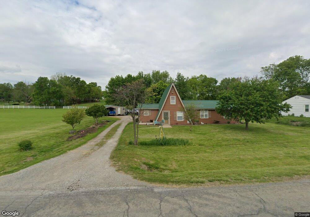
20080 Academy St Camden Point, MO 64018
Estimated Value: $313,000 - $339,000
2
Beds
2
Baths
1,676
Sq Ft
$192/Sq Ft
Est. Value
About This Home
This home is located at 20080 Academy St, Camden Point, MO 64018 and is currently estimated at $322,428, approximately $192 per square foot. 20080 Academy St is a home with nearby schools including North Platte Elementary School, North Platte Intermediate School, and North Platte Junior High School.
Ownership History
Date
Name
Owned For
Owner Type
Purchase Details
Closed on
Mar 10, 2025
Sold by
Bisig-Clayton Emma Jean
Bought by
Catlett Annette
Current Estimated Value
Home Financials for this Owner
Home Financials are based on the most recent Mortgage that was taken out on this home.
Original Mortgage
$95,000
Outstanding Balance
$94,358
Interest Rate
6.95%
Mortgage Type
New Conventional
Estimated Equity
$228,070
Create a Home Valuation Report for This Property
The Home Valuation Report is an in-depth analysis detailing your home's value as well as a comparison with similar homes in the area
Home Values in the Area
Average Home Value in this Area
Purchase History
| Date | Buyer | Sale Price | Title Company |
|---|---|---|---|
| Catlett Annette | -- | Stewart Title Company |
Source: Public Records
Mortgage History
| Date | Status | Borrower | Loan Amount |
|---|---|---|---|
| Open | Catlett Annette | $95,000 |
Source: Public Records
Tax History Compared to Growth
Tax History
| Year | Tax Paid | Tax Assessment Tax Assessment Total Assessment is a certain percentage of the fair market value that is determined by local assessors to be the total taxable value of land and additions on the property. | Land | Improvement |
|---|---|---|---|---|
| 2025 | $2,467 | $32,914 | $2,850 | $30,064 |
| 2024 | $2,364 | $32,914 | $2,850 | $30,064 |
| 2023 | $2,364 | $32,914 | $2,850 | $30,064 |
| 2022 | $2,085 | $28,746 | $2,850 | $25,896 |
| 2021 | $2,091 | $28,746 | $2,850 | $25,896 |
| 2020 | $1,368 | $18,378 | $2,850 | $15,528 |
| 2019 | $1,368 | $18,378 | $2,850 | $15,528 |
| 2018 | $1,376 | $18,378 | $2,850 | $15,528 |
| 2017 | $1,376 | $18,378 | $2,850 | $15,528 |
| 2016 | $1,362 | $18,378 | $2,850 | $15,528 |
| 2015 | $1,362 | $18,378 | $2,850 | $15,528 |
| 2013 | $1,329 | $18,378 | $0 | $0 |
Source: Public Records
Map
Nearby Homes
- 19710 Kansas City Blvd
- 9170 E Hwy
- 0 Cockriel Rd
- 103 Johnson Cir
- 605 E 2nd St
- 21970 Lamar Rd
- 24110 Highway Y N A
- 105 Wagers Cir
- 19925 S Ridgely Rd
- 19845 S Ridgely Rd
- 103 Sally Cir
- 16695 B Hwy
- 0 Missouri 273
- 300 Vine St
- 312 2nd St
- 0 Smith Rd
- 17135 Smith Rd
- 1009 Mary Kay Ln
- 501 N Platte Ave
- 8422 Hoover Rd