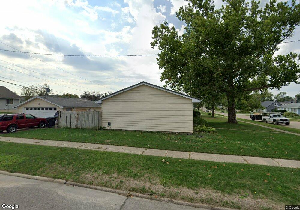
2009 26th St SW Cedar Rapids, IA 52404
Estimated Value: $197,969 - $227,000
3
Beds
2
Baths
1,176
Sq Ft
$185/Sq Ft
Est. Value
About This Home
This home is located at 2009 26th St SW, Cedar Rapids, IA 52404 and is currently estimated at $217,242, approximately $184 per square foot. 2009 26th St SW is a home located in Linn County with nearby schools including Junction City Elementary School, Van Buren Elementary School, and Bruce Hall Day Treatment Center.
Ownership History
Date
Name
Owned For
Owner Type
Purchase Details
Closed on
Nov 28, 2006
Sold by
Farmers State Bank
Bought by
Pearson Ruth A
Current Estimated Value
Purchase Details
Closed on
Jun 14, 1999
Sold by
Dales Rockne D and Dales Kimberly K
Bought by
Clark Scott D
Home Financials for this Owner
Home Financials are based on the most recent Mortgage that was taken out on this home.
Original Mortgage
$103,447
Interest Rate
6.99%
Mortgage Type
FHA
Create a Home Valuation Report for This Property
The Home Valuation Report is an in-depth analysis detailing your home's value as well as a comparison with similar homes in the area
Home Values in the Area
Average Home Value in this Area
Purchase History
| Date | Buyer | Sale Price | Title Company |
|---|---|---|---|
| Pearson Ruth A | -- | None Available | |
| Clark Scott D | $103,000 | -- |
Source: Public Records
Mortgage History
| Date | Status | Borrower | Loan Amount |
|---|---|---|---|
| Previous Owner | Clark Scott D | $103,447 |
Source: Public Records
Tax History Compared to Growth
Tax History
| Year | Tax Paid | Tax Assessment Tax Assessment Total Assessment is a certain percentage of the fair market value that is determined by local assessors to be the total taxable value of land and additions on the property. | Land | Improvement |
|---|---|---|---|---|
| 2025 | $2,828 | $184,700 | $47,900 | $136,800 |
| 2024 | $2,962 | $172,200 | $42,100 | $130,100 |
| 2023 | $2,962 | $170,300 | $40,200 | $130,100 |
| 2022 | $2,734 | $149,300 | $40,200 | $109,100 |
| 2021 | $2,786 | $140,900 | $36,400 | $104,500 |
| 2020 | $2,786 | $134,900 | $30,600 | $104,300 |
| 2019 | $2,510 | $125,000 | $30,600 | $94,400 |
| 2018 | $2,438 | $125,000 | $30,600 | $94,400 |
| 2017 | $2,567 | $120,800 | $30,600 | $90,200 |
| 2016 | $2,567 | $120,800 | $30,600 | $90,200 |
| 2015 | $2,627 | $123,458 | $30,631 | $92,827 |
| 2014 | $2,442 | $123,458 | $30,631 | $92,827 |
| 2013 | $2,386 | $123,458 | $30,631 | $92,827 |
Source: Public Records
Map
Nearby Homes
- 2404 25th St SW
- 2020 25th St SW
- 2207 Shady Grove Rd SW
- Remington - Cedar Rapids Plan at Whispering Pines
- Copeland Plan at Whispering Pines
- Meadowbrook - Cedar Rapids Plan at Stags Leap Estates
- Caldwell Plan at Stags Leap Estates
- Concord - Cedar Rapids Plan at Stags Leap Estates
- Yuma Expanded Plan at Whispering Pines
- Becker II Plan at Kirkwood Village - Kirk Wood Village
- Meadowbrook - Cedar Rapids Plan at Whispering Pines
- Richland Plan at Stags Leap Estates
- Prescott - Cedar Rapids Plan at Stags Leap Estates
- Becker Plan at Kirkwood Village - Kirk Wood Village
- Bakersfield - Cedar Rapids Plan at Whispering Pines
- Cedar Plan at Stags Leap Estates
- Becker - Cedar Rapids Plan at Whispering Pines
- Becker II - Cedar Rapids Plan at Whispering Pines
- Becker II - Cedar Rapids Plan at Stags Leap Estates
- Concord - Cedar Rapids Plan at Whispering Pines
- 2021 26th St SW
- 2002 25th St SW
- 2008 25th St SW
- 2508 Willow St SW
- 2516 Willow St SW
- 2010 26th St SW
- 2031 26th St SW
- 2014 25th St SW
- 2020 26th St SW
- 1912 25th St SW
- 2600 Willow St SW
- 2030 26th St SW
- 1906 25th St SW
- 2608 Willow St SW
- 2101 26th St SW
- 2617 Willow St SW
- 2507 Matthew Dr SW
- 2038 26th St SW
- 2515 Matthew Dr SW
- 2601 Matthew Dr SW