2009 Brampton Ct Ann Arbor, MI 48103
Vernon Downs NeighborhoodEstimated Value: $490,238 - $585,000
4
Beds
3
Baths
1,469
Sq Ft
$360/Sq Ft
Est. Value
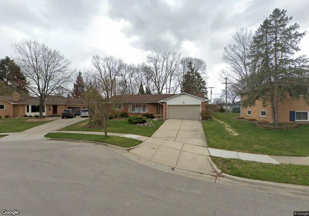
About This Home
This home is located at 2009 Brampton Ct, Ann Arbor, MI 48103 and is currently estimated at $529,560, approximately $360 per square foot. 2009 Brampton Ct is a home located in Washtenaw County with nearby schools including Dicken Elementary School, Slauson Middle School, and Pioneer High School.
Ownership History
Date
Name
Owned For
Owner Type
Purchase Details
Closed on
Jun 5, 2012
Sold by
Fox Elizabeth A
Bought by
Fox Elizabeth A and Elizabeth A Fox Trust
Current Estimated Value
Purchase Details
Closed on
Jul 29, 2011
Sold by
Weatherwax Robert B and Weatherwax Linda A
Bought by
Fox Elizabeth A
Home Financials for this Owner
Home Financials are based on the most recent Mortgage that was taken out on this home.
Original Mortgage
$210,400
Outstanding Balance
$17,345
Interest Rate
4.53%
Mortgage Type
New Conventional
Estimated Equity
$512,215
Purchase Details
Closed on
Apr 15, 1997
Sold by
Est Marvin Bray
Bought by
Weatherwax Robert B and Weatherwax Linda A
Home Financials for this Owner
Home Financials are based on the most recent Mortgage that was taken out on this home.
Original Mortgage
$136,300
Interest Rate
7.38%
Mortgage Type
New Conventional
Create a Home Valuation Report for This Property
The Home Valuation Report is an in-depth analysis detailing your home's value as well as a comparison with similar homes in the area
Home Values in the Area
Average Home Value in this Area
Purchase History
| Date | Buyer | Sale Price | Title Company |
|---|---|---|---|
| Fox Elizabeth A | -- | None Available | |
| Fox Elizabeth A | $263,000 | American Title Co Washtenaw | |
| Weatherwax Robert B | $143,500 | -- |
Source: Public Records
Mortgage History
| Date | Status | Borrower | Loan Amount |
|---|---|---|---|
| Open | Fox Elizabeth A | $210,400 | |
| Previous Owner | Weatherwax Robert B | $136,300 |
Source: Public Records
Tax History
| Year | Tax Paid | Tax Assessment Tax Assessment Total Assessment is a certain percentage of the fair market value that is determined by local assessors to be the total taxable value of land and additions on the property. | Land | Improvement |
|---|---|---|---|---|
| 2025 | $6,661 | $246,200 | $0 | $0 |
| 2024 | $6,497 | $242,800 | $0 | $0 |
| 2023 | $5,991 | $216,200 | $0 | $0 |
| 2022 | $6,528 | $197,000 | $0 | $0 |
| 2021 | $6,374 | $193,800 | $0 | $0 |
| 2020 | $6,245 | $181,700 | $0 | $0 |
| 2019 | $5,944 | $154,500 | $154,500 | $0 |
| 2018 | $5,860 | $146,900 | $0 | $0 |
| 2017 | $5,700 | $147,000 | $0 | $0 |
| 2016 | $4,856 | $113,990 | $0 | $0 |
| 2015 | $5,237 | $113,650 | $0 | $0 |
| 2014 | $5,237 | $110,100 | $0 | $0 |
| 2013 | -- | $110,100 | $0 | $0 |
Source: Public Records
Map
Nearby Homes
- 1900 Landmark Ct
- 1526 Barnard Rd
- 2310 Churchill Dr
- 1540 Westfield Ave
- 2521 Country Village Ct Unit 8
- 2205 Runnymede Blvd
- 1937 Alhambra Dr
- 1879 Kensington Blvd
- 2667 Oxford Cir
- 1347 Arella Blvd
- 2157 Pauline Ct Unit 1
- 2132 Pauline Blvd Unit 308
- 2124 Pauline Blvd Unit 307
- 2104 Pauline Blvd Unit 305
- 1265 S Maple Rd Unit 206
- 2051 Ascot Rd
- 1225 S Maple Rd Unit 307
- 1235 S Maple Rd Unit 101
- 1235 S Maple Rd Unit 302
- 1215 S Maple Rd Unit 202
- 2011 Brampton Ct
- 2005 Brampton Ct
- 2001 Brampton Ct
- 1905 Covington Dr
- 2012 Brampton Ct
- 1909 Covington Dr
- 2006 Brampton Ct
- 1950 Scio Church Rd
- 1900 Scio Church Rd
- 2016 Brampton Ct
- 1824 Waverly Rd
- 1908 Old Pear Tree Ct
- 1915 Covington Dr
- 1831 Covington Dr
- 1820 Waverly Rd
- 1839 Hanover Rd
- 2020 Scio Church Rd
- 1912 Old Pear Tree Ct
- 1917 Dunmore Rd
- 1909 Old Pear Tree Ct
Your Personal Tour Guide
Ask me questions while you tour the home.