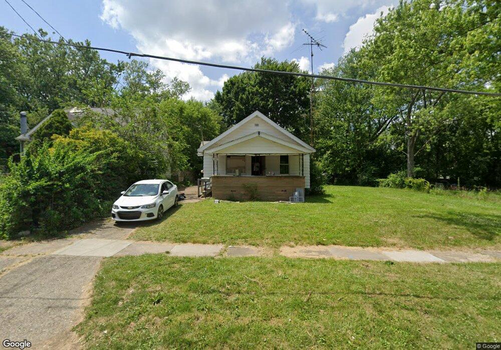
2009 Burns St Flint, MI 48506
Eastside NeighborhoodEstimated Value: $25,000 - $42,000
2
Beds
1
Bath
1,029
Sq Ft
$35/Sq Ft
Est. Value
About This Home
This home is located at 2009 Burns St, Flint, MI 48506 and is currently estimated at $36,290, approximately $35 per square foot. 2009 Burns St is a home located in Genesee County with nearby schools including Potter School, Flint Cultural Center Academy, and WAY Academy of Flint.
Ownership History
Date
Name
Owned For
Owner Type
Purchase Details
Closed on
Feb 11, 2025
Sold by
Strohmier Cornelius J
Bought by
Orient Road Llc
Current Estimated Value
Purchase Details
Closed on
Sep 24, 2024
Sold by
Genesee County Treasurer
Bought by
Strohmier Cornelius J
Purchase Details
Closed on
Nov 12, 2022
Sold by
Darling Buff D
Bought by
Searcy Ksstle
Purchase Details
Closed on
May 27, 2005
Sold by
Perkins Lynette D
Bought by
Schneider Kenneth S
Home Financials for this Owner
Home Financials are based on the most recent Mortgage that was taken out on this home.
Original Mortgage
$28,000
Interest Rate
5.87%
Mortgage Type
Credit Line Revolving
Create a Home Valuation Report for This Property
The Home Valuation Report is an in-depth analysis detailing your home's value as well as a comparison with similar homes in the area
Home Values in the Area
Average Home Value in this Area
Purchase History
| Date | Buyer | Sale Price | Title Company |
|---|---|---|---|
| Orient Road Llc | -- | None Listed On Document | |
| Strohmier Cornelius J | $3,800 | None Listed On Document | |
| Searcy Ksstle | -- | -- | |
| Schneider Kenneth S | -- | Metropolitan Title Company |
Source: Public Records
Mortgage History
| Date | Status | Borrower | Loan Amount |
|---|---|---|---|
| Previous Owner | Schneider Kenneth S | $28,000 |
Source: Public Records
Tax History
| Year | Tax Paid | Tax Assessment Tax Assessment Total Assessment is a certain percentage of the fair market value that is determined by local assessors to be the total taxable value of land and additions on the property. | Land | Improvement |
|---|---|---|---|---|
| 2025 | $774 | $13,900 | $0 | $0 |
| 2024 | $726 | $12,900 | $0 | $0 |
| 2023 | $716 | $11,200 | $0 | $0 |
| 2022 | $0 | $8,900 | $0 | $0 |
| 2021 | $608 | $8,500 | $0 | $0 |
| 2020 | $560 | $7,600 | $0 | $0 |
| 2019 | $554 | $7,600 | $0 | $0 |
| 2018 | $527 | $6,100 | $0 | $0 |
| 2017 | $515 | $0 | $0 | $0 |
| 2016 | $526 | $0 | $0 | $0 |
| 2015 | -- | $0 | $0 | $0 |
| 2014 | -- | $0 | $0 | $0 |
| 2012 | -- | $8,200 | $0 | $0 |
Source: Public Records
Map
Nearby Homes
- 2426 Broadway Blvd
- 1622 Arlington Ave
- 1510 N Vernon Ave
- 2321 Levern St
- 2601 Illinois Ave
- 2211 Torrance St
- 1805 Bennett Ave
- 2415 Pennsylvania Ave
- 2506 Arlington Ave
- 2426 Hoff St
- 2301 Missouri Ave
- 1318 Cronk Ave
- 2610 Pennsylvania Ave
- 1734 Missouri Ave
- 1721 New York Ave
- 2217 Maryland Ave
- 1609 Ohio Ave
- 1216 Minnesota Ave
- 2605 Nebraska Ave
- 1529 Broadway Blvd
- 2013 Burns St
- 2005 Burns St
- 2017 Burns St
- 2000 N Vernon Ave
- 2004 N Vernon Ave
- 1932 N Vernon Ave
- 2210 Broadway Blvd
- 1928 N Vernon Ave
- 2206 Broadway Blvd
- 1923 Burns St
- 1924 N Vernon Ave
- 2010 Burns St
- 2004 Burns St
- 2202 Broadway Blvd
- 2022 Burns St
- 1926 Burns St
- 2024 Burns St
- 1916 N Vernon Ave
- 1922 Burns St
- 1915 Burns St
Your Personal Tour Guide
Ask me questions while you tour the home.