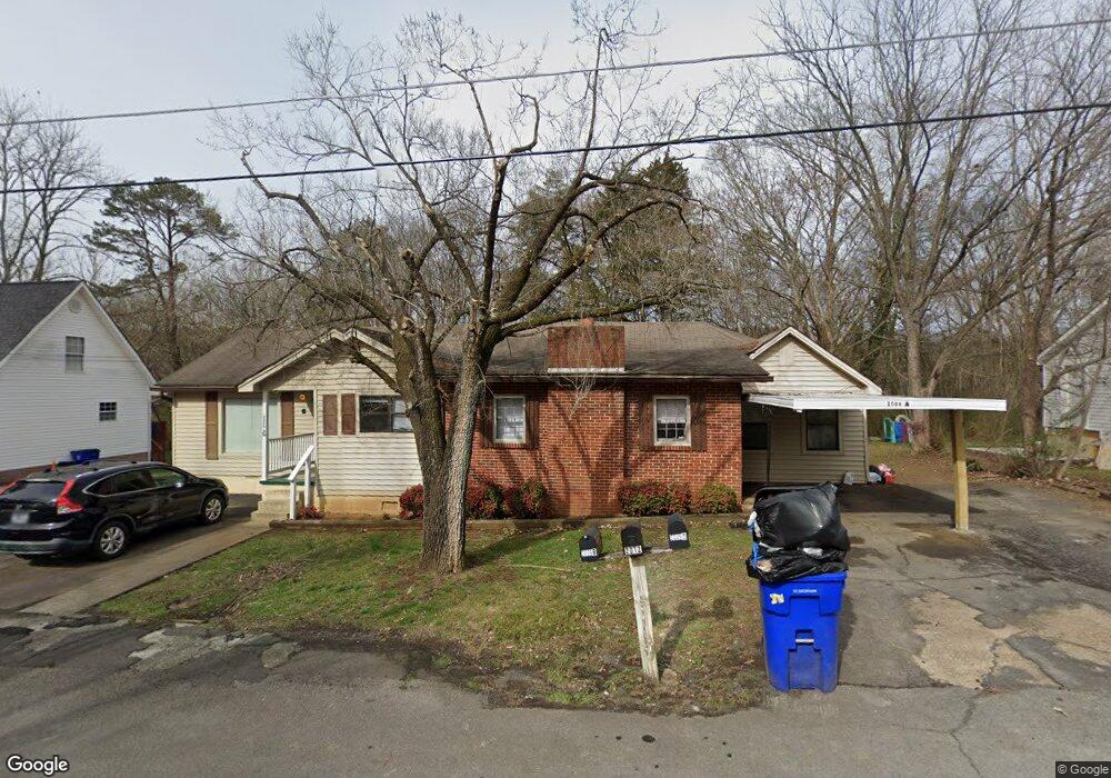
2009 Central St NW Cleveland, TN 37311
Estimated Value: $215,338 - $246,000
4
Beds
4
Baths
1,732
Sq Ft
$136/Sq Ft
Est. Value
About This Home
This home is located at 2009 Central St NW, Cleveland, TN 37311 and is currently estimated at $235,446, approximately $135 per square foot. 2009 Central St NW is a home located in Bradley County with nearby schools including George R. Stuart Elementary School and United Christian Academy.
Ownership History
Date
Name
Owned For
Owner Type
Purchase Details
Closed on
Oct 19, 2012
Sold by
Lombardi John
Bought by
Taylor Thomas Clarke and Taylor Clinton Robert
Current Estimated Value
Purchase Details
Closed on
Jan 2, 2003
Sold by
Spurlin W Dewayne
Bought by
Lombardi John
Home Financials for this Owner
Home Financials are based on the most recent Mortgage that was taken out on this home.
Original Mortgage
$76,500
Interest Rate
6.1%
Mortgage Type
Purchase Money Mortgage
Create a Home Valuation Report for This Property
The Home Valuation Report is an in-depth analysis detailing your home's value as well as a comparison with similar homes in the area
Home Values in the Area
Average Home Value in this Area
Purchase History
| Date | Buyer | Sale Price | Title Company |
|---|---|---|---|
| Taylor Thomas Clarke | $79,500 | -- | |
| Lombardi John | $85,000 | -- |
Source: Public Records
Mortgage History
| Date | Status | Borrower | Loan Amount |
|---|---|---|---|
| Previous Owner | Lombardi John | $76,500 |
Source: Public Records
Tax History Compared to Growth
Tax History
| Year | Tax Paid | Tax Assessment Tax Assessment Total Assessment is a certain percentage of the fair market value that is determined by local assessors to be the total taxable value of land and additions on the property. | Land | Improvement |
|---|---|---|---|---|
| 2025 | $514 | $73,000 | $14,760 | $58,240 |
| 2024 | $514 | $35,720 | $10,640 | $25,080 |
| 2023 | $1,126 | $35,720 | $10,640 | $25,080 |
| 2022 | $1,126 | $35,720 | $10,640 | $25,080 |
| 2021 | $1,126 | $35,720 | $0 | $0 |
| 2020 | $940 | $35,720 | $0 | $0 |
| 2019 | $940 | $24,480 | $0 | $0 |
| 2018 | $1,008 | $0 | $0 | $0 |
| 2017 | $504 | $0 | $0 | $0 |
| 2016 | $1,189 | $0 | $0 | $0 |
| 2015 | $1,189 | $0 | $0 | $0 |
| 2014 | $608 | $0 | $0 | $0 |
Source: Public Records
Map
Nearby Homes
- 2024 Caywood Dr NW
- 1505 Mohawk Ct NW
- 2113 Georgetown Rd NW
- 1509 17th St NW
- 2000 Georgetown Rd NW
- 5 18th St NW
- 2505 Hickory Dr NW
- 2460 Valley Hills Dr
- 1507 Everhart Dr NW
- 802 22nd St NW
- Lot 11 Ridge Point Dr NW
- 809 Park Ave NW
- 2270 Tennessee Nursery Rd NW
- 1002 17th St NW
- 2460 Tennessee Nursery Rd
- 1215 Clingan Ridge Dr NW
- 1007 Emmett Ave NW
- 2142 Timber Trace Cir NW
- 3011 Parkwood Trail NW
- 912 Fairmont Ave NW
- 2009 Central St NW Unit B
- 2007 Central St NW
- 2017 Central St NW
- 2025 Central St NW
- 2025 Central St NW Unit 5
- 2012 Central St NW
- 2027 Central St NW
- 2016 Central St NW
- 2010 Central St NW
- 2001 Central St NW
- 2020 Central St NW
- 2012 Westside Dr NW
- 2000 Central St NW
- 2008 Westside Dr NW
- 2013 Ohio Ave NW
- 2004 Westside Dr NW
- 2024 Central St NW
- 2003 Ohio Ave NW
- 2043 Central St NW
- 2017 Ohio Ave NW