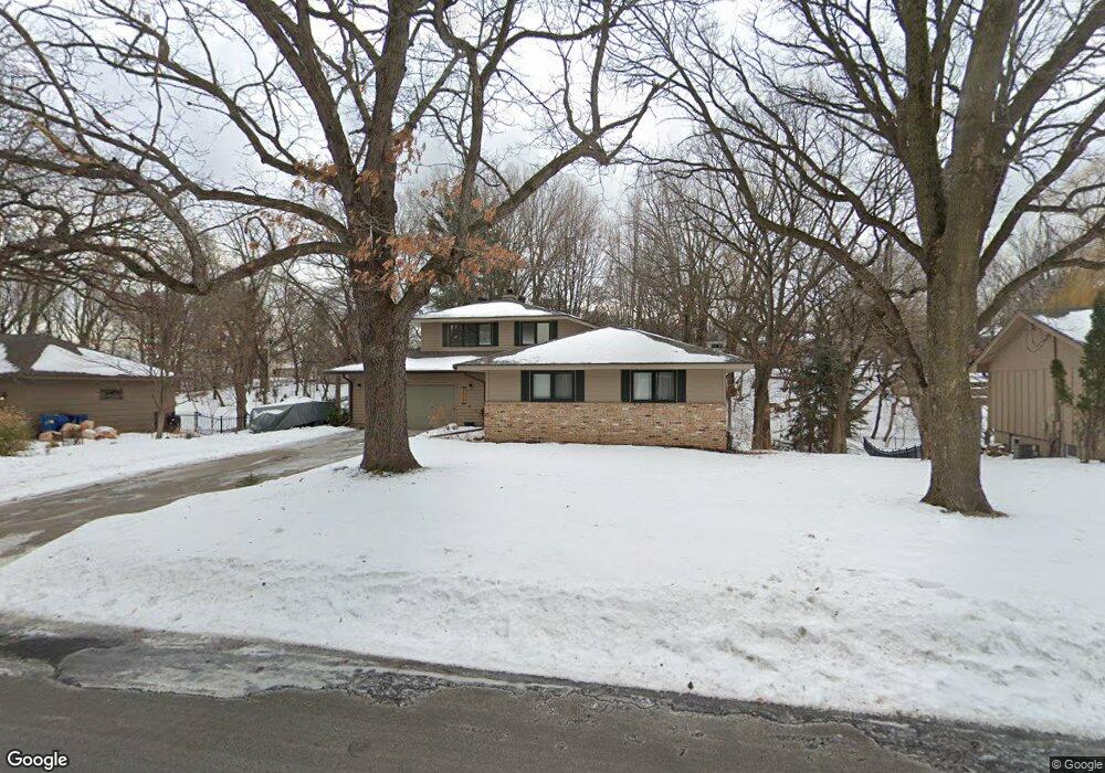
2009 E 125th St Burnsville, MN 55337
Estimated Value: $411,000 - $496,000
3
Beds
3
Baths
2,940
Sq Ft
$160/Sq Ft
Est. Value
About This Home
This home is located at 2009 E 125th St, Burnsville, MN 55337 and is currently estimated at $471,063, approximately $160 per square foot. 2009 E 125th St is a home located in Dakota County with nearby schools including William Byrne Elementary School, Burnsville High School, and Gateway STEM Academy.
Ownership History
Date
Name
Owned For
Owner Type
Purchase Details
Closed on
Jan 23, 2019
Sold by
Wiedenman Douglas M and Wiedenman Donna M
Bought by
Powers Derek L and Powers Heidi M
Current Estimated Value
Home Financials for this Owner
Home Financials are based on the most recent Mortgage that was taken out on this home.
Original Mortgage
$312,548
Outstanding Balance
$274,793
Interest Rate
4.6%
Mortgage Type
New Conventional
Estimated Equity
$196,270
Create a Home Valuation Report for This Property
The Home Valuation Report is an in-depth analysis detailing your home's value as well as a comparison with similar homes in the area
Home Values in the Area
Average Home Value in this Area
Purchase History
| Date | Buyer | Sale Price | Title Company |
|---|---|---|---|
| Powers Derek L | $333,000 | Burnet Title |
Source: Public Records
Mortgage History
| Date | Status | Borrower | Loan Amount |
|---|---|---|---|
| Open | Powers Derek L | $312,548 |
Source: Public Records
Tax History Compared to Growth
Tax History
| Year | Tax Paid | Tax Assessment Tax Assessment Total Assessment is a certain percentage of the fair market value that is determined by local assessors to be the total taxable value of land and additions on the property. | Land | Improvement |
|---|---|---|---|---|
| 2024 | $5,240 | $499,100 | $93,000 | $406,100 |
| 2023 | $5,240 | $497,900 | $93,100 | $404,800 |
| 2022 | $4,194 | $482,300 | $92,900 | $389,400 |
| 2021 | $4,290 | $391,000 | $80,700 | $310,300 |
| 2020 | $4,176 | $379,800 | $75,100 | $304,700 |
| 2019 | $4,211 | $357,700 | $71,500 | $286,200 |
| 2018 | $4,181 | $343,700 | $68,100 | $275,600 |
| 2017 | $4,075 | $323,700 | $64,900 | $258,800 |
| 2016 | $3,916 | $310,000 | $61,800 | $248,200 |
| 2015 | $3,736 | $275,699 | $57,617 | $218,082 |
| 2014 | -- | $273,737 | $56,513 | $217,224 |
| 2013 | -- | $259,349 | $51,374 | $207,975 |
Source: Public Records
Map
Nearby Homes
- 1966 Skyline Dr S
- 2400 E 125th St
- 2300 Villaburne Ct W
- 12316 Michelle Cir
- 12420 Chippewa Ln
- 12232 Oak Leaf Cir
- 2007 E 122nd St Unit B15
- 2011 E 122nd St Unit D24
- 2009 E 122nd St Unit C8
- 2005 E 122nd St Unit A23
- 2005 E 122nd St Unit A14
- 2005 E 122nd St Unit A7
- 122 Birnamwood Dr
- 72 River Woods Ln
- 37 Birnamwood Dr
- 55 River Woods Ln
- 2708 Lassen Ct
- 12284 River Valley Dr
- 12251 River Valley Dr
- 146 River Woods Ln
- 2005 E 125th St
- 2036 Skyline Dr S
- 2040 Skyline Dr S
- 2004 E 125th St
- 2001 E 125th St
- 2105 E 125th St
- 2034 Skyline Dr S
- 2008 E 125th St
- 2144 Skyline Dr S
- 2000 Skyline Dr S
- 2100 E 125th St
- 1921 E 125th St
- 2154 Skyline Dr S
- 2109 E 125th St
- 2000 E 125th St
- 1920 E 125th St
- 2207 Skyline Dr S
- 2104 E 125th St
- 2166 Skyline Dr S
- 1917 E 125th St