Estimated Value: $103,019 - $131,000
3
Beds
1
Bath
1,040
Sq Ft
$111/Sq Ft
Est. Value
About This Home
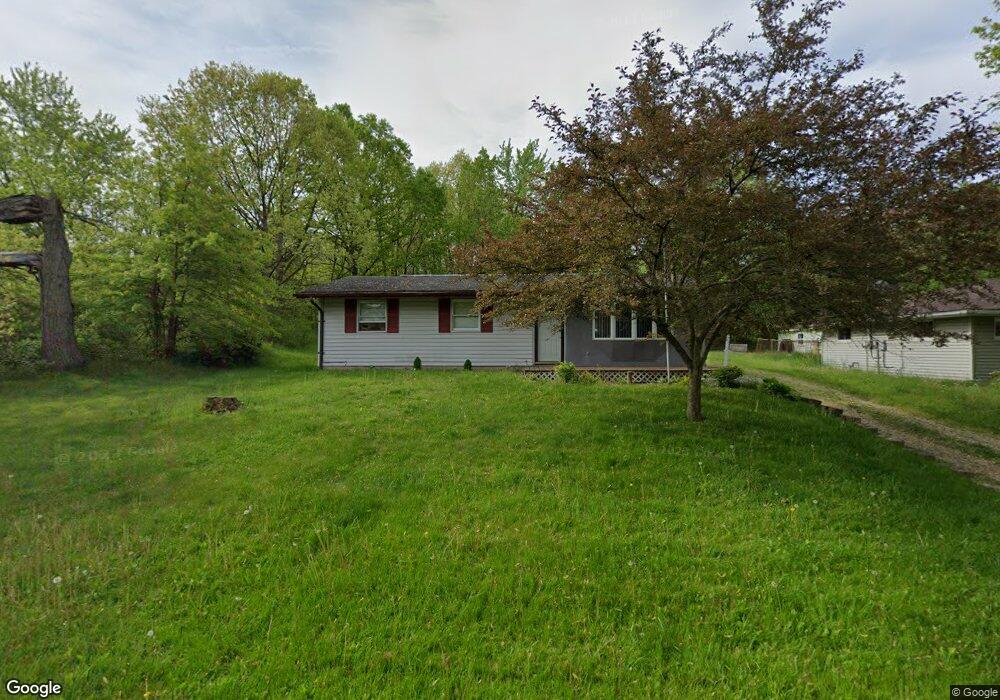
This home is located at 2009 James St, Niles, OH 44446 and is currently estimated at $115,755, approximately $111 per square foot. 2009 James St is a home located in Trumbull County with nearby schools including Niles Primary School, Niles Intermediate School, and Niles Middle School.
Ownership History
Date
Name
Owned For
Owner Type
Purchase Details
Closed on
Jul 28, 2004
Sold by
Kaloci George and Kaloci Arlene A
Bought by
Kaloci George and Kaloci Arlene A
Current Estimated Value
Purchase Details
Closed on
Jul 15, 2004
Sold by
Kaloci George and Kaloci Arlene A
Bought by
Kaloci George and Kaloci Arlene A
Purchase Details
Closed on
Jan 1, 1990
Bought by
Geo E Kaloci
Create a Home Valuation Report for This Property
The Home Valuation Report is an in-depth analysis detailing your home's value as well as a comparison with similar homes in the area
Home Values in the Area
Average Home Value in this Area
Purchase History
| Date | Buyer | Sale Price | Title Company |
|---|---|---|---|
| Kaloci George | -- | -- | |
| Kaloci George | -- | -- | |
| Geo E Kaloci | -- | -- |
Source: Public Records
Tax History
| Year | Tax Paid | Tax Assessment Tax Assessment Total Assessment is a certain percentage of the fair market value that is determined by local assessors to be the total taxable value of land and additions on the property. | Land | Improvement |
|---|---|---|---|---|
| 2024 | $444 | $23,040 | $4,030 | $19,010 |
| 2023 | $302 | $23,040 | $4,030 | $19,010 |
| 2022 | $481 | $18,590 | $4,030 | $14,560 |
| 2021 | $505 | $18,590 | $4,030 | $14,560 |
| 2020 | $510 | $18,590 | $4,030 | $14,560 |
| 2019 | $463 | $17,260 | $4,030 | $13,230 |
| 2018 | $462 | $17,260 | $4,030 | $13,230 |
| 2017 | $459 | $17,260 | $4,030 | $13,230 |
| 2016 | $536 | $18,590 | $4,060 | $14,530 |
| 2015 | $530 | $18,590 | $4,060 | $14,530 |
| 2014 | $1,004 | $18,590 | $4,060 | $14,530 |
| 2013 | $998 | $19,500 | $4,060 | $15,440 |
Source: Public Records
Map
Nearby Homes
- 0 James St
- 1919 Carnegie Heights Dr
- 2243 N Glenwood Ave
- 126 S Rhodes Ave
- 166 Oak Knoll St SE
- 223 Russell Ave
- 352 N Rhodes Ave
- 340 Mcevoy Ct
- 45 Summit Ave
- 21 Summit Ave
- 1436 Clinton St
- 1236 Robbins Ave
- 32 Summit Ave
- 1675 Roosevelt Ave
- 304 Baldwin Ave
- 2218 Crestmont Dr
- 311 High Ave
- 307 Peffer Ave
- 2153 Coates Dr
- 2139 Coates Dr
- 2008 James St
- 2002 James St
- 1945 James St
- 98 Poplar Ave
- 1937 James St
- 215 McDonald Ave
- 224 McDonald Ave
- 0 Brecknock Unit 4043060
- 90 Poplar Ave
- 211 McDonald Ave
- 218 McDonald Ave
- 91 Poplar Ave
- 205 McDonald Ave
- 1938 James St
- 1933 James St
- 84 Poplar Ave
- 87 Poplar Ave
- 201 McDonald Ave
- 1932 James St
- 208 McDonald Ave
Your Personal Tour Guide
Ask me questions while you tour the home.