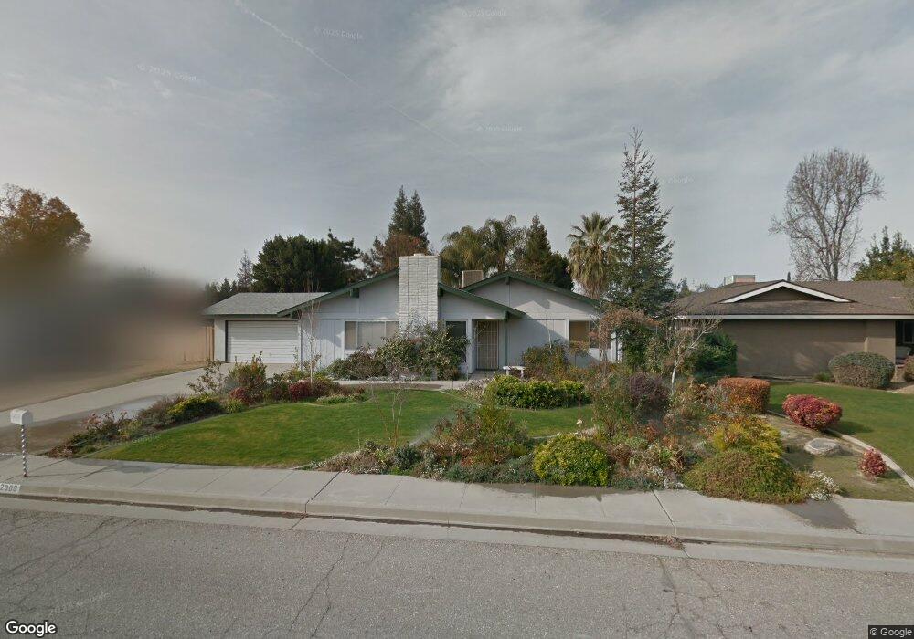
2009 Jason St Bakersfield, CA 93312
Greenacres NeighborhoodEstimated Value: $468,721 - $527,000
4
Beds
2
Baths
1,788
Sq Ft
$282/Sq Ft
Est. Value
About This Home
This home is located at 2009 Jason St, Bakersfield, CA 93312 and is currently estimated at $504,430, approximately $282 per square foot. 2009 Jason St is a home located in Kern County with nearby schools including American Elementary School, Rosedale Middle School, and Liberty High School.
Ownership History
Date
Name
Owned For
Owner Type
Purchase Details
Closed on
Oct 14, 2016
Sold by
Carnell David T and Carnell Theresa
Bought by
Carnell David T and Carnell Theresa A
Current Estimated Value
Purchase Details
Closed on
Oct 10, 2016
Sold by
Carnell David T and Carnell Theresa
Bought by
Carnell David T and Carnell Theresa A
Purchase Details
Closed on
Sep 8, 2003
Sold by
Va
Bought by
Carnell David T and Carnell Theresa
Home Financials for this Owner
Home Financials are based on the most recent Mortgage that was taken out on this home.
Original Mortgage
$120,000
Interest Rate
6.17%
Mortgage Type
Purchase Money Mortgage
Create a Home Valuation Report for This Property
The Home Valuation Report is an in-depth analysis detailing your home's value as well as a comparison with similar homes in the area
Home Values in the Area
Average Home Value in this Area
Purchase History
| Date | Buyer | Sale Price | Title Company |
|---|---|---|---|
| Carnell David T | -- | None Available | |
| Carnell David T | -- | None Available | |
| Carnell David T | -- | Fidelity Title |
Source: Public Records
Mortgage History
| Date | Status | Borrower | Loan Amount |
|---|---|---|---|
| Closed | Carnell David T | $120,000 |
Source: Public Records
Tax History Compared to Growth
Tax History
| Year | Tax Paid | Tax Assessment Tax Assessment Total Assessment is a certain percentage of the fair market value that is determined by local assessors to be the total taxable value of land and additions on the property. | Land | Improvement |
|---|---|---|---|---|
| 2025 | $3,292 | $248,877 | $72,128 | $176,749 |
| 2024 | $3,203 | $243,998 | $70,714 | $173,284 |
| 2023 | $3,203 | $239,215 | $69,328 | $169,887 |
| 2022 | $3,115 | $234,525 | $67,969 | $166,556 |
| 2021 | $3,000 | $229,928 | $66,637 | $163,291 |
| 2020 | $2,929 | $227,571 | $65,954 | $161,617 |
| 2019 | $2,871 | $227,571 | $65,954 | $161,617 |
| 2018 | $2,789 | $218,737 | $63,394 | $155,343 |
| 2017 | $2,738 | $214,449 | $62,151 | $152,298 |
| 2016 | $2,576 | $210,245 | $60,933 | $149,312 |
| 2015 | $2,534 | $207,088 | $60,018 | $147,070 |
| 2014 | $2,454 | $203,033 | $58,843 | $144,190 |
Source: Public Records
Map
Nearby Homes
- 10729 Lindalee Ln
- 11407 Palm Ave
- 10920 Cilantro Ave
- 2008 Torrey Dr
- 11520 Pinehaven Ave
- 10931 Shellabarger Rd
- 2125 Verdugo Ln
- 11510 Finsbury Ct
- 10429 Enger St
- 1850 Verdugo Ln
- 11717 Old Town Rd
- 10307 Glenn St
- 10514 Brimhall Rd
- 10711 Four Bears Dr
- 10418 Brimhall Rd
- 3108 Holbrook St
- 11617 Cactus Dr
- 11201 Paddock Ave
- 11705 Cactus Dr
- 11017 Iron Creek Ave
- 2013 Jason St
- 2005 Jason St
- 2017 Jason St
- 2001 Jason St
- 10728 Palm Ave
- 10724 Palm Ave
- 2021 Jason St
- 2020 Jason St
- 2025 Jason St
- 10720 Palm Ave
- 2000 Jewetta Ave
- 2029 Jason St
- 10725 Lindalee Ln
- 1909 Spanke St
- 10716 Palm Ave
- 2020 Jewetta Ave
- 2008 Jewetta Ave
- 10721 Lindalee Ln
- 2012 Jewetta Ave
- 2004 Jewetta Ave