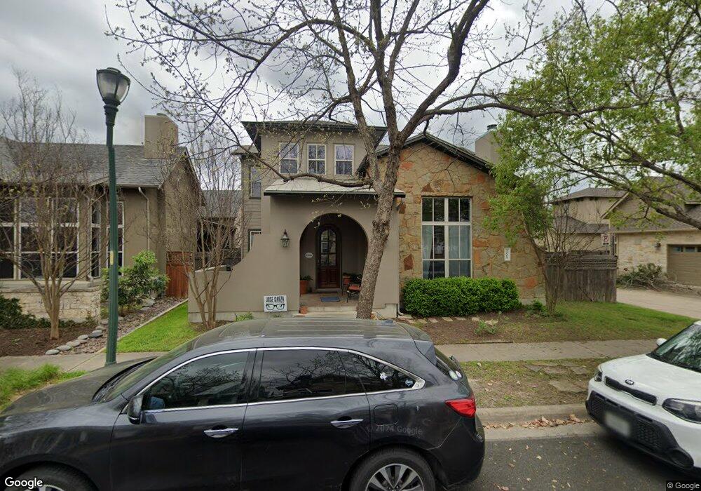
2009 Mccloskey St Austin, TX 78723
Mueller NeighborhoodEstimated Value: $931,000 - $1,116,000
Studio
3
Baths
2,669
Sq Ft
$392/Sq Ft
Est. Value
About This Home
This home is located at 2009 Mccloskey St, Austin, TX 78723 and is currently estimated at $1,045,209, approximately $391 per square foot. 2009 Mccloskey St is a home located in Travis County with nearby schools including Maplewood Elementary School, Kealing Middle School, and McCallum High School.
Ownership History
Date
Name
Owned For
Owner Type
Purchase Details
Closed on
Nov 14, 2008
Sold by
Standard Pacific Of Texas Inc
Bought by
Wilson Preston S and Wilson Lila R
Current Estimated Value
Home Financials for this Owner
Home Financials are based on the most recent Mortgage that was taken out on this home.
Original Mortgage
$351,400
Outstanding Balance
$229,524
Interest Rate
5.98%
Mortgage Type
Purchase Money Mortgage
Estimated Equity
$815,685
Create a Home Valuation Report for This Property
The Home Valuation Report is an in-depth analysis detailing your home's value as well as a comparison with similar homes in the area
Home Values in the Area
Average Home Value in this Area
Purchase History
| Date | Buyer | Sale Price | Title Company |
|---|---|---|---|
| Wilson Preston S | -- | First American Title |
Source: Public Records
Mortgage History
| Date | Status | Borrower | Loan Amount |
|---|---|---|---|
| Open | Wilson Preston S | $351,400 |
Source: Public Records
Tax History
| Year | Tax Paid | Tax Assessment Tax Assessment Total Assessment is a certain percentage of the fair market value that is determined by local assessors to be the total taxable value of land and additions on the property. | Land | Improvement |
|---|---|---|---|---|
| 2025 | $16,982 | $996,303 | $488,225 | $508,078 |
| 2023 | $15,649 | $1,011,997 | $0 | $0 |
| 2022 | $18,169 | $919,997 | $0 | $0 |
| 2021 | $18,205 | $836,361 | $230,000 | $606,361 |
| 2020 | $17,025 | $793,756 | $230,000 | $563,756 |
| 2018 | $16,386 | $740,113 | $230,000 | $510,113 |
| 2017 | $15,251 | $683,859 | $230,000 | $470,881 |
| 2016 | $13,865 | $621,690 | $143,750 | $517,941 |
| 2015 | $11,029 | $565,173 | $100,000 | $532,873 |
| 2014 | $11,029 | $513,794 | $0 | $0 |
Source: Public Records
Map
Nearby Homes
- 4108 Camacho St
- 4004 Pinckney St
- 1912 Antone St
- 2237 Zach Scott St
- 2133 Emma Long St
- 2624 Tom Miller St
- 3824 Hermalinda St
- 1931 E 38th 1 2 St Unit 33
- 3900 Threadgill St Unit 2
- 2805 Mccurdy St Unit Building 19
- 2805 Mccurdy St Unit 10
- 2805 Mccurdy St Unit 9
- 2805 Mccurdy St Unit 1
- 2805 Mccurdy St Unit 3
- 2805 Mccurdy St Unit 2
- 1931 E 38 1 2 St Unit 43
- 3709 Tower View Ct
- 3824 Berkman Dr
- 3705 Tower View Ct
- 2805 Mc Curdy St Unit 1
- 2013 Mccloskey St
- 2017 Mccloskey St
- 4029 Camacho St
- 4025 Camacho St
- 2008 Emma Long St
- 4021 Camacho St
- 2012 Emma Long St
- 2021 Mccloskey St
- 2012 Mccloskey St
- 2008 Mccloskey St
- 2016 Mccloskey St
- 2016 Mccloskey St Unit 2
- 2016 Emma Long St
- 4017 Camacho St
- 2004 Mccloskey St
- 2020 Emma Long St
- 2000 Mccloskey St
- 2025 Mccloskey St
- 4101 Scales St
- 4105 Scales St
Your Personal Tour Guide
Ask me questions while you tour the home.