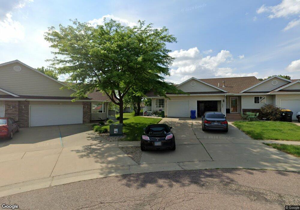
2009 S Leah Cir Sioux Falls, SD 57106
Northwest Sioux Falls NeighborhoodEstimated Value: $250,000 - $260,000
2
Beds
2
Baths
1,464
Sq Ft
$174/Sq Ft
Est. Value
About This Home
This home is located at 2009 S Leah Cir, Sioux Falls, SD 57106 and is currently estimated at $254,392, approximately $173 per square foot. 2009 S Leah Cir is a home located in Minnehaha County with nearby schools including Discovery Elementary School, Memorial Middle School, and Jefferson High School - 67.
Ownership History
Date
Name
Owned For
Owner Type
Purchase Details
Closed on
Jul 27, 2018
Sold by
Burns Bobbi S
Bought by
Kolander Judith M and Kolander Darin S
Current Estimated Value
Home Financials for this Owner
Home Financials are based on the most recent Mortgage that was taken out on this home.
Original Mortgage
$137,362
Outstanding Balance
$119,293
Interest Rate
4.5%
Mortgage Type
FHA
Estimated Equity
$135,099
Purchase Details
Closed on
Jul 7, 2014
Sold by
Deborah K Deborah K
Bought by
Burns Bobbi S
Home Financials for this Owner
Home Financials are based on the most recent Mortgage that was taken out on this home.
Original Mortgage
$127,497
Interest Rate
4.15%
Mortgage Type
FHA
Create a Home Valuation Report for This Property
The Home Valuation Report is an in-depth analysis detailing your home's value as well as a comparison with similar homes in the area
Home Values in the Area
Average Home Value in this Area
Purchase History
| Date | Buyer | Sale Price | Title Company |
|---|---|---|---|
| Kolander Judith M | $160,000 | Stewart Title Company | |
| Burns Bobbi S | $129,850 | -- |
Source: Public Records
Mortgage History
| Date | Status | Borrower | Loan Amount |
|---|---|---|---|
| Open | Kolander Judith M | $137,362 | |
| Previous Owner | Burns Bobbi S | $127,497 |
Source: Public Records
Tax History Compared to Growth
Tax History
| Year | Tax Paid | Tax Assessment Tax Assessment Total Assessment is a certain percentage of the fair market value that is determined by local assessors to be the total taxable value of land and additions on the property. | Land | Improvement |
|---|---|---|---|---|
| 2024 | $2,415 | $180,100 | $19,400 | $160,700 |
| 2023 | $2,334 | $167,600 | $19,400 | $148,200 |
| 2022 | $2,009 | $135,700 | $16,100 | $119,600 |
| 2021 | $1,955 | $128,000 | $0 | $0 |
| 2020 | $1,955 | $127,000 | $0 | $0 |
| 2019 | $1,880 | $119,913 | $0 | $0 |
| 2018 | $1,677 | $112,553 | $0 | $0 |
| 2017 | $1,675 | $107,400 | $14,763 | $92,637 |
| 2016 | $1,675 | $107,400 | $14,763 | $92,637 |
| 2015 | $1,728 | $106,623 | $13,986 | $92,637 |
| 2014 | $1,698 | $106,389 | $13,752 | $92,637 |
Source: Public Records
Map
Nearby Homes
- 1805 S Sertoma Ave Unit 105
- 1907 S Campbell Trail
- 7404 W Strabane St
- 1917 S Grinnell Ave
- 7005 W Strabane Trail
- 1805 S Strabane Cir
- 6817 W Westminster Dr
- 6728 W Westminster Dr
- 6909 W Westminster Dr
- 6915 W Westminster Dr
- 7721 W Raegan St
- 7409 W Harvard Dr
- 2621 S Rutgers Ave
- 7304 W Lobelia St St
- 1209 S Discovery Ave
- 6308 W Westminster Dr
- 1301 Hyannis Port Ln
- 7116 W Panama St
- 7412 W Zinnia Cir
- 8101 W 24th St
- 2013 S Leah Cir
- 2001 S Leah Cir
- 2017 S Leah Cir
- 2026 S Dorothy Ave
- 2022 S Dorothy Ave
- 2000 S Leah Cir
- 2028 S Dorothy Ave
- 2020 S Dorothy Ave
- 2030 S Dorothy Ave
- 2021 S Leah Cir
- 2032 S Dorothy Ave
- 2024 S Dorothy Ave
- 2004 S Leah Cir
- 2025 S Leah Cir
- 2034 S Dorothy Ave
- 2016 S Dorothy Ave
- 2016 S Leah Cir
- 2018 S Dorothy Ave
- 2012 S Leah Cir
- 2036 S Dorothy Ave