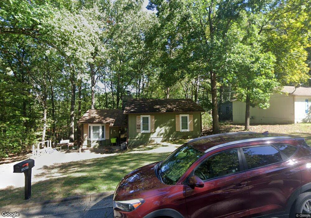
2009 Singleton Ct Little Rock, AR 72204
John Barrow NeighborhoodEstimated Value: $98,125 - $124,000
--
Bed
2
Baths
1,034
Sq Ft
$110/Sq Ft
Est. Value
About This Home
This home is located at 2009 Singleton Ct, Little Rock, AR 72204 and is currently estimated at $113,781, approximately $110 per square foot. 2009 Singleton Ct is a home located in Pulaski County with nearby schools including Bale Elementary School, J.A. Fair K8 Preparatory School, and Henderson Middle School.
Ownership History
Date
Name
Owned For
Owner Type
Purchase Details
Closed on
Apr 30, 2010
Sold by
Wallace Jonathan D
Bought by
Garrison Dea S
Current Estimated Value
Home Financials for this Owner
Home Financials are based on the most recent Mortgage that was taken out on this home.
Original Mortgage
$66,462
Outstanding Balance
$44,112
Interest Rate
4.93%
Mortgage Type
FHA
Estimated Equity
$69,669
Purchase Details
Closed on
Oct 9, 2009
Sold by
Secretary Of Veterans Affairs
Bought by
Wallace Jonathan D
Purchase Details
Closed on
Aug 16, 2009
Sold by
Velez Samuel David
Bought by
Midfirst Bank
Create a Home Valuation Report for This Property
The Home Valuation Report is an in-depth analysis detailing your home's value as well as a comparison with similar homes in the area
Home Values in the Area
Average Home Value in this Area
Purchase History
| Date | Buyer | Sale Price | Title Company |
|---|---|---|---|
| Garrison Dea S | $70,000 | Lenders Title Company | |
| Wallace Jonathan D | -- | None Available | |
| Midfirst Bank | $27,320 | None Available |
Source: Public Records
Mortgage History
| Date | Status | Borrower | Loan Amount |
|---|---|---|---|
| Open | Garrison Dea S | $66,462 |
Source: Public Records
Tax History Compared to Growth
Tax History
| Year | Tax Paid | Tax Assessment Tax Assessment Total Assessment is a certain percentage of the fair market value that is determined by local assessors to be the total taxable value of land and additions on the property. | Land | Improvement |
|---|---|---|---|---|
| 2025 | $874 | $16,413 | $1,000 | $15,413 |
| 2024 | $801 | $16,413 | $1,000 | $15,413 |
| 2023 | $801 | $16,413 | $1,000 | $15,413 |
| 2022 | $764 | $16,413 | $1,000 | $15,413 |
| 2021 | $733 | $10,400 | $2,200 | $8,200 |
| 2020 | $353 | $10,400 | $2,200 | $8,200 |
| 2019 | $353 | $10,400 | $2,200 | $8,200 |
| 2018 | $378 | $10,400 | $2,200 | $8,200 |
| 2017 | $378 | $10,400 | $2,200 | $8,200 |
| 2016 | $645 | $14,210 | $2,840 | $11,370 |
| 2015 | $900 | $13,994 | $2,840 | $11,154 |
| 2014 | $900 | $12,834 | $2,840 | $9,994 |
Source: Public Records
Map
Nearby Homes
- 2112 Singleton Ct
- 2204 Singleton Cove
- 2208 Singleton Cove
- 3918 W 23rd St
- 8001 Kanis Pines Dr
- 8300 W 23rd St
- 8127 Kanis Pines Dr
- Lot 42R Kanis Pines Dr
- Lot 39R Kanis Pines Dr
- 7921 Kanis Oaks Dr
- Lot 8 Kanis Oaks Dr
- 8010 Kanis Oaks Dr
- 2522 Quebec Dr
- 3003 Vancouver Dr
- 2918 Vancouver Dr
- 2922 Vancouver Dr
- 1718 Leander Dr
- 2706 Longcoy St
- 3101 Gilman St
- 8904 Sage Meadows Dr
- 2015 Singleton Ct
- 2103 Singleton Ct
- 2012 Vancouver Dr
- 2006 Vancouver Dr
- 2018 Vancouver Dr
- 2001 Singleton Ct
- tba Singleton Ct
- 2024 Vancouver Dr
- 2014 Singleton Ct
- Lot 8 Singleton Ct
- 2107 Singleton Ct
- 2010 Singleton Ct
- 2102 Singleton Ct
- 2000 Vancouver Dr
- 2100 Vancouver Dr
- 2108 Singleton Ct
- 2111 Singleton Ct
- 2115 Singleton Ct
- 2106 Vancouver Dr
- 2001 Vancouver Dr