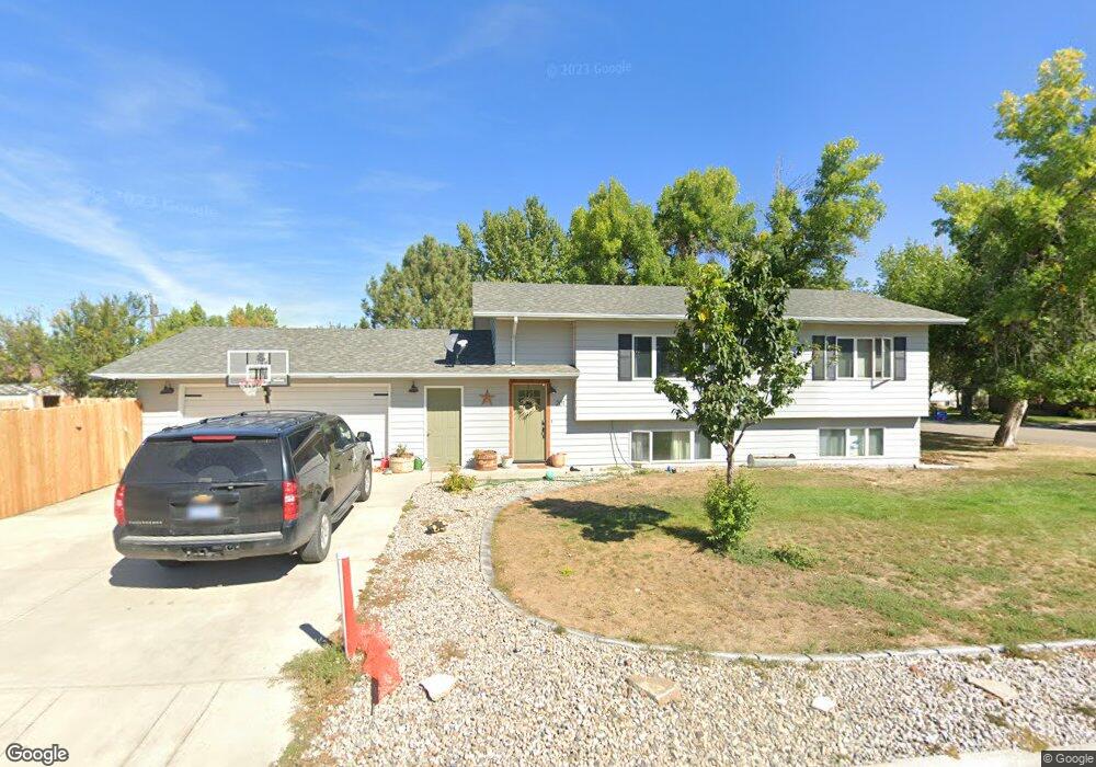
201 1st Ave SW Conrad, MT 59425
Estimated Value: $251,000 - $325,000
5
Beds
3
Baths
1,080
Sq Ft
$271/Sq Ft
Est. Value
About This Home
This home is located at 201 1st Ave SW, Conrad, MT 59425 and is currently estimated at $292,756, approximately $271 per square foot. 201 1st Ave SW is a home located in Pondera County with nearby schools including Meadowlark School, Utterback Middle School (7-8), and Conrad High School.
Ownership History
Date
Name
Owned For
Owner Type
Purchase Details
Closed on
Feb 24, 2025
Sold by
Cannady Bob W
Bought by
Reid Thomas R
Current Estimated Value
Home Financials for this Owner
Home Financials are based on the most recent Mortgage that was taken out on this home.
Original Mortgage
$304,000
Outstanding Balance
$296,366
Interest Rate
0.68%
Mortgage Type
Construction
Estimated Equity
-$3,610
Purchase Details
Closed on
Sep 5, 2024
Sold by
Perkins Lee and Perkins Taylor
Bought by
Cannady Bob W
Home Financials for this Owner
Home Financials are based on the most recent Mortgage that was taken out on this home.
Original Mortgage
$476,155
Interest Rate
0.52%
Mortgage Type
Construction
Purchase Details
Closed on
Jun 1, 2004
Bought by
Drishinski Julia
Create a Home Valuation Report for This Property
The Home Valuation Report is an in-depth analysis detailing your home's value as well as a comparison with similar homes in the area
Home Values in the Area
Average Home Value in this Area
Purchase History
| Date | Buyer | Sale Price | Title Company |
|---|---|---|---|
| Reid Thomas R | $380,000 | Flying S Title & Escrow/Montan | |
| Cannady Bob W | $595,194 | Flying S Title & Escrow | |
| Drishinski Julia | -- | -- |
Source: Public Records
Mortgage History
| Date | Status | Borrower | Loan Amount |
|---|---|---|---|
| Open | Reid Thomas R | $304,000 | |
| Previous Owner | Cannady Bob W | $476,155 |
Source: Public Records
Tax History
| Year | Tax Paid | Tax Assessment Tax Assessment Total Assessment is a certain percentage of the fair market value that is determined by local assessors to be the total taxable value of land and additions on the property. | Land | Improvement |
|---|---|---|---|---|
| 2025 | $1,386 | $277,900 | $0 | $0 |
| 2024 | $1,966 | $204,400 | $0 | $0 |
| 2023 | $2,123 | $204,400 | $0 | $0 |
| 2022 | $1,909 | $179,000 | $0 | $0 |
| 2021 | $1,957 | $179,000 | $0 | $0 |
| 2020 | $2,247 | $188,100 | $0 | $0 |
| 2019 | $2,208 | $188,100 | $0 | $0 |
| 2018 | $2,127 | $178,700 | $0 | $0 |
| 2017 | $1,912 | $178,700 | $0 | $0 |
| 2016 | $1,905 | $164,100 | $0 | $0 |
| 2015 | $1,985 | $164,100 | $0 | $0 |
| 2014 | $1,027 | $51,092 | $0 | $0 |
Source: Public Records
Map
Nearby Homes
- 102 N Virginia St
- 2 N Maryland St
- 1 S Maryland St
- 1 S Delaware St
- 13 S Wisconsin St
- 113 S Delaware St
- 302 S Wisconsin St
- 119 S Dakota St
- 417 4th Ave SW
- 407 S Illinois St
- 408 S Michigan St
- 412 S Iowa St
- 509 S Michigan St
- 601 S Michigan St
- 946 Lederer Rd
- 115 Brady St N
- Lot 7 and 8 3rd Ave SW
- Lot 9 3rd Ave SW
- 2820 5th Ln NW
- 2243 Buena Vista Rd
- 201 1st Ave NW
- 201 1st Ave NW
- 104 N Maryland St
- 20 N Maryland St
- 223 1st Ave NW
- 223 1st Ave NW
- 105 N Delaware St
- 112 N Maryland St
- 16 N Maryland St
- 224 1st Ave NW
- 125 1st Ave NW
- 109 N Delaware St
- 105 N Maryland St
- 15 N Delaware St
- 12 N Maryland St
- 124 1st Ave NW
- 107 N Maryland St
- 111 N Delaware St
- 114 N Maryland St
- 13 N Delaware St
Your Personal Tour Guide
Ask me questions while you tour the home.