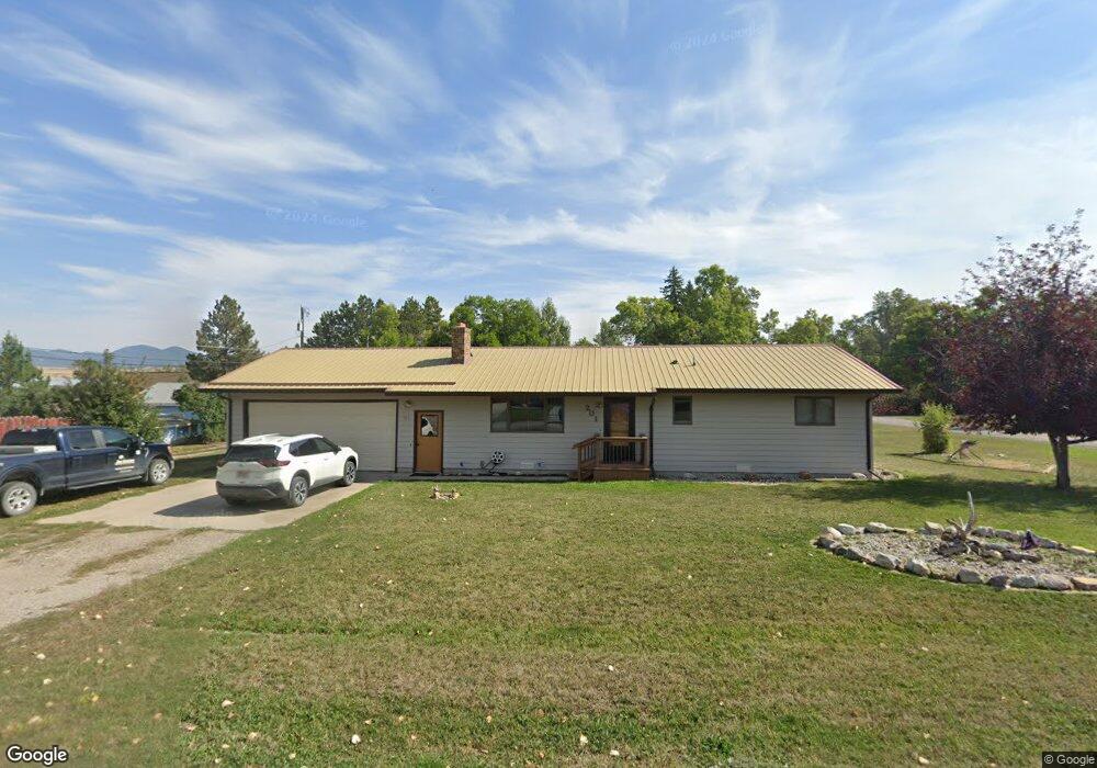
201 3rd St W Lewistown, MT 59457
Estimated Value: $198,000 - $376,000
2
Beds
2
Baths
1,232
Sq Ft
$241/Sq Ft
Est. Value
About This Home
This home is located at 201 3rd St W, Lewistown, MT 59457 and is currently estimated at $297,137, approximately $241 per square foot. 201 3rd St W is a home located in Fergus County with nearby schools including Fergus High School.
Ownership History
Date
Name
Owned For
Owner Type
Purchase Details
Closed on
Mar 14, 2023
Sold by
Clave Louis J
Bought by
Jackson Paul and Jackson Kristy
Current Estimated Value
Home Financials for this Owner
Home Financials are based on the most recent Mortgage that was taken out on this home.
Original Mortgage
$313,222
Outstanding Balance
$303,318
Interest Rate
6.09%
Mortgage Type
New Conventional
Estimated Equity
-$6,181
Purchase Details
Closed on
Apr 9, 2021
Sold by
Blitz Llc
Bought by
Clave Louis J
Purchase Details
Closed on
Apr 1, 2021
Sold by
Blitz Llc
Bought by
Cave Louis J and Cleve Arlene C
Create a Home Valuation Report for This Property
The Home Valuation Report is an in-depth analysis detailing your home's value as well as a comparison with similar homes in the area
Home Values in the Area
Average Home Value in this Area
Purchase History
| Date | Buyer | Sale Price | Title Company |
|---|---|---|---|
| Jackson Paul | -- | -- | |
| Clave Louis J | -- | First American | |
| Cave Louis J | -- | New Title Company Name |
Source: Public Records
Mortgage History
| Date | Status | Borrower | Loan Amount |
|---|---|---|---|
| Open | Jackson Paul | $313,222 |
Source: Public Records
Tax History Compared to Growth
Tax History
| Year | Tax Paid | Tax Assessment Tax Assessment Total Assessment is a certain percentage of the fair market value that is determined by local assessors to be the total taxable value of land and additions on the property. | Land | Improvement |
|---|---|---|---|---|
| 2025 | $2,406 | $303,500 | $0 | $0 |
| 2024 | $2,911 | $242,325 | $0 | $0 |
| 2023 | $2,896 | $239,600 | $0 | $0 |
| 2022 | $2,238 | $143,500 | $0 | $0 |
| 2021 | $1,664 | $144,000 | $0 | $0 |
| 2020 | $1,947 | $134,500 | $0 | $0 |
| 2019 | $1,935 | $134,500 | $0 | $0 |
| 2018 | $1,902 | $131,200 | $0 | $0 |
| 2017 | $1,481 | $131,200 | $0 | $0 |
| 2016 | $1,804 | $48,672 | $0 | $0 |
| 2015 | $1,035 | $132,400 | $0 | $0 |
| 2014 | $656 | $65,826 | $0 | $0 |
Source: Public Records
Map
Nearby Homes
- NHN Truck Bypass
- TBD Truck Bypass
- 35 acres Truck Bypass
- NHN A St
- 414 Warr St
- 412 W Huron St
- 501 Wright St
- 105 Hillcrest Dr
- 313 W Idaho St
- 1014 Mountain View Dr
- 316 W Corcoran St
- 318 W Evelyn St
- 628 Mountain View Dr
- 632 Mountain View Dr
- 0 Tbd Unit 20682760
- 0 Tbd Unit 11290776
- 514 2nd Ave N
- 624 W Broadway St
- 115 7th Ave N
- 1011 W Broadway St
- 220 7th Ave W
- 202 3rd St W
- 215 7th Ave W
- 221 Hilger Ave
- 212 3rd St W
- 308 7th Ave W
- 307 7th Ave W
- 104 3rd St W
- 305 Hilger Ave
- 214 7th Ave W
- 220 Highland Ave
- 307 Hilger Ave
- 307 Hilger Ave Unit Lewistown
- 211 Hilger Ave
- 308 Highland Ave
- 312 Highland Ave
- 310 7th Ave W
- 317 Hilger Ave
- 306 3rd St W
- 310 Highland Ave