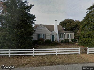
201 54th St Unit A Virginia Beach, VA 23451
North End NeighborhoodEstimated Value: $820,000 - $1,048,000
4
Beds
2
Baths
2,421
Sq Ft
$391/Sq Ft
Est. Value
About This Home
This home is located at 201 54th St Unit A, Virginia Beach, VA 23451 and is currently estimated at $946,115, approximately $390 per square foot. 201 54th St Unit A is a home located in Virginia Beach City with nearby schools including Linkhorn Park Elementary School, Virginia Beach Middle School, and Frank W. Cox High School.
Ownership History
Date
Name
Owned For
Owner Type
Purchase Details
Closed on
May 3, 1999
Sold by
Riordan Barrett J
Bought by
Clark Michael L
Current Estimated Value
Home Financials for this Owner
Home Financials are based on the most recent Mortgage that was taken out on this home.
Original Mortgage
$128,600
Interest Rate
6.95%
Create a Home Valuation Report for This Property
The Home Valuation Report is an in-depth analysis detailing your home's value as well as a comparison with similar homes in the area
Home Values in the Area
Average Home Value in this Area
Purchase History
| Date | Buyer | Sale Price | Title Company |
|---|---|---|---|
| Clark Michael L | $49,000 | -- |
Source: Public Records
Mortgage History
| Date | Status | Borrower | Loan Amount |
|---|---|---|---|
| Open | Jordan Robbin A | $145,250 | |
| Closed | Jordan Robbin A | $159,400 | |
| Closed | Jordan Robbin A | $150,000 | |
| Closed | Jordan Timothy H | $150,000 | |
| Closed | Clark Michael L | $128,600 |
Source: Public Records
Tax History Compared to Growth
Tax History
| Year | Tax Paid | Tax Assessment Tax Assessment Total Assessment is a certain percentage of the fair market value that is determined by local assessors to be the total taxable value of land and additions on the property. | Land | Improvement |
|---|---|---|---|---|
| 2024 | $3,029 | $780,700 | $620,000 | $160,700 |
| 2023 | $7,702 | $778,000 | $623,800 | $154,200 |
| 2022 | $4,258 | $650,800 | $496,600 | $154,200 |
| 2021 | $6,278 | $634,100 | $496,600 | $137,500 |
| 2020 | $4,258 | $632,900 | $496,600 | $136,300 |
| 2019 | $4,258 | $542,600 | $407,400 | $135,200 |
| 2018 | $5,440 | $542,600 | $407,400 | $135,200 |
| 2017 | $4,258 | $510,800 | $375,600 | $135,200 |
| 2016 | $4,258 | $536,300 | $401,100 | $135,200 |
| 2015 | $4,258 | $494,600 | $381,900 | $112,700 |
| 2014 | $3,406 | $476,900 | $375,600 | $101,300 |
Source: Public Records
Map
Nearby Homes
- 113 53rd St Unit B
- 113 53rd St Unit A
- 5303 Holly Rd
- 117 52nd St
- 5207 Ocean Front Ave
- 220 56th St Unit B
- 307 55th St
- 5701 Holly Rd
- 5703 Holly Rd
- 210 58th St Unit B
- 5601 Dawson Rd
- 5006 Ocean Front Ave
- 5602 Meer St
- 206 50th St Unit C
- 402 48th St
- 112 62nd St
- 4506 Atlantic Ave
- 416 Susan Constant Dr
- 6310 Atlantic Ave
- 1125 Ivy Dr
- 201 54th St Unit B
- 201 54th St Unit A
- 205 54th St
- 5402 Atlantic Ave
- 5402 Atlantic Ave Unit B
- 5400 54th St
- 200 54th St
- 207 54th St
- 5406 Atlantic Ave
- 5306 Atlantic Ave
- 5306 Atlantic Ave
- 5306 Atlantic Ave Unit A
- 207 55th St
- 207 55th St Unit A
- 207 55th St Unit B
- 200 55th St
- 119 54th St Unit A
- 119 54th St Unit B
- 119 54th St
- 209 54th St