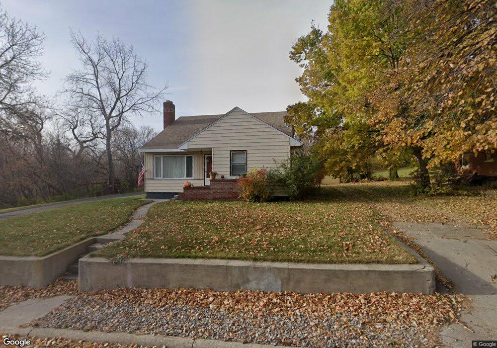
201 9th St Walhalla, ND 58282
Estimated Value: $88,000 - $126,458
Studio
--
Bath
--
Sq Ft
6,795
Sq Ft Lot
About This Home
This home is located at 201 9th St, Walhalla, ND 58282 and is currently estimated at $107,615. 201 9th St is a home.
Ownership History
Date
Name
Owned For
Owner Type
Purchase Details
Closed on
Jun 16, 2011
Sold by
Danielson Joanie L and Danielson Randy
Bought by
Thornberg Erick and Thornberg Sarah
Current Estimated Value
Home Financials for this Owner
Home Financials are based on the most recent Mortgage that was taken out on this home.
Original Mortgage
$60,408
Interest Rate
4.67%
Mortgage Type
New Conventional
Purchase Details
Closed on
Apr 12, 2007
Sold by
Hurley Edward L
Bought by
Danielson Joanie L and Hurley Edward L
Create a Home Valuation Report for This Property
The Home Valuation Report is an in-depth analysis detailing your home's value as well as a comparison with similar homes in the area
Purchase History
| Date | Buyer | Sale Price | Title Company |
|---|---|---|---|
| Thornberg Erick | -- | None Available | |
| Danielson Joanie L | -- | None Available |
Source: Public Records
Mortgage History
| Date | Status | Borrower | Loan Amount |
|---|---|---|---|
| Closed | Thornberg Erick | $60,408 |
Source: Public Records
Tax History
| Year | Tax Paid | Tax Assessment Tax Assessment Total Assessment is a certain percentage of the fair market value that is determined by local assessors to be the total taxable value of land and additions on the property. | Land | Improvement |
|---|---|---|---|---|
| 2024 | $1,009 | $40,562 | $1,969 | $38,593 |
| 2023 | $1,090 | $32,058 | $1,894 | $30,164 |
| 2022 | $1,019 | $32,058 | $1,894 | $30,164 |
| 2021 | $965 | $30,531 | $1,804 | $28,727 |
| 2020 | $1,003 | $30,531 | $1,804 | $28,727 |
| 2019 | $1,260 | $37,992 | $1,804 | $36,188 |
| 2018 | $1,214 | $34,855 | $1,655 | $33,200 |
| 2017 | $1,228 | $34,855 | $1,655 | $33,200 |
| 2016 | $1,076 | $32,105 | $1,655 | $30,450 |
| 2015 | $1,039 | $0 | $0 | $0 |
| 2014 | $951 | $0 | $0 | $0 |
| 2013 | $840 | $0 | $0 | $0 |
Source: Public Records
Map
Nearby Homes
- 203 9th St
- 803 Riverside Ave
- 202 9th St
- 810 Emmerling Ave
- 808 Emmerling Ave
- 802 Emmerling Ave
- 206 9th St
- 907 Riverside Ave
- 904 Emmerling Ave
- 906 Riverside Ave
- 711 Riverside Ave
- 811 Emmerling Ave
- 908 Emmerling Ave
- 807 Emmerling Ave
- 712 Emmerling Ave
- 707 Riverside Ave
- 911 Riverside Ave
- 805 Emmerling Ave
- 203 10th St
- 302 9th St
Your Personal Tour Guide
Ask me questions while you tour the home.