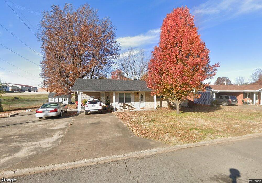
201 Adams St Morrilton, AR 72110
Estimated Value: $145,418 - $161,000
4
Beds
2
Baths
1,276
Sq Ft
$119/Sq Ft
Est. Value
About This Home
This home is located at 201 Adams St, Morrilton, AR 72110 and is currently estimated at $152,355, approximately $119 per square foot. 201 Adams St is a home located in Conway County with nearby schools including Morrilton Primary School, Morrilton Elementary School, and Morrilton Intermediate School.
Ownership History
Date
Name
Owned For
Owner Type
Purchase Details
Closed on
Aug 15, 2011
Sold by
Smith Gary F and Smith Patricia A
Bought by
Wofford Sherri L
Current Estimated Value
Purchase Details
Closed on
May 30, 2008
Sold by
Izaguirre Michelle M Dusek
Bought by
Smith Gary F and Smith Patricia A
Purchase Details
Closed on
Mar 28, 2002
Bought by
Izaguirre Michelle M
Purchase Details
Closed on
Aug 11, 2000
Bought by
Lokey Evelyn L
Purchase Details
Closed on
Jun 2, 2000
Bought by
Hawkins Matilde C
Purchase Details
Closed on
Jan 1, 1984
Bought by
Hawkins Thomas D
Create a Home Valuation Report for This Property
The Home Valuation Report is an in-depth analysis detailing your home's value as well as a comparison with similar homes in the area
Home Values in the Area
Average Home Value in this Area
Purchase History
| Date | Buyer | Sale Price | Title Company |
|---|---|---|---|
| Wofford Sherri L | -- | -- | |
| Smith Gary F | -- | -- | |
| Izaguirre Michelle M | $52,000 | -- | |
| Lokey Evelyn L | -- | -- | |
| Lokey Evelyn L | -- | -- | |
| Hawkins Matilde C | -- | -- | |
| Hawkins Thomas D | -- | -- |
Source: Public Records
Tax History Compared to Growth
Tax History
| Year | Tax Paid | Tax Assessment Tax Assessment Total Assessment is a certain percentage of the fair market value that is determined by local assessors to be the total taxable value of land and additions on the property. | Land | Improvement |
|---|---|---|---|---|
| 2025 | $138 | $20,780 | $2,280 | $18,500 |
| 2024 | $238 | $20,780 | $2,280 | $18,500 |
| 2023 | $313 | $20,780 | $2,280 | $18,500 |
| 2022 | $363 | $20,780 | $2,280 | $18,500 |
| 2021 | $363 | $15,890 | $1,880 | $14,010 |
| 2020 | $363 | $15,890 | $1,880 | $14,010 |
| 2019 | $363 | $15,890 | $1,880 | $14,010 |
| 2018 | $388 | $15,890 | $1,880 | $14,010 |
| 2017 | $388 | $15,890 | $1,880 | $14,010 |
| 2016 | $378 | $13,635 | $1,320 | $12,315 |
| 2015 | $325 | $13,635 | $1,320 | $12,315 |
| 2014 | $325 | $13,635 | $1,320 | $12,315 |
Source: Public Records
Map
Nearby Homes
- 203 Adams St
- 200 Adams St
- 205 Adams St
- 128 Shadybrook Dr
- 117 Adams St
- 130 Shadybrook Dr
- 127 and 130 Shady Brook Dr
- 206 Adams St
- 101 Cleveland St
- 116 Adams St
- 0 Adams St
- 115 Adams St
- 301 Adams St
- 126 Shadybrook Dr
- 100 Eisenhower St
- 114 Adams St
- 103 Cleveland St
- 127 Shadybrook Dr
- 113 Adams St
- 303 Adams St