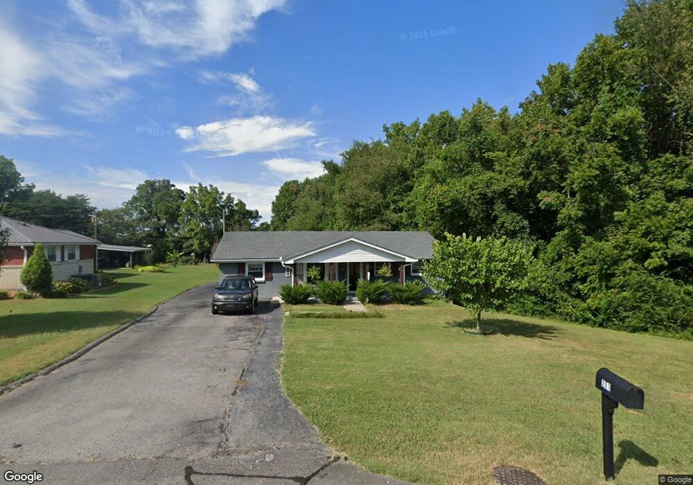
201 Alsup Dr Springfield, TN 37172
Estimated Value: $278,000 - $291,000
3
Beds
2
Baths
1,150
Sq Ft
$247/Sq Ft
Est. Value
About This Home
This home is located at 201 Alsup Dr, Springfield, TN 37172 and is currently estimated at $284,218, approximately $247 per square foot. 201 Alsup Dr is a home located in Robertson County with nearby schools including Westside Elementary School, Cheatham Park Elementary School, and Jo Byrns High School.
Ownership History
Date
Name
Owned For
Owner Type
Purchase Details
Closed on
May 28, 2019
Sold by
Fann Jacob R and Fann Jonathan R
Bought by
Callis Andrew M and Walko Kevin M
Current Estimated Value
Home Financials for this Owner
Home Financials are based on the most recent Mortgage that was taken out on this home.
Original Mortgage
$139,920
Outstanding Balance
$122,254
Interest Rate
4.1%
Mortgage Type
New Conventional
Estimated Equity
$161,964
Purchase Details
Closed on
Aug 30, 2018
Sold by
Jrf Llc
Bought by
Fann Jacob R
Purchase Details
Closed on
Dec 29, 2017
Sold by
Jones Beatrice Head
Bought by
Jrf Llc
Home Financials for this Owner
Home Financials are based on the most recent Mortgage that was taken out on this home.
Original Mortgage
$113,000
Interest Rate
3.95%
Mortgage Type
Commercial
Purchase Details
Closed on
Apr 2, 1959
Bought by
Jones Davis and Jones Beatrice H
Create a Home Valuation Report for This Property
The Home Valuation Report is an in-depth analysis detailing your home's value as well as a comparison with similar homes in the area
Home Values in the Area
Average Home Value in this Area
Purchase History
| Date | Buyer | Sale Price | Title Company |
|---|---|---|---|
| Callis Andrew M | $174,900 | Warranty Title Ins Co Inc | |
| Fann Jacob R | -- | None Available | |
| Jrf Llc | $88,000 | None Available | |
| Jones Davis | -- | -- |
Source: Public Records
Mortgage History
| Date | Status | Borrower | Loan Amount |
|---|---|---|---|
| Open | Callis Andrew M | $139,920 | |
| Previous Owner | Jrf Llc | $113,000 |
Source: Public Records
Tax History
| Year | Tax Paid | Tax Assessment Tax Assessment Total Assessment is a certain percentage of the fair market value that is determined by local assessors to be the total taxable value of land and additions on the property. | Land | Improvement |
|---|---|---|---|---|
| 2025 | -- | $69,825 | $22,500 | $47,325 |
| 2024 | -- | $69,825 | $22,500 | $47,325 |
| 2023 | $1,749 | $69,825 | $22,500 | $47,325 |
| 2022 | $1,503 | $41,200 | $5,500 | $35,700 |
| 2021 | $1,503 | $41,200 | $5,500 | $35,700 |
| 2020 | $1,503 | $41,200 | $5,500 | $35,700 |
| 2019 | $28,263 | $25,750 | $5,500 | $20,250 |
| 2018 | $939 | $25,750 | $5,500 | $20,250 |
| 2017 | $949 | $22,125 | $4,925 | $17,200 |
| 2016 | $949 | $22,125 | $4,925 | $17,200 |
| 2015 | $920 | $22,125 | $4,925 | $17,200 |
| 2014 | $920 | $22,125 | $4,925 | $17,200 |
Source: Public Records
Map
Nearby Homes
- 244 Green Hills Dr
- 7373 New Chapel Rd
- 610 5th Ave W
- 409 7th Ave W
- 702 Richard St
- 504 5th Ave W
- 5148 Highway 49 W
- 603 Crestview Dr
- 1421 Lawrence Ln
- 2130 Bessie St
- 1 Bessie St
- 0 Bessie St
- 2083 Bessie St
- 113 11th Ave W
- 325 N Walnut St
- 409 N Oak St
- 509 3rd Ave W
- 2067 Bessie St
- 311 Walnut St
- 307 Walnut St
Your Personal Tour Guide
Ask me questions while you tour the home.