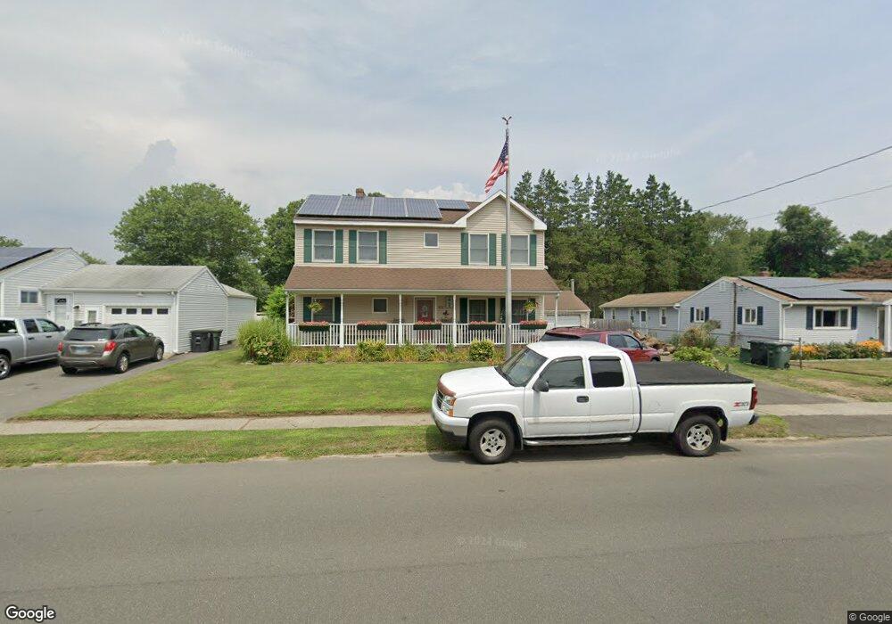
201 Anderson Ave Milford, CT 06460
East Milford NeighborhoodEstimated Value: $736,000 - $864,000
5
Beds
3
Baths
3,005
Sq Ft
$260/Sq Ft
Est. Value
About This Home
This home is located at 201 Anderson Ave, Milford, CT 06460 and is currently estimated at $781,277, approximately $259 per square foot. 201 Anderson Ave is a home located in New Haven County with nearby schools including Live Oaks School, East Shore Middle School, and Joseph A. Foran High School.
Ownership History
Date
Name
Owned For
Owner Type
Purchase Details
Closed on
Aug 13, 2009
Sold by
Hofmeister Karl W
Bought by
Hofmeister Jennifer
Current Estimated Value
Purchase Details
Closed on
Jun 30, 1999
Sold by
Sinnott Edmond W and Sinnott Ruth G
Bought by
Hofmeister Karl W
Home Financials for this Owner
Home Financials are based on the most recent Mortgage that was taken out on this home.
Original Mortgage
$109,100
Interest Rate
7.19%
Create a Home Valuation Report for This Property
The Home Valuation Report is an in-depth analysis detailing your home's value as well as a comparison with similar homes in the area
Home Values in the Area
Average Home Value in this Area
Purchase History
| Date | Buyer | Sale Price | Title Company |
|---|---|---|---|
| Hofmeister Jennifer | -- | -- | |
| Hofmeister Jennifer | -- | -- | |
| Hofmeister Karl W | $110,000 | -- | |
| Hofmeister Karl W | $110,000 | -- |
Source: Public Records
Mortgage History
| Date | Status | Borrower | Loan Amount |
|---|---|---|---|
| Previous Owner | Hofmeister Karl W | $278,400 | |
| Previous Owner | Hofmeister Karl W | $170,000 | |
| Previous Owner | Hofmeister Karl W | $109,100 |
Source: Public Records
Tax History Compared to Growth
Tax History
| Year | Tax Paid | Tax Assessment Tax Assessment Total Assessment is a certain percentage of the fair market value that is determined by local assessors to be the total taxable value of land and additions on the property. | Land | Improvement |
|---|---|---|---|---|
| 2025 | $10,870 | $367,850 | $108,420 | $259,430 |
| 2024 | $10,719 | $367,850 | $108,420 | $259,430 |
| 2023 | $9,994 | $367,850 | $108,420 | $259,430 |
| 2022 | $9,803 | $367,850 | $108,420 | $259,430 |
| 2021 | $8,539 | $308,840 | $75,320 | $233,520 |
| 2020 | $8,549 | $308,840 | $75,320 | $233,520 |
| 2019 | $8,558 | $308,840 | $75,320 | $233,520 |
| 2018 | $8,567 | $308,840 | $75,320 | $233,520 |
| 2017 | $8,583 | $308,840 | $75,320 | $233,520 |
| 2016 | $8,456 | $303,720 | $75,320 | $228,400 |
| 2015 | $8,468 | $303,720 | $75,320 | $228,400 |
| 2014 | $8,267 | $303,720 | $75,320 | $228,400 |
Source: Public Records
Map
Nearby Homes
- 26 Riverdale Rd
- 18 Riverdale Rd
- 15 Greenwich Way
- 64 Greenwich Way
- 29 Anderson Ave
- 32 Wall St
- 6 Howe St
- 30 Salem Walk
- 36 Kenwood Rd
- 79 Cooper Rd
- 40 Hawley Ave
- 28 Live Oaks Rd
- 83 Pauline Ave
- 35 Whippoorwill Dr
- 207 Merwin Ave
- 25 Belle Cir
- 152 Beach Ave
- 5 Cora Place
- 25 Village Rd
- 1120 New Haven Ave Unit 148
- 207 Anderson Ave
- 195 Anderson Ave
- 187 Anderson Ave
- 213 Anderson Ave
- 219 Anderson Ave
- 204 Anderson Ave
- 181 Anderson Ave
- 198 Anderson Ave
- 210 Anderson Ave
- 190 Anderson Ave
- 216 Anderson Ave
- 184 Anderson Ave
- 519 Merwin Ave
- 175 Anderson Ave
- 227 Anderson Ave
- 222 Anderson Ave
- 38 Riverdale Rd
- 32 Riverdale Rd
- 178 Anderson Ave
- 169 Anderson Ave