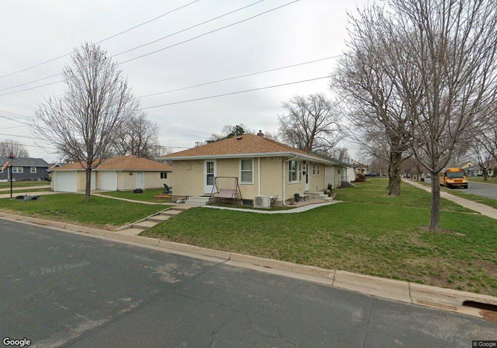
201 Ash St E South Saint Paul, MN 55075
Estimated Value: $302,000 - $322,000
4
Beds
2
Baths
950
Sq Ft
$329/Sq Ft
Est. Value
About This Home
This home is located at 201 Ash St E, South Saint Paul, MN 55075 and is currently estimated at $312,273, approximately $328 per square foot. 201 Ash St E is a home located in Dakota County with nearby schools including Kaposia Education Center Elementary, South St. Paul Secondary, and Discovery Charter School.
Ownership History
Date
Name
Owned For
Owner Type
Purchase Details
Closed on
Sep 6, 2007
Sold by
Granfors Gary M
Bought by
Retka David
Current Estimated Value
Purchase Details
Closed on
May 17, 2005
Sold by
Crowe Lawrence Angela
Bought by
Granfors Gary M
Purchase Details
Closed on
Jun 30, 2000
Sold by
Burger Joseph Anthony and Burger Theresa
Bought by
Lawrence Angela C Crowe
Create a Home Valuation Report for This Property
The Home Valuation Report is an in-depth analysis detailing your home's value as well as a comparison with similar homes in the area
Home Values in the Area
Average Home Value in this Area
Purchase History
| Date | Buyer | Sale Price | Title Company |
|---|---|---|---|
| Retka David | $192,000 | -- | |
| Granfors Gary M | $210,000 | -- | |
| Lawrence Angela C Crowe | $138,500 | -- |
Source: Public Records
Tax History Compared to Growth
Tax History
| Year | Tax Paid | Tax Assessment Tax Assessment Total Assessment is a certain percentage of the fair market value that is determined by local assessors to be the total taxable value of land and additions on the property. | Land | Improvement |
|---|---|---|---|---|
| 2024 | $4,144 | $313,600 | $75,700 | $237,900 |
| 2023 | $4,144 | $304,000 | $76,200 | $227,800 |
| 2022 | $3,606 | $304,700 | $76,100 | $228,600 |
| 2021 | $3,398 | $270,300 | $66,200 | $204,100 |
| 2020 | $3,164 | $251,800 | $63,000 | $188,800 |
| 2019 | $2,843 | $241,900 | $60,000 | $181,900 |
| 2018 | $2,757 | $211,700 | $54,600 | $157,100 |
| 2017 | $2,438 | $198,500 | $52,000 | $146,500 |
| 2016 | $2,451 | $182,300 | $47,300 | $135,000 |
| 2015 | $2,269 | $155,145 | $39,555 | $115,590 |
| 2014 | -- | $152,202 | $39,408 | $112,794 |
| 2013 | -- | $137,923 | $33,987 | $103,936 |
Source: Public Records
Map
Nearby Homes
- 137 South St E
- 101 Frost St W
- 1403 Concord St S Unit 1
- 1436 5th Ave S
- 100 W Warburton St
- 233 Richmond St W
- 1456 6th Ave S
- 151 Park St W
- 1215 8th Ave S
- 1434 8th Ave S
- 6051 Concord Blvd
- 6050 Cahill Ave
- 1127 9th Ave S
- 5472 Bryce Ave
- 5938 Burke Trail
- 928 8th Ave S
- 4020 64th St E
- 6445 Coryell Ct
- 5903 Bryant Ln
- 6425 Delilah Ave
- 207 Ash St E
- 213 Ash St E
- 155 Ash St E
- 202 Poplar St E
- 208 Poplar St E
- 219 Ash St E
- 214 Poplar St E
- 149 Ash St E
- 156 Poplar St E
- 202 Ash St E
- 219 219 Ash St E
- 208 Ash St E
- 225 225 Ash-Street-e
- 225 225 Ash St E
- 220 Poplar St E
- 214 Ash St E
- 202 202 Poplar St E
- 150 Poplar St E
- 225 Ash St E
- 156 Ash St E