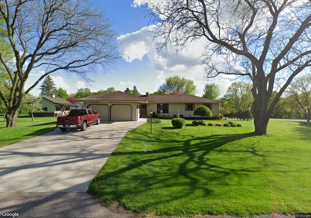
201 Bittersweet Ln Mankato, MN 56001
Country Club Estates NeighborhoodEstimated Value: $349,000 - $426,000
3
Beds
2
Baths
1,526
Sq Ft
$251/Sq Ft
Est. Value
About This Home
This home is located at 201 Bittersweet Ln, Mankato, MN 56001 and is currently estimated at $383,381, approximately $251 per square foot. 201 Bittersweet Ln is a home located in Blue Earth County with nearby schools including Franklin Elementary School, Prairie Winds Middle School, and Mankato East Senior High School.
Ownership History
Date
Name
Owned For
Owner Type
Purchase Details
Closed on
Nov 4, 2020
Sold by
Peterson Nicole Margaret
Bought by
Peterson Wesley Lloyd
Current Estimated Value
Purchase Details
Closed on
May 16, 2013
Sold by
Witte David B and Witte Michele A
Bought by
Peterson Wesley
Home Financials for this Owner
Home Financials are based on the most recent Mortgage that was taken out on this home.
Original Mortgage
$130,000
Interest Rate
3.39%
Mortgage Type
New Conventional
Create a Home Valuation Report for This Property
The Home Valuation Report is an in-depth analysis detailing your home's value as well as a comparison with similar homes in the area
Home Values in the Area
Average Home Value in this Area
Purchase History
| Date | Buyer | Sale Price | Title Company |
|---|---|---|---|
| Peterson Wesley Lloyd | -- | None Available | |
| Peterson Wesley | $170,000 | North American Title |
Source: Public Records
Mortgage History
| Date | Status | Borrower | Loan Amount |
|---|---|---|---|
| Previous Owner | Peterson Wesley | $130,000 |
Source: Public Records
Tax History Compared to Growth
Tax History
| Year | Tax Paid | Tax Assessment Tax Assessment Total Assessment is a certain percentage of the fair market value that is determined by local assessors to be the total taxable value of land and additions on the property. | Land | Improvement |
|---|---|---|---|---|
| 2025 | $3,452 | $338,500 | $46,900 | $291,600 |
| 2024 | $3,452 | $319,200 | $46,800 | $272,400 |
| 2023 | $3,678 | $320,700 | $46,800 | $273,900 |
| 2022 | $3,240 | $320,700 | $46,800 | $273,900 |
| 2021 | $3,210 | $266,000 | $46,800 | $219,200 |
| 2020 | $2,864 | $237,000 | $46,700 | $190,300 |
| 2019 | $2,828 | $237,000 | $46,700 | $190,300 |
| 2018 | $2,698 | $233,700 | $46,700 | $187,000 |
| 2017 | $2,120 | $225,300 | $46,700 | $178,600 |
| 2016 | $1,950 | $190,700 | $46,700 | $144,000 |
| 2015 | $19 | $178,400 | $52,400 | $126,000 |
| 2014 | $1,510 | $178,500 | $52,400 | $126,100 |
Source: Public Records
Map
Nearby Homes
- 22911 N Riverfront Dr
- 17 Wood Dr Unit 5
- 23 Wood Dr Unit 8
- 25 Wood Dr Unit 9
- 29 Wood Dr Unit 11
- 24 Wood Dr Unit 33
- 66 Knoll Ln Unit 36
- 64 Knoll Ln Unit 35
- 34 Wood Dr Unit 38
- 55 Wood Dr Unit 24
- 107 Maple Dr Unit 46
- 111 Maple Dr Unit 48
- 103 Maple Dr Unit 44
- 110 Maple Dr Unit 74
- 133 Maple Dr Unit 59
- 130 Maple Dr Unit 64
- 126 Maple Dr Unit 62
- 212 Spruce Ln Unit 89
- 210 Spruce Ln Unit 90
- 204 Spruce Ln Unit 93
- 205 Bittersweet Ln
- 206 Bittersweet Ln
- 190 Mary Ln
- 133 Bittersweet Ln
- 132 Bittersweet Ln
- 192 Mary Ln
- 209 Bittersweet Ln
- 210 Bittersweet Ln
- 210 210 Bittersweet Ln
- 128 Bittersweet Ln
- 129 Bittersweet Ln
- 202 Mary Ln
- 213 Bittersweet Ln
- 212 Bittersweet Ln
- 212 Mary Ln
- 57749 227th St
- 127 Mary Ln
- 125 125 Bittersweet Ln
- 125 Bittersweet Ln
- 216 Bittersweet Ln