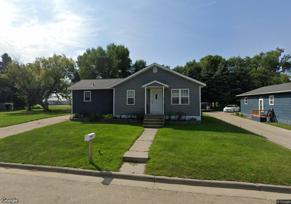
201 Boundary Rd W Cavalier, ND 58220
Estimated Value: $57,609 - $131,000
Studio
--
Bath
--
Sq Ft
7,667
Sq Ft
About This Home
This home is located at 201 Boundary Rd W, Cavalier, ND 58220 and is currently estimated at $87,902. 201 Boundary Rd W is a home with nearby schools including Cavalier Elementary School and Cavalier High School.
Ownership History
Date
Name
Owned For
Owner Type
Purchase Details
Closed on
Aug 16, 2013
Sold by
Symington Alan and Symington Tiffanie M
Bought by
Sagerhorn Jeffrey G
Current Estimated Value
Home Financials for this Owner
Home Financials are based on the most recent Mortgage that was taken out on this home.
Original Mortgage
$40,000
Interest Rate
4.25%
Mortgage Type
Purchase Money Mortgage
Purchase Details
Closed on
Apr 16, 2010
Sold by
Reynolds Duane and Reynolds Robert
Bought by
Symington Alan and Reiser Tiffanie M
Purchase Details
Closed on
Jan 13, 2009
Sold by
Reynolds Mavis and Reynolds Mavis L
Bought by
Reynolds Duane and Reynolds Robert
Create a Home Valuation Report for This Property
The Home Valuation Report is an in-depth analysis detailing your home's value as well as a comparison with similar homes in the area
Purchase History
| Date | Buyer | Sale Price | Title Company |
|---|---|---|---|
| Sagerhorn Jeffrey G | $50,000 | None Available | |
| Symington Alan | $40,000 | None Available | |
| Reynolds Duane | -- | None Available |
Source: Public Records
Mortgage History
| Date | Status | Borrower | Loan Amount |
|---|---|---|---|
| Closed | Sagerhorn Jeffrey G | $40,000 |
Source: Public Records
Tax History
| Year | Tax Paid | Tax Assessment Tax Assessment Total Assessment is a certain percentage of the fair market value that is determined by local assessors to be the total taxable value of land and additions on the property. | Land | Improvement |
|---|---|---|---|---|
| 2024 | $1,342 | $13,600 | $2,659 | $10,941 |
| 2023 | $1,323 | $12,000 | $2,557 | $9,443 |
| 2022 | $1,797 | $36,239 | $2,557 | $33,682 |
| 2021 | $1,835 | $36,242 | $4,164 | $32,078 |
| 2020 | $1,968 | $36,242 | $4,164 | $32,078 |
| 2019 | $1,945 | $33,594 | $4,164 | $29,430 |
| 2018 | $1,860 | $28,570 | $3,820 | $24,750 |
| 2017 | $1,812 | $26,520 | $3,820 | $22,700 |
| 2016 | $1,827 | $25,420 | $3,820 | $21,600 |
| 2015 | $1,781 | $0 | $0 | $0 |
| 2014 | $1,813 | $0 | $0 | $0 |
| 2013 | $1,541 | $0 | $0 | $0 |
Source: Public Records
Map
Nearby Homes
- 306 E 1st Ave S
- 104 Mountain St W
- 103 W 1st Ave N
- 302 Elizabeth St
- 104 Park St W
- 100 Oak St E
- 9177 N Dakota 18
- 13709 N Dakota 5
- 9749 134th Ave NE
- Rural
- TBD 94th St NE
- TBD Main St
- 201 Russet Ln
- 423 Emmerling Cir
- 1203 Mountain Ave
- 1201 Mountain Ave
- 807 6th St
- 15616 106th St NE
- 372 W Renville St
- 425 S 3rd St
- 203 Boundary Rd W
- 205 Boundary Rd W
- 200 Boundary Rd E
- 107 Boundary Rd W
- 106 Boundary Rd W
- 314 Felson Dr
- 108 Boundary Rd W
- 312 Felson Dr
- 313 Division Ave S
- 105 Boundary Rd W
- 301 Boundary Rd W
- 315 Division Ave S
- 301 Boundary Rd W
- 311 Division Ave N
- 308 Felson Dr
- 104 Boundary Rd W
- 305 Boundary Rd W
- 111 Dakota St W
- 109 Dakota St W
- 203 Dakota St W
Your Personal Tour Guide
Ask me questions while you tour the home.