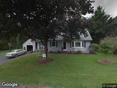
201 Braeburn Rd East Longmeadow, MA 01028
Estimated Value: $358,033 - $508,000
3
Beds
2
Baths
1,960
Sq Ft
$224/Sq Ft
Est. Value
About This Home
This home is located at 201 Braeburn Rd, East Longmeadow, MA 01028 and is currently estimated at $439,758, approximately $224 per square foot. 201 Braeburn Rd is a home located in Hampden County with nearby schools including Meadowbrook Elementary School, Birchland Park Middle School, and East Longmeadow High School.
Ownership History
Date
Name
Owned For
Owner Type
Purchase Details
Closed on
Nov 19, 1968
Bought by
Mazzariello Robert A and Mazzariello Mary R
Current Estimated Value
Create a Home Valuation Report for This Property
The Home Valuation Report is an in-depth analysis detailing your home's value as well as a comparison with similar homes in the area
Home Values in the Area
Average Home Value in this Area
Purchase History
| Date | Buyer | Sale Price | Title Company |
|---|---|---|---|
| Mazzariello Robert A | -- | -- |
Source: Public Records
Mortgage History
| Date | Status | Borrower | Loan Amount |
|---|---|---|---|
| Closed | Mazzariello Robert A | $35,000 | |
| Open | Mazzariello Robert A | $70,000 | |
| Closed | Mazzariello Mary R | $37,335 | |
| Closed | Mazzariello Robert A | $55,000 | |
| Closed | Mazzariello Robert A | $45,000 | |
| Closed | Mazzariello Robert A | $37,200 |
Source: Public Records
Tax History Compared to Growth
Tax History
| Year | Tax Paid | Tax Assessment Tax Assessment Total Assessment is a certain percentage of the fair market value that is determined by local assessors to be the total taxable value of land and additions on the property. | Land | Improvement |
|---|---|---|---|---|
| 2025 | $5,917 | $320,200 | $84,200 | $236,000 |
| 2024 | $5,627 | $303,500 | $84,200 | $219,300 |
| 2023 | $5,326 | $277,400 | $76,500 | $200,900 |
| 2022 | $5,087 | $250,700 | $69,500 | $181,200 |
| 2021 | $5,016 | $238,200 | $64,400 | $173,800 |
| 2020 | $4,781 | $229,400 | $64,400 | $165,000 |
| 2019 | $4,585 | $223,100 | $62,500 | $160,600 |
| 2018 | $4,469 | $213,400 | $62,500 | $150,900 |
| 2017 | $4,343 | $209,100 | $59,400 | $149,700 |
| 2016 | $4,482 | $212,200 | $64,000 | $148,200 |
| 2015 | $4,397 | $212,200 | $64,000 | $148,200 |
Source: Public Records
Map
Nearby Homes
- 277 Dwight Rd
- 141 Cooper St
- 0 Donald Ave
- 40 Fenimore Blvd
- 112 Entrybrook Dr
- 106 Hartwick St
- 26 Dwight Rd
- 93 Crestmont St
- 3 Birch Ave
- 53 Gail St
- 0 Niagara St
- 253 Draper St
- 84 Eleanor Rd
- 90 Westwood Ave
- 69 Bassing St
- 101 Melwood Ave
- 302 W Allen Ridge Rd
- 235 Dorset St
- 0 Carver St Unit 73334545
- 33 Taber St
- 201 Braeburn Rd
- 195 Braeburn Rd
- 207 Braeburn Rd
- 3 Princeton St
- 61 Holy Cross Cir
- 58 Tufts St
- 57 Tufts Rd
- 48 Tufts St
- 4 Princeton St
- 36 Tufts St
- 48 Tufts St
- 18 Channing Rd
- 21 Channing Rd
- 36-37 Tufts Rd & Channing Rd
- 7 Princeton St
- 215 Braeburn Rd
- 189 Braeburn Rd
- 21 Channing
- 55 Holy Cross Cir
- 60 Holy Cross Cir