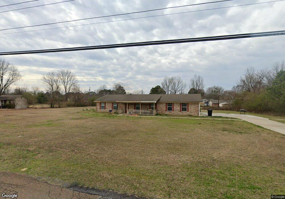
201 Center Rd Columbus, MS 39702
Estimated Value: $192,000 - $233,930
--
Bed
--
Bath
1,873
Sq Ft
$112/Sq Ft
Est. Value
About This Home
This home is located at 201 Center Rd, Columbus, MS 39702 and is currently estimated at $208,983, approximately $111 per square foot. 201 Center Rd is a home.
Ownership History
Date
Name
Owned For
Owner Type
Purchase Details
Closed on
Aug 31, 2016
Sold by
Ruth Steve
Bought by
Jenness James K
Current Estimated Value
Home Financials for this Owner
Home Financials are based on the most recent Mortgage that was taken out on this home.
Original Mortgage
$129,562
Outstanding Balance
$103,208
Interest Rate
3.43%
Mortgage Type
New Conventional
Estimated Equity
$105,775
Purchase Details
Closed on
Jul 9, 2015
Sold by
Murdock Kathy
Bought by
Ruth Steve
Purchase Details
Closed on
Jul 8, 2015
Sold by
Patterson Brenda and Hays Debra
Bought by
Murdock Kathy
Create a Home Valuation Report for This Property
The Home Valuation Report is an in-depth analysis detailing your home's value as well as a comparison with similar homes in the area
Home Values in the Area
Average Home Value in this Area
Purchase History
| Date | Buyer | Sale Price | Title Company |
|---|---|---|---|
| Jenness James K | -- | Attorney | |
| Ruth Steve | -- | Attorney | |
| Murdock Kathy | -- | Attorney |
Source: Public Records
Mortgage History
| Date | Status | Borrower | Loan Amount |
|---|---|---|---|
| Open | Jenness James K | $129,562 |
Source: Public Records
Tax History Compared to Growth
Tax History
| Year | Tax Paid | Tax Assessment Tax Assessment Total Assessment is a certain percentage of the fair market value that is determined by local assessors to be the total taxable value of land and additions on the property. | Land | Improvement |
|---|---|---|---|---|
| 2025 | $821 | $11,457 | $0 | $0 |
| 2024 | $812 | $11,457 | $0 | $0 |
| 2023 | $667 | $10,011 | $0 | $0 |
| 2022 | $668 | $10,011 | $0 | $0 |
| 2021 | $632 | $10,011 | $0 | $0 |
| 2020 | $581 | $10,011 | $0 | $0 |
| 2019 | $573 | $9,655 | $0 | $0 |
| 2018 | $573 | $9,620 | $0 | $0 |
| 2017 | $1,251 | $14,431 | $0 | $0 |
| 2016 | $1,251 | $14,431 | $0 | $0 |
| 2015 | $660 | $7,609 | $0 | $0 |
| 2014 | $660 | $7,609 | $0 | $0 |
Source: Public Records
Map
Nearby Homes