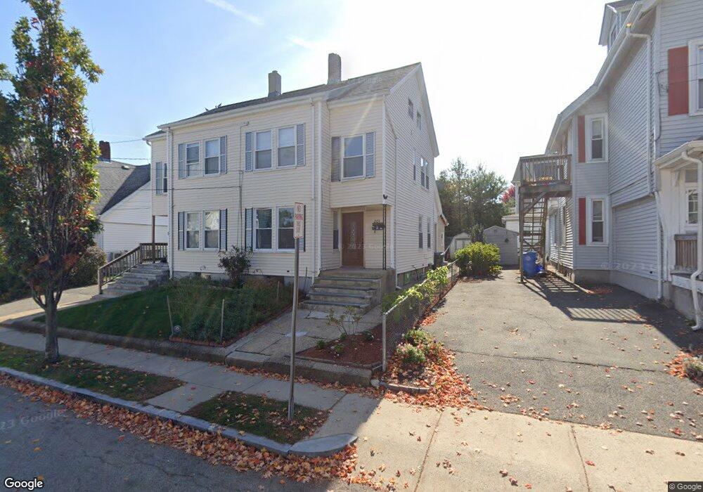
201 Chestnut St Unit 203 Waltham, MA 02453
South Side NeighborhoodEstimated Value: $1,073,000 - $1,207,000
4
Beds
2
Baths
3,262
Sq Ft
$341/Sq Ft
Est. Value
About This Home
This home is located at 201 Chestnut St Unit 203, Waltham, MA 02453 and is currently estimated at $1,112,627, approximately $341 per square foot. 201 Chestnut St Unit 203 is a home located in Middlesex County with nearby schools including Henry Whittemore Elementary School, John W. Mcdevitt Middle School, and Waltham Sr High School.
Ownership History
Date
Name
Owned For
Owner Type
Purchase Details
Closed on
Mar 21, 2006
Sold by
Mary P Walker T
Bought by
Rivera Miriam
Current Estimated Value
Home Financials for this Owner
Home Financials are based on the most recent Mortgage that was taken out on this home.
Original Mortgage
$408,000
Outstanding Balance
$231,945
Interest Rate
6.27%
Mortgage Type
Purchase Money Mortgage
Estimated Equity
$880,682
Purchase Details
Closed on
Apr 2, 1987
Sold by
Terrasi Charles F
Bought by
Walker Mary
Home Financials for this Owner
Home Financials are based on the most recent Mortgage that was taken out on this home.
Original Mortgage
$75,000
Interest Rate
9.48%
Create a Home Valuation Report for This Property
The Home Valuation Report is an in-depth analysis detailing your home's value as well as a comparison with similar homes in the area
Home Values in the Area
Average Home Value in this Area
Purchase History
| Date | Buyer | Sale Price | Title Company |
|---|---|---|---|
| Rivera Miriam | $510,000 | -- | |
| Walker Mary | $55,000 | -- |
Source: Public Records
Mortgage History
| Date | Status | Borrower | Loan Amount |
|---|---|---|---|
| Open | Rivera Miriam | $408,000 | |
| Previous Owner | Walker Mary | $75,000 | |
| Previous Owner | Walker Mary | $75,000 |
Source: Public Records
Tax History Compared to Growth
Tax History
| Year | Tax Paid | Tax Assessment Tax Assessment Total Assessment is a certain percentage of the fair market value that is determined by local assessors to be the total taxable value of land and additions on the property. | Land | Improvement |
|---|---|---|---|---|
| 2025 | $9,053 | $921,900 | $357,500 | $564,400 |
| 2024 | $8,329 | $864,000 | $357,500 | $506,500 |
| 2023 | $8,409 | $814,800 | $325,700 | $489,100 |
| 2022 | $8,521 | $764,900 | $297,400 | $467,500 |
| 2021 | $8,119 | $717,200 | $269,000 | $448,200 |
| 2020 | $8,015 | $670,700 | $254,900 | $415,800 |
| 2019 | $7,447 | $588,200 | $252,300 | $335,900 |
| 2018 | $6,691 | $530,600 | $233,600 | $297,000 |
| 2017 | $6,398 | $509,400 | $212,400 | $297,000 |
| 2016 | $5,932 | $484,600 | $187,600 | $297,000 |
| 2015 | $5,608 | $427,100 | $184,100 | $243,000 |
Source: Public Records
Map
Nearby Homes
- 308 Newton St Unit 1
- 312 Newton St Unit 1A
- 81 Alder St
- 39 Clinton St Unit 2
- 39 Clinton St Unit 1
- 42 Alder St
- 138 Myrtle St Unit 2
- 61 Hall St Unit 9
- 61 Hall St Unit 7
- 162 Myrtle St Unit 1
- 47 Alder St Unit 6
- 40 Myrtle St Unit 9
- 15 Alder St Unit 1
- 28-32 Calvary St
- 9 John St
- 25 Tolman St Unit 2
- 24 Tolman St Unit A
- 659 Moody St Unit 2
- 266-274 River St
- 240 River St
- 201-203 Chestnut St
- 205 Chestnut St
- 197 Chetnut St Unit 2
- 197 Chestnut St Unit 2
- 197 Chestnut St Unit 1
- 197 Chestnut St
- 38 Stearns St
- 285 Newton St
- 207 Chestnut St
- 50 Stearns St
- 50 Stearns St Unit 2
- 206 Chestnut St
- 208 Chestnut St
- 271 Newton St
- 52 Stearns St
- 52 Stearns St Unit 1
- 193 Chestnut St Unit 195
- 39 Stearns St Unit 1
- 293-295 Newton St
- 293 Newton St Unit 2