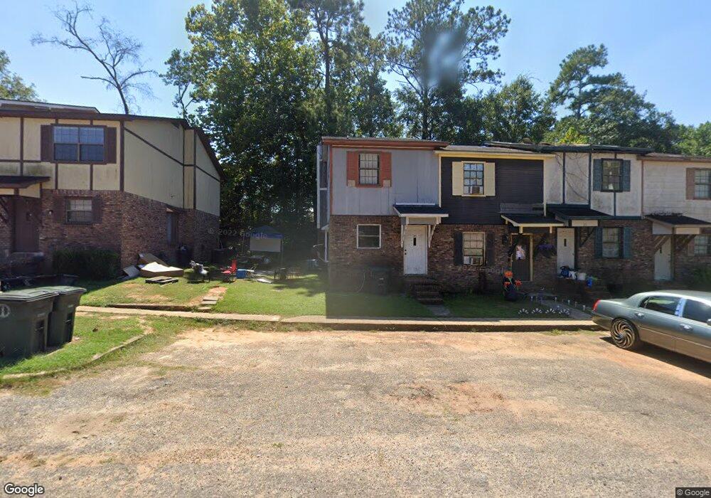
201 Colony Dr Unit 21 Enterprise, AL 36330
Estimated Value: $64,000 - $107,000
--
Bed
1
Bath
1,144
Sq Ft
$79/Sq Ft
Est. Value
About This Home
This home is located at 201 Colony Dr Unit 21, Enterprise, AL 36330 and is currently estimated at $89,832, approximately $78 per square foot. 201 Colony Dr Unit 21 is a home located in Coffee County with nearby schools including Holly Hill Elementary School, Dauphin Junior High School, and Enterprise High School.
Ownership History
Date
Name
Owned For
Owner Type
Purchase Details
Closed on
Feb 23, 2009
Sold by
Baker Charles G
Bought by
Panza Joseph L
Current Estimated Value
Purchase Details
Closed on
Jun 6, 2008
Sold by
Scott Mary E and Scott Jimmy
Bought by
Scott Ronnie
Home Financials for this Owner
Home Financials are based on the most recent Mortgage that was taken out on this home.
Original Mortgage
$35,840
Interest Rate
6.04%
Mortgage Type
Purchase Money Mortgage
Purchase Details
Closed on
Sep 18, 2007
Sold by
H And H Investments Inc
Bought by
Howard Dexter D
Create a Home Valuation Report for This Property
The Home Valuation Report is an in-depth analysis detailing your home's value as well as a comparison with similar homes in the area
Home Values in the Area
Average Home Value in this Area
Purchase History
| Date | Buyer | Sale Price | Title Company |
|---|---|---|---|
| Panza Joseph L | -- | -- | |
| Scott Ronnie | -- | -- | |
| Howard Dexter D | -- | -- |
Source: Public Records
Mortgage History
| Date | Status | Borrower | Loan Amount |
|---|---|---|---|
| Previous Owner | Scott Ronnie | $35,840 |
Source: Public Records
Tax History Compared to Growth
Tax History
| Year | Tax Paid | Tax Assessment Tax Assessment Total Assessment is a certain percentage of the fair market value that is determined by local assessors to be the total taxable value of land and additions on the property. | Land | Improvement |
|---|---|---|---|---|
| 2024 | $354 | $7,440 | $802 | $6,638 |
| 2023 | $332 | $6,140 | $800 | $5,340 |
| 2022 | $297 | $6,140 | $0 | $0 |
| 2021 | $272 | $5,560 | $0 | $0 |
| 2020 | $107 | $2,660 | $0 | $0 |
| 2019 | $107 | $2,660 | $0 | $0 |
| 2018 | $107 | $2,660 | $0 | $0 |
| 2017 | $99 | $2,440 | $0 | $0 |
| 2016 | $105 | $2,600 | $0 | $0 |
| 2015 | $114 | $2,840 | $0 | $0 |
| 2014 | -- | $3,040 | $0 | $0 |
| 2011 | -- | $3,560 | $0 | $0 |
Source: Public Records
Map
Nearby Homes
- 208 Colony Dr
- 307 Colony Dr
- 814 E Lee St
- 309 Colony Dr
- 635 Glover Ave
- 103 Andrews St
- 406 Gibson St
- 119 Birchwood Place
- 641 Glover Ave
- 105 Feagin St
- 103 Candy Dr
- 113 Wynn Rd
- 406 & 408 Glover Ave
- 106 Bird St
- 213 Cherryhill Rd
- 602 Cedar Dr
- 204 Holly Hill Rd
- 621 Boll Weevil Cir Unit 40
- 109 Forest Ave
- 211 E Watts St
- 201 Colony Drive 9-12
- 201 Colony Dr Unit 18
- 201 Colony Dr Unit 24
- 201 Colony Dr Unit 28
- 201 Colony Dr
- 201 Colony Dr
- 201 Colony Dr Unit 9-12
- 201 Colony Dr
- 201 Colony Drive #19
- 201 Colony Dr
- 201 Colony Drive#26
- 300 Colony Dr
- 300(A-D Colony Dr
- 206 Colony Dr
- 204 Colony Dr
- 301 Colony Drive A-D
- 1914 County Rd
- 200 Colony Dr
- 118 Colony Dr
- 116 Colony Dr