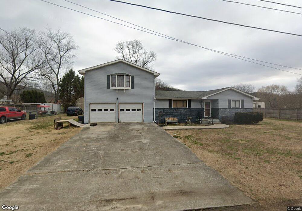
201 Daisy Ave Soddy Daisy, TN 37379
Estimated Value: $257,262 - $338,000
3
Beds
2
Baths
1,848
Sq Ft
$156/Sq Ft
Est. Value
About This Home
This home is located at 201 Daisy Ave, Soddy Daisy, TN 37379 and is currently estimated at $288,316, approximately $156 per square foot. 201 Daisy Ave is a home located in Hamilton County with nearby schools including Ivy Academy Inc and New South Daisy Christian Academy.
Ownership History
Date
Name
Owned For
Owner Type
Purchase Details
Closed on
May 19, 2009
Sold by
Musselwhite James B
Bought by
Walraven Joseph
Current Estimated Value
Home Financials for this Owner
Home Financials are based on the most recent Mortgage that was taken out on this home.
Original Mortgage
$114,750
Outstanding Balance
$72,658
Interest Rate
4.89%
Mortgage Type
Purchase Money Mortgage
Estimated Equity
$215,658
Purchase Details
Closed on
Jan 17, 2009
Sold by
Clean Slate Properties Llc
Bought by
Musselwhite James B and Roy T Musselwhite Revocable Living Trust
Purchase Details
Closed on
Aug 7, 2007
Sold by
Crowe Earlene L
Bought by
Clean State Properties Llc
Purchase Details
Closed on
Feb 10, 2003
Sold by
Crowe Michael Ray and Crowe Heather Lynn
Bought by
Crowe Earlene L
Purchase Details
Closed on
Aug 1, 2002
Sold by
Crowe Earlene L
Bought by
Crowe Michael Ray
Create a Home Valuation Report for This Property
The Home Valuation Report is an in-depth analysis detailing your home's value as well as a comparison with similar homes in the area
Home Values in the Area
Average Home Value in this Area
Purchase History
| Date | Buyer | Sale Price | Title Company |
|---|---|---|---|
| Walraven Joseph | $112,500 | Milligan Reynolds Guaranty T | |
| Musselwhite James B | -- | Resource Title Agency Of Ten | |
| Clean State Properties Llc | $102,001 | None Available | |
| Crowe Earlene L | -- | Pioneer Title Agency Inc | |
| Crowe Michael Ray | -- | Pioneer Title Agency Inc |
Source: Public Records
Mortgage History
| Date | Status | Borrower | Loan Amount |
|---|---|---|---|
| Open | Walraven Joseph | $114,750 |
Source: Public Records
Tax History Compared to Growth
Tax History
| Year | Tax Paid | Tax Assessment Tax Assessment Total Assessment is a certain percentage of the fair market value that is determined by local assessors to be the total taxable value of land and additions on the property. | Land | Improvement |
|---|---|---|---|---|
| 2024 | $735 | $32,850 | $0 | $0 |
| 2023 | $1,111 | $32,850 | $0 | $0 |
| 2022 | $1,111 | $32,850 | $0 | $0 |
| 2021 | $1,111 | $32,850 | $0 | $0 |
| 2020 | $1,215 | $29,300 | $0 | $0 |
| 2019 | $1,215 | $29,300 | $0 | $0 |
| 2018 | $1,215 | $29,300 | $0 | $0 |
| 2017 | $1,215 | $29,300 | $0 | $0 |
| 2016 | $1,206 | $0 | $0 | $0 |
| 2015 | $1,206 | $29,075 | $0 | $0 |
| 2014 | $1,206 | $0 | $0 | $0 |
Source: Public Records
Map
Nearby Homes
- 10206 Card Rd
- 110 Mountain View Dr
- 110 Mountainview Dr
- 10280 Card Rd
- 9839 Walnut St
- 168 Turner Rd
- 9851 Millsaps St
- 874 Ponderosa Dr
- 10192 Big Pine Ln
- 698 Green Pond Rd
- 9885 Lovell Rd
- 201 Northern Trails Dr
- 203 Northern Trails Dr
- 0 Lovell Rd Unit 1523036
- 623 Sunset Valley Dr
- 9811 Lovell Rd
- 13212 Dayton Pike
- 9693 W Ridge Trail Rd
- 9606 Shooting Star Cir
- 9709 Lovell Rd