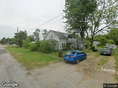
201 E Grandview Alvordton, OH 43501
Estimated Value: $87,000 - $125,000
4
Beds
2
Baths
2,589
Sq Ft
$43/Sq Ft
Est. Value
About This Home
This home is located at 201 E Grandview, Alvordton, OH 43501 and is currently estimated at $110,665, approximately $42 per square foot. 201 E Grandview is a home located in Williams County with nearby schools including Hilltop Elementary School and Hilltop High School.
Ownership History
Date
Name
Owned For
Owner Type
Purchase Details
Closed on
Jun 11, 2009
Sold by
Layman Anita and Layman Anita S
Bought by
Deutsche Bank National Trust Co
Current Estimated Value
Purchase Details
Closed on
Feb 28, 2002
Sold by
Layman Ronald and Anita Po Box 168
Bought by
Layman Anita S Po Box 168
Purchase Details
Closed on
Feb 25, 2002
Sold by
Layman Dobson C and Layman Ronald O
Bought by
Layman Ronald and Anita Po Box 168
Purchase Details
Closed on
Jul 12, 2000
Sold by
Dobson Patsy A
Bought by
Layman Dobson C and Layman Ronald O
Purchase Details
Closed on
Jan 1, 1990
Bought by
Dobson Patsy A
Create a Home Valuation Report for This Property
The Home Valuation Report is an in-depth analysis detailing your home's value as well as a comparison with similar homes in the area
Home Values in the Area
Average Home Value in this Area
Purchase History
| Date | Buyer | Sale Price | Title Company |
|---|---|---|---|
| Layman Anita S Po Box 168 | -- | -- | |
| Layman Ronald | $28,700 | -- | |
| Layman Dobson C | $28,500 | -- | |
| Dobson Patsy A | -- | -- |
Source: Public Records
Mortgage History
| Date | Status | Borrower | Loan Amount |
|---|---|---|---|
| Closed | Yockil Timothy | $36,900 |
Source: Public Records
Tax History Compared to Growth
Tax History
| Year | Tax Paid | Tax Assessment Tax Assessment Total Assessment is a certain percentage of the fair market value that is determined by local assessors to be the total taxable value of land and additions on the property. | Land | Improvement |
|---|---|---|---|---|
| 2024 | $1,186 | $32,660 | $3,820 | $28,840 |
| 2023 | $1,186 | $25,450 | $3,360 | $22,090 |
| 2022 | $1,117 | $25,450 | $3,360 | $22,090 |
| 2021 | $1,117 | $25,450 | $3,360 | $22,090 |
| 2020 | $1,152 | $24,230 | $3,190 | $21,040 |
| 2019 | $1,073 | $24,230 | $3,190 | $21,040 |
| 2018 | $1,037 | $24,230 | $3,190 | $21,040 |
| 2017 | $1,027 | $23,210 | $3,190 | $20,020 |
| 2016 | $1,129 | $23,210 | $3,190 | $20,020 |
| 2015 | $1,063 | $23,210 | $3,190 | $20,020 |
| 2014 | $1,063 | $23,210 | $3,190 | $20,020 |
| 2013 | $1,056 | $23,210 | $3,190 | $20,020 |
Source: Public Records
Map
Nearby Homes
- 9666 County Road 19-50
- 21308 County Road 20n
- 120 S Mackinaw St
- 109 E Catherine St
- 410 N Main St
- 201 E Rings St
- 606 W North St
- 608 W North St
- 602 W Main St
- 000 W Jackson
- 207 S College St
- 307 Maple St
- 300 Irene Ct
- 303 W Main St
- 301 N Gorham St
- 206 W Main St
- 0 County Road M Unit 6122423
- 201 E Spring St
- 16339 State Route 15
- 105 W Lynn St
- 201 E Grandview
- 201 Grandview St
- 314 Anderson St
- 314 Anderson Ave
- 401 Anderson Ave
- 401 Anderson St
- 310 Anderson Ave
- 305 S Michigan Ave
- 407 Anderson St
- 307 S Michigan Ave
- 401 S Michigan Ave
- 403 S Michigan Ave
- 405 S Michigan Ave
- 203 S Anderson Ave
- 306 S Michigan Ave
- 400 S Michigan St
- 402 S Michigan Ave
- 300 S Michigan Ave
- 501 S Michigan Ave
- 201 Anderson Ave