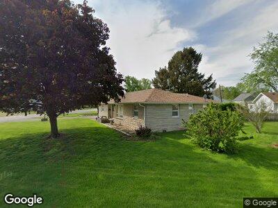
201 E Madison St Unit 1 Auburn, IL 62615
Estimated Value: $112,707 - $165,000
--
Bed
--
Bath
--
Sq Ft
4,835
Sq Ft Lot
About This Home
This home is located at 201 E Madison St Unit 1, Auburn, IL 62615 and is currently estimated at $144,427. 201 E Madison St Unit 1 is a home located in Sangamon County with nearby schools including Auburn Elementary School, Auburn Middle School, and Auburn Junior High School.
Ownership History
Date
Name
Owned For
Owner Type
Purchase Details
Closed on
Aug 10, 2020
Sold by
Deheve Shirley A
Bought by
Krug Gannedy S and Krug Jessie L
Current Estimated Value
Purchase Details
Closed on
Oct 2, 2019
Sold by
Deheve Shirley A
Bought by
Deheve Shirley A
Home Financials for this Owner
Home Financials are based on the most recent Mortgage that was taken out on this home.
Original Mortgage
$159,000
Interest Rate
4.05%
Mortgage Type
FHA
Create a Home Valuation Report for This Property
The Home Valuation Report is an in-depth analysis detailing your home's value as well as a comparison with similar homes in the area
Home Values in the Area
Average Home Value in this Area
Purchase History
| Date | Buyer | Sale Price | Title Company |
|---|---|---|---|
| Krug Gannedy S | -- | Deheve Shirley A |
Source: Public Records
Mortgage History
| Date | Status | Borrower | Loan Amount |
|---|---|---|---|
| Previous Owner | Deheve Shirley A | $159,000 |
Source: Public Records
Tax History Compared to Growth
Tax History
| Year | Tax Paid | Tax Assessment Tax Assessment Total Assessment is a certain percentage of the fair market value that is determined by local assessors to be the total taxable value of land and additions on the property. | Land | Improvement |
|---|---|---|---|---|
| 2023 | $1,381 | $40,925 | $4,432 | $36,493 |
| 2022 | $1,367 | $38,747 | $4,196 | $34,551 |
| 2021 | $1,388 | $37,211 | $4,030 | $33,181 |
| 2020 | $1,392 | $37,081 | $4,016 | $33,065 |
| 2019 | $1,398 | $36,163 | $3,917 | $32,246 |
| 2018 | $1,403 | $35,416 | $3,836 | $31,580 |
| 2017 | $1,461 | $34,103 | $3,694 | $30,409 |
| 2016 | $1,413 | $33,890 | $3,671 | $30,219 |
| 2015 | $1,452 | $33,495 | $3,628 | $29,867 |
| 2014 | $1,462 | $34,015 | $3,684 | $30,331 |
| 2013 | $1,311 | $32,897 | $3,563 | $29,334 |
Source: Public Records
Map
Nearby Homes
- 406 E Washington St
- 511 N 5th St Unit 1
- 342 Interurban St
- 716 W Monroe St Unit 1
- 520 N 6th St Unit 1
- 890 W Van Buren St
- 921 W Monroe St Unit 1
- 427 N 10th St
- 1020 W Adams St Unit 1
- 14594 Dixon Rd Unit 1
- 1390 Horse Farm Rd
- 11910 Bubbling Well Rd Unit 1
- 222 W Madison Unit 1
- 41 Covered Bridge Acres Unit 1
- 424 S Lincoln St Unit 1
- 60 Covered Bridge Acres
- 615 Henrietta
- 125 Kodiak Dr
- 0 State Route 4
- 42 Buckingham Rd Unit 1
- 201 E Madison St Unit 1
- 211 E Madison St Unit 1
- 270 E Monroe St
- 268 E Monroe St
- 107 S Springfield St Unit 1
- 270 E Madison St Unit 1
- 202 E Madison St Unit 1
- 111 S Springfield St Unit 1
- 260 E Monroe St
- 215 E Madison St Unit 1
- 208 E Madison St Unit 1
- 212 E Madison St Unit 1
- 258 E Monroe St Unit 1
- 205 S Springfield St Unit 1
- 216 E Madison St
- 254 E Monroe St Unit 1
- 271 E Monroe St
- 221 E Madison St
- 221 E Madison St Unit 1