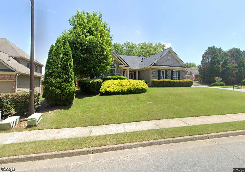
201 Elmbrook Ln Canton, GA 30114
Sutallee NeighborhoodEstimated Value: $435,538 - $457,000
3
Beds
2
Baths
1,746
Sq Ft
$256/Sq Ft
Est. Value
About This Home
This home is located at 201 Elmbrook Ln, Canton, GA 30114 and is currently estimated at $446,269, approximately $255 per square foot. 201 Elmbrook Ln is a home located in Cherokee County with nearby schools including Liberty Elementary School, Freedom Middle School, and Cherokee High School.
Ownership History
Date
Name
Owned For
Owner Type
Purchase Details
Closed on
Jun 27, 2008
Sold by
2004-Hb1 Merrill Lynch Mlcc
Bought by
Walker James C
Current Estimated Value
Home Financials for this Owner
Home Financials are based on the most recent Mortgage that was taken out on this home.
Original Mortgage
$173,375
Outstanding Balance
$110,941
Interest Rate
6.08%
Mortgage Type
New Conventional
Estimated Equity
$335,328
Purchase Details
Closed on
Mar 4, 2008
Sold by
Law Cregg A
Bought by
2004-Hb1 Merrill Lynch Mlcc
Create a Home Valuation Report for This Property
The Home Valuation Report is an in-depth analysis detailing your home's value as well as a comparison with similar homes in the area
Home Values in the Area
Average Home Value in this Area
Purchase History
| Date | Buyer | Sale Price | Title Company |
|---|---|---|---|
| Walker James C | $182,500 | -- | |
| 2004-Hb1 Merrill Lynch Mlcc | $173,184 | -- |
Source: Public Records
Mortgage History
| Date | Status | Borrower | Loan Amount |
|---|---|---|---|
| Open | Walker James C | $173,375 |
Source: Public Records
Tax History Compared to Growth
Tax History
| Year | Tax Paid | Tax Assessment Tax Assessment Total Assessment is a certain percentage of the fair market value that is determined by local assessors to be the total taxable value of land and additions on the property. | Land | Improvement |
|---|---|---|---|---|
| 2025 | $1,454 | $199,960 | $38,000 | $161,960 |
| 2024 | $813 | $159,360 | $34,000 | $125,360 |
| 2023 | $669 | $157,840 | $34,000 | $123,840 |
| 2022 | $738 | $124,040 | $30,000 | $94,040 |
| 2021 | $718 | $101,920 | $22,000 | $79,920 |
| 2020 | $696 | $95,480 | $22,000 | $73,480 |
| 2019 | $665 | $87,160 | $22,000 | $65,160 |
| 2018 | $657 | $82,000 | $20,800 | $61,200 |
| 2017 | $647 | $187,900 | $17,200 | $57,960 |
| 2016 | $664 | $185,600 | $17,200 | $57,040 |
| 2015 | $2,051 | $174,400 | $16,000 | $53,760 |
| 2014 | $1,941 | $164,700 | $14,000 | $51,880 |
Source: Public Records
Map
Nearby Homes
- 3092 Woodbridge Ln Unit 3L
- 3085 Woodbridge Ln
- 227 Elmbrook Ln Unit 3L
- 113 Gold Bridge Crossing
- 313 Meadow Lark Crossing Unit 31
- 429 Arrowhead Trail
- 619 Blackwater Ridge
- 426 Arrowhead Trail
- 251 Brookwood Dr
- 422 Arrowhead Trail
- 511 Highwater Pass
- 435 Lake Point Trace Unit 3J
- 1354 Bridgemill Ave
- 520 Waterside Ct
- 152 Gold Mill Place Unit 4F
- 273 Deer Valley Run
- 308 Deer Valley Run
- 305 Deer Valley Run
- 309 Deer Valley Run
- 252 Deer Valley Run
- 3076 Woodbridge Ln Unit 3L
- 203 Elmbrook Ln
- 200 Elmbrook Ln Unit 3L
- 205 Elmbrook Ln Unit 3L
- 202 Elmbrook Ln
- 502 Millside Trail
- 500 Millside Trail Unit 3L
- 504 Millside Trail
- 3068 Woodbridge Ln Unit 3L
- 506 Millside Trail
- 3073 Woodbridge Ln
- 3075 Woodbridge Ln
- 300 White Oak Way
- 506 Millside Tr
- 207 Elmbrook Ln
- 3071 Woodbridge Ln
- 3077 Woodbridge Ln Unit 3L
- 3069 Woodbridge Ln
- 3066 Woodbridge Ln
- 302 White Oak Way