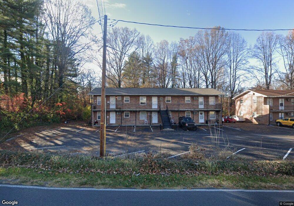
201 Forrest Cir Jonesborough, TN 37659
Estimated Value: $136,000 - $155,000
--
Bed
1
Bath
576
Sq Ft
$246/Sq Ft
Est. Value
About This Home
This home is located at 201 Forrest Cir, Jonesborough, TN 37659 and is currently estimated at $141,532, approximately $245 per square foot. 201 Forrest Cir is a home located in Washington County with nearby schools including Jonesborough Elementary School, Jonesborough Middle School, and David Crockett High School.
Ownership History
Date
Name
Owned For
Owner Type
Purchase Details
Closed on
Aug 12, 2024
Sold by
Fonberg Ignacy B and Fonberg Margaret S
Bought by
Stoots-Fonberg Chasity A and Hankerson Mario
Current Estimated Value
Purchase Details
Closed on
Jun 10, 1999
Sold by
Murray Robert D and Murray Pam R
Bought by
Ernst-Fonberg Mary Lou
Purchase Details
Closed on
May 28, 1997
Sold by
Hardin Blake and Hardin Terry
Bought by
Murray And Assoc
Home Financials for this Owner
Home Financials are based on the most recent Mortgage that was taken out on this home.
Original Mortgage
$29,000
Interest Rate
8.01%
Purchase Details
Closed on
Aug 8, 1991
Create a Home Valuation Report for This Property
The Home Valuation Report is an in-depth analysis detailing your home's value as well as a comparison with similar homes in the area
Home Values in the Area
Average Home Value in this Area
Purchase History
| Date | Buyer | Sale Price | Title Company |
|---|---|---|---|
| Stoots-Fonberg Chasity A | -- | None Listed On Document | |
| Stoots-Fonberg Chasity A | -- | None Listed On Document | |
| Ernst-Fonberg Mary Lou | $35,700 | -- | |
| Murray And Assoc | $34,900 | -- | |
| -- | $16,000 | -- |
Source: Public Records
Mortgage History
| Date | Status | Borrower | Loan Amount |
|---|---|---|---|
| Previous Owner | -- | $29,000 |
Source: Public Records
Tax History Compared to Growth
Tax History
| Year | Tax Paid | Tax Assessment Tax Assessment Total Assessment is a certain percentage of the fair market value that is determined by local assessors to be the total taxable value of land and additions on the property. | Land | Improvement |
|---|---|---|---|---|
| 2025 | $501 | $29,300 | $7,625 | $21,675 |
| 2024 | $501 | $29,300 | $7,625 | $21,675 |
| 2022 | $388 | $18,050 | $7,050 | $11,000 |
| 2021 | $605 | $18,050 | $7,050 | $11,000 |
| 2020 | $605 | $18,050 | $7,050 | $11,000 |
| 2019 | $407 | $18,050 | $7,050 | $11,000 |
| 2018 | $573 | $15,525 | $5,875 | $9,650 |
| 2017 | $573 | $15,525 | $5,875 | $9,650 |
| 2016 | $573 | $15,525 | $5,875 | $9,650 |
| 2015 | $511 | $15,525 | $5,875 | $9,650 |
| 2014 | $511 | $15,525 | $5,875 | $9,650 |
Source: Public Records
Map
Nearby Homes
- 211 Forest Cir
- Tract C3 E Jackson Blvd
- Tbd Forest Dr
- Tbd Jackson Blvd
- 110 Jackson Ln
- 121 Vines Dr
- 1113 E Jackson Blvd
- 282 Ruby Rose Ridge
- Tbd Old Boones Creek Rd
- 298 Ruby Rose Ridge
- 1299 Mccoy Cir
- 273 Ruby Rose Ridge
- 261 Ruby Rose Ridge
- 246 Ruby Rose Ridge
- 310 Ruby Rose Ridge
- 249 Ruby Rose Ridge
- 234 Ruby Rose Ridge
- 240 Ruby Rose Ridge
- 153 Marigold Ln
- 155 Marigold Ln
- 203 Forrest Cir
- 207 Forrest Dr
- 207 Forest Dr
- 301 Forest Cir
- 205 Forrest Cir
- 198 Forrest Cir
- 198 Forest Cir
- 203 Forest Dr
- 207 Forest Cir
- 200 Forrest Cir
- 207 Forrest Cir
- 303 Forrest Dr
- 202 Forrest Dr
- 1003 Shamrock Dr
- 305 Forest Dr
- 103 Forrest Dr
- 1002 Shamrock Dr
- 209 Forrest Cir
- 1005 Shamrock Dr
- 1004 Shamrock Dr
