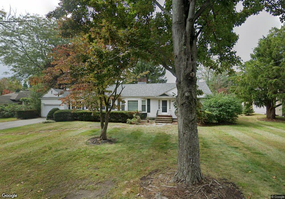
201 Holt Rd Unit a Andover, MA 01810
Phillips Academy NeighborhoodEstimated Value: $758,000 - $902,000
3
Beds
1
Bath
1,550
Sq Ft
$543/Sq Ft
Est. Value
About This Home
This home is located at 201 Holt Rd Unit a, Andover, MA 01810 and is currently estimated at $842,016, approximately $543 per square foot. 201 Holt Rd Unit a is a home located in Essex County with nearby schools including Bancroft Elementary School, Doherty Middle School, and Andover High School.
Ownership History
Date
Name
Owned For
Owner Type
Purchase Details
Closed on
Aug 20, 2004
Sold by
Kryzynski Sophie
Bought by
Ventura James and Brogna-Ventura Lizbeth
Current Estimated Value
Home Financials for this Owner
Home Financials are based on the most recent Mortgage that was taken out on this home.
Original Mortgage
$380,800
Interest Rate
6.03%
Mortgage Type
Purchase Money Mortgage
Create a Home Valuation Report for This Property
The Home Valuation Report is an in-depth analysis detailing your home's value as well as a comparison with similar homes in the area
Home Values in the Area
Average Home Value in this Area
Purchase History
| Date | Buyer | Sale Price | Title Company |
|---|---|---|---|
| Ventura James | $476,000 | -- | |
| Ventura James | $476,000 | -- |
Source: Public Records
Mortgage History
| Date | Status | Borrower | Loan Amount |
|---|---|---|---|
| Open | Ventura James | $318,000 | |
| Closed | Ventura James | $329,000 | |
| Closed | Ventura James | $346,500 | |
| Closed | Ventura James | $380,800 |
Source: Public Records
Tax History Compared to Growth
Tax History
| Year | Tax Paid | Tax Assessment Tax Assessment Total Assessment is a certain percentage of the fair market value that is determined by local assessors to be the total taxable value of land and additions on the property. | Land | Improvement |
|---|---|---|---|---|
| 2024 | $9,799 | $760,800 | $507,200 | $253,600 |
| 2023 | $9,369 | $685,900 | $456,800 | $229,100 |
| 2022 | $8,795 | $602,400 | $404,300 | $198,100 |
| 2021 | $8,406 | $549,800 | $367,500 | $182,300 |
| 2020 | $8,060 | $537,000 | $358,600 | $178,400 |
| 2019 | $7,740 | $506,900 | $344,600 | $162,300 |
| 2018 | $7,423 | $474,600 | $325,000 | $149,600 |
| 2017 | $7,050 | $464,400 | $318,600 | $145,800 |
| 2016 | $6,882 | $464,400 | $318,600 | $145,800 |
| 2015 | $6,647 | $444,000 | $306,400 | $137,600 |
Source: Public Records
Map
Nearby Homes