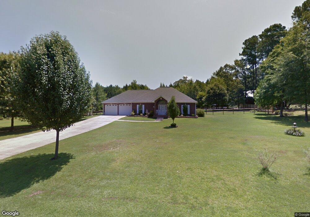
201 Mayfield Rd Ruston, LA 71270
Estimated Value: $293,000 - $391,000
3
Beds
2
Baths
1,908
Sq Ft
$181/Sq Ft
Est. Value
About This Home
This home is located at 201 Mayfield Rd, Ruston, LA 71270 and is currently estimated at $345,918, approximately $181 per square foot. 201 Mayfield Rd is a home located in Lincoln Parish with nearby schools including Glen View Elementary School, Cypress Springs Elementary School, and Ruston Junior High School.
Ownership History
Date
Name
Owned For
Owner Type
Purchase Details
Closed on
Apr 12, 2019
Sold by
Faircloth Carl A and Faircloth Paula M
Bought by
Rowell Johnny C and Rowell Suzette T
Current Estimated Value
Home Financials for this Owner
Home Financials are based on the most recent Mortgage that was taken out on this home.
Original Mortgage
$160,000
Outstanding Balance
$139,511
Interest Rate
4.3%
Mortgage Type
New Conventional
Estimated Equity
$206,407
Purchase Details
Closed on
Mar 19, 2009
Sold by
Swaim Allen Bruce and Vicknair Kathleen A
Bought by
Faircloth Carl A and Faircloth Paula M
Home Financials for this Owner
Home Financials are based on the most recent Mortgage that was taken out on this home.
Original Mortgage
$214,012
Interest Rate
5.36%
Mortgage Type
Purchase Money Mortgage
Purchase Details
Closed on
Nov 10, 2005
Sold by
Taylor Mark Anthony and Taylor Patricia Ann Chrisman
Bought by
Swaim Allen Bruce and Swaim Kathleen A
Create a Home Valuation Report for This Property
The Home Valuation Report is an in-depth analysis detailing your home's value as well as a comparison with similar homes in the area
Purchase History
| Date | Buyer | Sale Price | Title Company |
|---|---|---|---|
| Rowell Johnny C | $265,000 | -- | |
| Faircloth Carl A | $218,500 | None Available | |
| Swaim Allen Bruce | $200,000 | None Available |
Source: Public Records
Mortgage History
| Date | Status | Borrower | Loan Amount |
|---|---|---|---|
| Open | Rowell Johnny C | $160,000 | |
| Previous Owner | Faircloth Carl A | $214,012 |
Source: Public Records
Tax History
| Year | Tax Paid | Tax Assessment Tax Assessment Total Assessment is a certain percentage of the fair market value that is determined by local assessors to be the total taxable value of land and additions on the property. | Land | Improvement |
|---|---|---|---|---|
| 2025 | $2,557 | $31,130 | $6,089 | $25,041 |
| 2024 | $2,557 | $31,129 | $6,089 | $25,040 |
| 2023 | $1,976 | $23,081 | $2,661 | $20,420 |
| 2022 | $2,169 | $25,291 | $2,661 | $22,630 |
| 2021 | $2,001 | $25,290 | $2,661 | $22,629 |
| 2020 | $1,996 | $25,077 | $2,661 | $22,416 |
| 2019 | $1,946 | $25,077 | $2,661 | $22,416 |
| 2018 | $1,891 | $25,077 | $2,661 | $22,416 |
| 2017 | $1,896 | $25,077 | $2,661 | $22,416 |
| 2016 | $1,876 | $0 | $0 | $0 |
| 2015 | $1,868 | $22,753 | $2,416 | $20,337 |
| 2013 | $1,898 | $22,753 | $2,416 | $20,337 |
Source: Public Records
Map
Nearby Homes
- 136 Shade Tree Trace
- Lot 1B Unit 1 Harmony Church Rd
- 185 Mount Harmony Church Rd
- 193 Mount Harmony Church Rd
- 209 Mount Harmony Church Rd
- 180 Vz Top Farm Rd
- 144 Creeks Crossing
- 3252 Highway 821
- 128 Marlou Cir
- 173 Oak Alley Dr
- 209 Burgessville Rd
- 641 Goodgoin Rd
- 1709 Rampart Dr
- 0 English Turn
- 145 Woodshire Ln
- 2900 Post Oak Dr
- 197 Baxter Rd
- 2805 Post Oak Dr
- 294 Moody Rd
- 2420 Highway 33
- 203 Mayfield Rd
- 202 Mayfield Rd
- 115 Mayfield Rd
- 223 Mayfield Rd
- 150 Mayfield Rd
- 220 Adam Cir
- 133 Mayfield Rd
- 217 Adam Cir
- 214 Mayfield Rd
- 218 Mayfield Rd
- 103 Adam Cir
- 102 Adam Cir
- 218 Adam Cir
- 101 Mayfield Rd
- 224 Mayfield Rd
- 224 Mayfield Rd
- 1130 Highway 3072
- 232 Mayfield Rd
- 104 Adam Cir
- 1146 Highway 3072
Your Personal Tour Guide
Ask me questions while you tour the home.