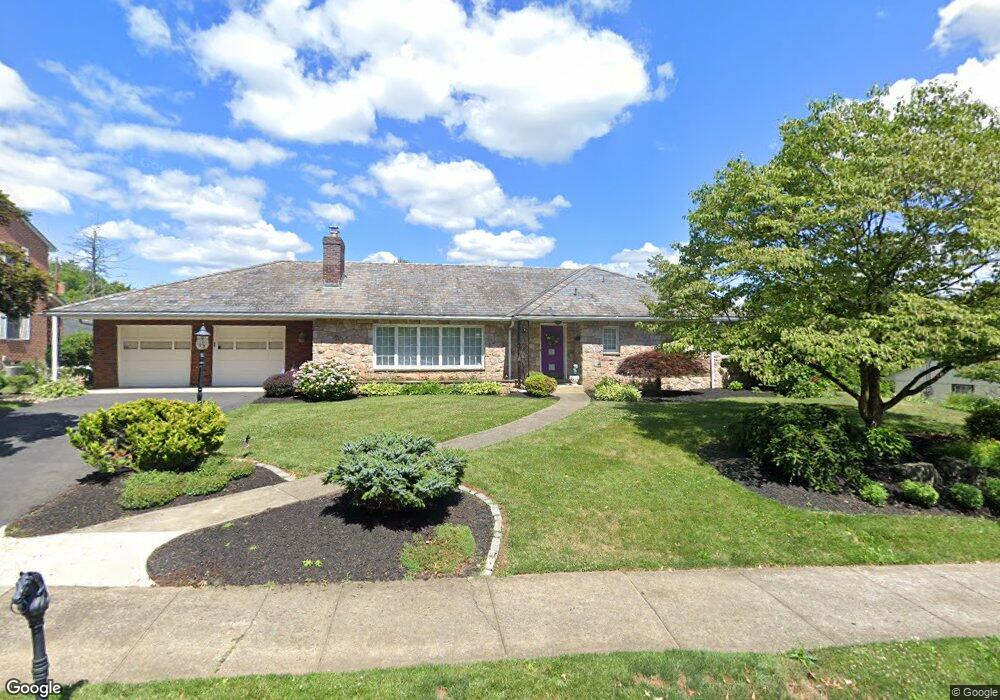
201 N 27th St Unit 211 Allentown, PA 18104
West End Allentown NeighborhoodEstimated Value: $411,000 - $479,000
3
Beds
2
Baths
1,864
Sq Ft
$240/Sq Ft
Est. Value
About This Home
This home is located at 201 N 27th St Unit 211, Allentown, PA 18104 and is currently estimated at $448,163, approximately $240 per square foot. 201 N 27th St Unit 211 is a home located in Lehigh County with nearby schools including Muhlenberg Elementary School, San Rafael Junior High School, and Trexler Middle School.
Ownership History
Date
Name
Owned For
Owner Type
Purchase Details
Closed on
Sep 25, 1995
Sold by
Perrotto Mary Lou
Bought by
Parry William J and Mary Lou
Current Estimated Value
Purchase Details
Closed on
Dec 14, 1992
Sold by
Perrotto John D and Mary Lou
Bought by
Perrotto Mary Lou
Purchase Details
Closed on
Jul 25, 1980
Bought by
Perrotto John D and Mary Lou
Create a Home Valuation Report for This Property
The Home Valuation Report is an in-depth analysis detailing your home's value as well as a comparison with similar homes in the area
Home Values in the Area
Average Home Value in this Area
Purchase History
| Date | Buyer | Sale Price | Title Company |
|---|---|---|---|
| Parry William J | -- | -- | |
| Perrotto Mary Lou | -- | -- | |
| Perrotto John D | $105,000 | -- |
Source: Public Records
Tax History Compared to Growth
Tax History
| Year | Tax Paid | Tax Assessment Tax Assessment Total Assessment is a certain percentage of the fair market value that is determined by local assessors to be the total taxable value of land and additions on the property. | Land | Improvement |
|---|---|---|---|---|
| 2025 | $7,951 | $232,300 | $40,800 | $191,500 |
| 2024 | $7,951 | $232,300 | $40,800 | $191,500 |
| 2023 | $7,951 | $232,300 | $40,800 | $191,500 |
| 2022 | $7,686 | $232,300 | $191,500 | $40,800 |
| 2021 | $7,541 | $232,300 | $40,800 | $191,500 |
| 2020 | $7,354 | $232,300 | $40,800 | $191,500 |
| 2019 | $7,242 | $232,300 | $40,800 | $191,500 |
| 2018 | $6,702 | $232,300 | $40,800 | $191,500 |
| 2017 | $6,541 | $232,300 | $40,800 | $191,500 |
| 2016 | -- | $232,300 | $40,800 | $191,500 |
| 2015 | -- | $232,300 | $40,800 | $191,500 |
| 2014 | -- | $232,300 | $40,800 | $191,500 |
Source: Public Records
Map
Nearby Homes
- 2702-2710 Liberty St Unit 2702
- 514 N Broad St Unit 520
- 525 N Main St Unit 527
- 521 N 25th St
- 615 N 27th St
- 2823 Hamilton Blvd
- 2411 Union St
- 737 N 27th St
- 2895 Hamilton Blvd Unit 104
- 303 College Dr
- 614 N 23rd St
- 2140 W Gordon St
- 525 N Leh St
- 712 N 30th St
- 2133 W Gordon St Unit 2135
- 81 S Cedar Crest Blvd
- 419 S Ott St
- 2317-2319 Elm St
- 215 S 23rd St
- 921 N 26th St
- 219 N 27th St
- 213 N 27th St Unit 221
- 2645 Parkway Blvd Unit 2649
- 2647 Parkway Blvd
- 2635 Parkway Blvd
- 210 N Ott St
- 141 N 27th St
- 2629 Parkway Blvd Unit 2639
- 220 N Ott St
- 210 N 27th St
- 146 N 27th St Unit 202
- 212 N 27th St Unit 222
- 223 N 27th St Unit 233
- 2703 Parkway Blvd Unit 2713
- 230 N Ott St
- 222 N 27th St Unit 228
- 145 N Broad St Unit 207
- 215 N Ott St Unit 223
- 232 N 27th St
- 209 N Broad St Unit 231