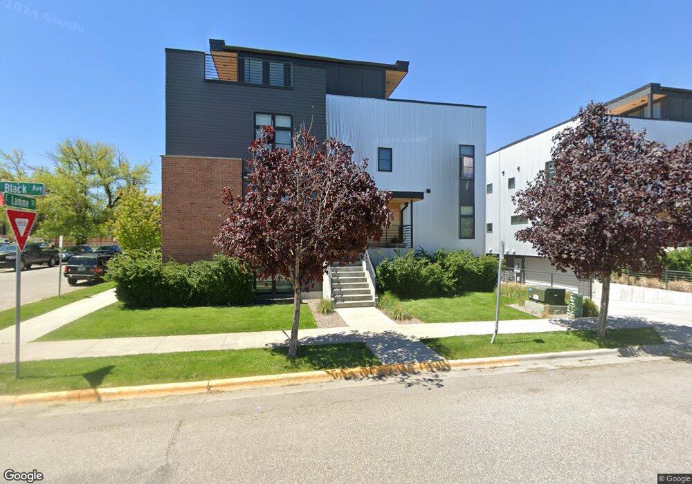
201 N Black Ave Bozeman, MT 59715
Northeast Bozeman NeighborhoodEstimated Value: $2,056,278 - $2,528,000
3
Beds
3
Baths
3,210
Sq Ft
$727/Sq Ft
Est. Value
About This Home
This home is located at 201 N Black Ave, Bozeman, MT 59715 and is currently estimated at $2,334,570, approximately $727 per square foot. 201 N Black Ave is a home located in Gallatin County with nearby schools including Lincoln Titus Elementary School, Hawthorne Elementary School, and Van Cortlandtville School.
Ownership History
Date
Name
Owned For
Owner Type
Purchase Details
Closed on
Sep 9, 2015
Sold by
Block M Llc
Bought by
Pine Jonathan and Pine Renae
Current Estimated Value
Home Financials for this Owner
Home Financials are based on the most recent Mortgage that was taken out on this home.
Original Mortgage
$700,000
Outstanding Balance
$417,459
Interest Rate
3.91%
Mortgage Type
New Conventional
Estimated Equity
$1,917,111
Create a Home Valuation Report for This Property
The Home Valuation Report is an in-depth analysis detailing your home's value as well as a comparison with similar homes in the area
Home Values in the Area
Average Home Value in this Area
Purchase History
| Date | Buyer | Sale Price | Title Company |
|---|---|---|---|
| Pine Jonathan | -- | Montana Title & Escrow |
Source: Public Records
Mortgage History
| Date | Status | Borrower | Loan Amount |
|---|---|---|---|
| Open | Pine Jonathan | $700,000 |
Source: Public Records
Tax History Compared to Growth
Tax History
| Year | Tax Paid | Tax Assessment Tax Assessment Total Assessment is a certain percentage of the fair market value that is determined by local assessors to be the total taxable value of land and additions on the property. | Land | Improvement |
|---|---|---|---|---|
| 2025 | $16,896 | $2,326,700 | $0 | $0 |
| 2024 | $11,331 | $1,702,200 | $0 | $0 |
| 2023 | $10,941 | $1,702,200 | $0 | $0 |
| 2022 | $11,817 | $1,541,058 | $0 | $0 |
| 2021 | $13,040 | $1,541,058 | $0 | $0 |
| 2020 | $11,113 | $1,304,100 | $0 | $0 |
| 2019 | $11,369 | $1,304,100 | $0 | $0 |
| 2018 | $9,106 | $968,000 | $0 | $0 |
| 2017 | $8,512 | $968,000 | $0 | $0 |
| 2016 | $8,557 | $909,376 | $0 | $0 |
| 2015 | $5,190 | $550,726 | $0 | $0 |
Source: Public Records
Map
Nearby Homes
- 19 E Lamme St
- 309 N Black Ave
- 315 N Tracy Ave Unit 207
- 315 N Tracy Ave Unit 604
- 315 N Tracy Ave Unit 306
- 315 N Tracy Ave Unit 301
- 315 N Tracy Ave Unit 403
- 315 N Tracy Ave Unit 308
- 315 N Tracy Ave Unit 406
- 315 N Tracy Ave Unit 602
- 315 N Tracy Ave Unit 303
- 315 N Tracy Ave Unit 407
- 315 N Tracy Ave Unit 508
- 315 N Tracy Ave Unit 102
- 315 N Tracy Ave Unit 202
- 315 N Tracy Ave Unit 503
- 315 N Tracy Ave Unit 408
- 315 N Tracy Ave Unit 502
- 315 N Tracy Ave Unit 107
- 5 W Mendenhall St Unit 414