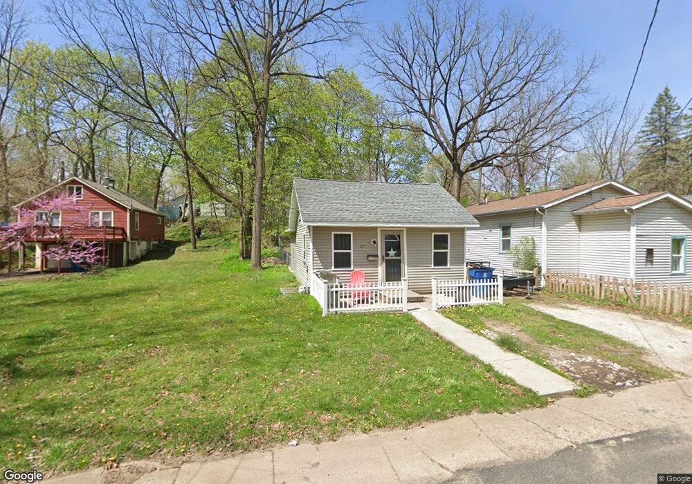
201 N Clarendon St Kalamazoo, MI 49006
Westwood NeighborhoodEstimated Value: $134,000 - $142,290
2
Beds
1
Bath
640
Sq Ft
$215/Sq Ft
Est. Value
About This Home
This home is located at 201 N Clarendon St, Kalamazoo, MI 49006 and is currently estimated at $137,823, approximately $215 per square foot. 201 N Clarendon St is a home located in Kalamazoo County with nearby schools including Northglade Montessori School, Linden Grove Middle School, and Kalamazoo Central High School.
Ownership History
Date
Name
Owned For
Owner Type
Purchase Details
Closed on
Aug 4, 2016
Sold by
Flegall Robert A and Flegal Emily B
Bought by
Flegal Robert A and Flegal Emily B
Current Estimated Value
Home Financials for this Owner
Home Financials are based on the most recent Mortgage that was taken out on this home.
Original Mortgage
$20,000
Outstanding Balance
$12,572
Interest Rate
3.41%
Mortgage Type
Credit Line Revolving
Estimated Equity
$125,251
Purchase Details
Closed on
Jul 15, 2003
Sold by
Page Patsy J
Bought by
Popham Emily B and Flegal Robert A
Home Financials for this Owner
Home Financials are based on the most recent Mortgage that was taken out on this home.
Original Mortgage
$62,505
Outstanding Balance
$26,654
Interest Rate
5.3%
Mortgage Type
FHA
Estimated Equity
$111,169
Create a Home Valuation Report for This Property
The Home Valuation Report is an in-depth analysis detailing your home's value as well as a comparison with similar homes in the area
Home Values in the Area
Average Home Value in this Area
Purchase History
| Date | Buyer | Sale Price | Title Company |
|---|---|---|---|
| Flegal Robert A | -- | Chicago Title | |
| Popham Emily B | $63,000 | Devon |
Source: Public Records
Mortgage History
| Date | Status | Borrower | Loan Amount |
|---|---|---|---|
| Open | Flegal Robert A | $20,000 | |
| Open | Popham Emily B | $62,505 |
Source: Public Records
Tax History Compared to Growth
Tax History
| Year | Tax Paid | Tax Assessment Tax Assessment Total Assessment is a certain percentage of the fair market value that is determined by local assessors to be the total taxable value of land and additions on the property. | Land | Improvement |
|---|---|---|---|---|
| 2025 | $1,648 | $53,900 | $0 | $0 |
| 2024 | $311 | $49,900 | $0 | $0 |
| 2023 | $297 | $43,700 | $0 | $0 |
| 2022 | $1,500 | $39,300 | $0 | $0 |
| 2021 | $1,409 | $35,100 | $0 | $0 |
| 2020 | $1,386 | $31,900 | $0 | $0 |
| 2019 | $1,324 | $28,900 | $0 | $0 |
| 2018 | $1,290 | $26,200 | $0 | $0 |
| 2017 | $0 | $26,200 | $0 | $0 |
| 2016 | -- | $25,300 | $0 | $0 |
| 2015 | -- | $24,900 | $0 | $0 |
| 2014 | -- | $23,300 | $0 | $0 |
Source: Public Records
Map
Nearby Homes
- 204 Nelson Ave
- 2010 Commonwealth Ave
- 426 Pinehurst Blvd
- 1709 Jefferson Ave
- 1605 W North St
- 1455 W North St
- 2306 Kenwood St
- 1416 Forbes St
- 115 Monroe St
- 204 Monroe St
- 124 Lanark Ct Unit 64
- 150 Carberry Hill Ct Unit C
- 154 Carberry Hill Ct Unit 43
- 113 Inverness Ct
- 141 Selkirk Ct Unit 103
- 629 Jefferson Place
- 1108 Warren Place
- 508 Monroe St
- 1338 Summit Ave
- 1209 Grand Ave
- 205 N Clarendon St
- 131 N Clarendon St
- 211 N Clarendon St
- 204 N Dartmouth St
- 136 N Dartmouth St
- 128 N Dartmouth St
- 210 N Dartmouth St
- 219 N Clarendon St
- 204 N Clarendon St
- 218 N Dartmouth St
- 132 N Clarendon St
- 122 N Dartmouth St
- 212 N Clarendon St
- 126 N Clarendon St
- 111 N Clarendon St
- 111 N Clarendon St Unit B
- 227 N Clarendon St
- 120 N Clarendon St
- 230 N Clarendon St
- 1924 Grove St