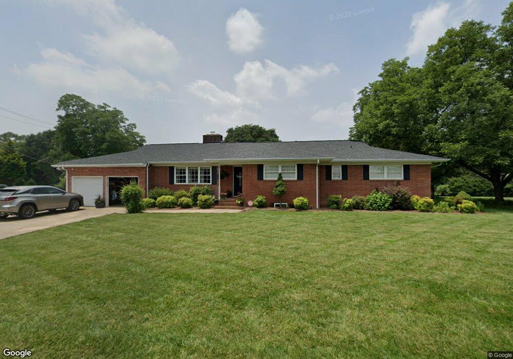
201 N Roxford Rd Kings Mountain, NC 28086
Estimated Value: $338,000 - $451,000
--
Bed
--
Bath
2,657
Sq Ft
$139/Sq Ft
Est. Value
About This Home
This home is located at 201 N Roxford Rd, Kings Mountain, NC 28086 and is currently estimated at $368,566, approximately $138 per square foot. 201 N Roxford Rd is a home located in Cleveland County with nearby schools including North Elementary School, Kings Mountain Intermediate School, and Kings Mountain Middle.
Ownership History
Date
Name
Owned For
Owner Type
Purchase Details
Closed on
May 28, 2015
Sold by
Johnson Jill S
Bought by
Foy Charles and Bowman Dana
Current Estimated Value
Purchase Details
Closed on
Jan 1, 2009
Sold by
Leonell Jill Strickland and Leonell John Jeffrey
Bought by
Leonell Jill Strickland and Leonell John Jeffrey
Purchase Details
Closed on
Oct 9, 2006
Sold by
Dreeden Enterprises A Nc General Parters
Bought by
Joeinson Jill S
Create a Home Valuation Report for This Property
The Home Valuation Report is an in-depth analysis detailing your home's value as well as a comparison with similar homes in the area
Home Values in the Area
Average Home Value in this Area
Purchase History
| Date | Buyer | Sale Price | Title Company |
|---|---|---|---|
| Foy Charles | $97,000 | None Available | |
| Leonell Jill Strickland | -- | None Available | |
| Joeinson Jill S | $103,000 | None Available |
Source: Public Records
Tax History Compared to Growth
Tax History
| Year | Tax Paid | Tax Assessment Tax Assessment Total Assessment is a certain percentage of the fair market value that is determined by local assessors to be the total taxable value of land and additions on the property. | Land | Improvement |
|---|---|---|---|---|
| 2025 | $3,895 | $379,977 | $31,638 | $348,339 |
| 2024 | $2,186 | $185,098 | $25,310 | $159,788 |
| 2023 | $1,621 | $185,098 | $25,310 | $159,788 |
| 2022 | $2,083 | $185,098 | $25,310 | $159,788 |
| 2021 | $1,621 | $142,777 | $25,310 | $117,467 |
| 2020 | $1,334 | $114,065 | $20,856 | $93,209 |
| 2019 | $1,334 | $114,065 | $20,856 | $93,209 |
| 2018 | $1,333 | $114,065 | $20,856 | $93,209 |
| 2017 | $1,326 | $114,065 | $20,856 | $93,209 |
| 2016 | $1,330 | $114,065 | $20,856 | $93,209 |
| 2015 | $1,410 | $124,243 | $20,248 | $103,995 |
| 2014 | $1,410 | $124,243 | $20,248 | $103,995 |
Source: Public Records
Map
Nearby Homes
- 208 Victoria Cir
- 1301 Shelby Rd
- 117 Parker Claire Ln
- 111 Parker Claire Ln
- 213 Parker Claire Ln
- 442 Phifer Rd
- 417 Phifer Rd
- 1500 Shelby Rd
- 1417 Merrimont Ave
- 521 Coman Ln
- 430 Fulton Dr
- 811 W Gold St Unit 26
- 1610 Shelby Rd
- 1427 Merrimont Ave
- 155 Patterson Rd
- 804 Lee St
- Plan 2338 at Cottages at Clovis Point
- Plan 2723 at Cottages at Clovis Point
- Plan 2539 at Cottages at Clovis Point
- Plan 1844 at Cottages at Clovis Point
- 109 N Roxford Rd
- 1012 Sherwood Ln
- 111 N Roxford Rd
- 1203 Suzanne St
- 1205 Suzanne St
- 107 N Roxford Rd
- 1017 Sherwood Ln
- 205 N Roxford Rd
- 202 N Roxford Rd
- 1207 Suzanne St
- 102 N Roxford Rd
- 204 N Roxford Rd
- 1202 Shelby Rd
- 1209 Suzanne St
- 1015 Sherwood Ln
- 1008 Sherwood Ln
- 106 Garrison Dr
- 106 Garrison Dr
- 102 Garrison Dr
- 1110 Shelby Rd