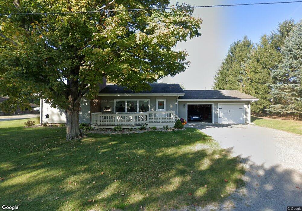
201 N Silver St Waynesfield, OH 45896
Estimated Value: $116,000 - $154,745
3
Beds
1
Bath
1,247
Sq Ft
$106/Sq Ft
Est. Value
About This Home
This home is located at 201 N Silver St, Waynesfield, OH 45896 and is currently estimated at $132,686, approximately $106 per square foot. 201 N Silver St is a home located in Auglaize County with nearby schools including Waynesfield-Goshen Local Elementary School and Waynesfield-Goshen Local High School.
Ownership History
Date
Name
Owned For
Owner Type
Purchase Details
Closed on
Sep 23, 2015
Sold by
Babcock Daniel J and Babcock Kevin L
Bought by
Winegardner Justine E
Current Estimated Value
Home Financials for this Owner
Home Financials are based on the most recent Mortgage that was taken out on this home.
Original Mortgage
$74,100
Outstanding Balance
$58,061
Interest Rate
3.84%
Mortgage Type
Purchase Money Mortgage
Estimated Equity
$74,625
Purchase Details
Closed on
Nov 10, 1997
Sold by
Babcock Nelson Victor
Bought by
Babcock Patricia L
Create a Home Valuation Report for This Property
The Home Valuation Report is an in-depth analysis detailing your home's value as well as a comparison with similar homes in the area
Home Values in the Area
Average Home Value in this Area
Purchase History
| Date | Buyer | Sale Price | Title Company |
|---|---|---|---|
| Winegardner Justine E | $78,000 | Superior Title | |
| Babcock Patricia L | -- | -- |
Source: Public Records
Mortgage History
| Date | Status | Borrower | Loan Amount |
|---|---|---|---|
| Open | Winegardner Justine E | $74,100 |
Source: Public Records
Tax History Compared to Growth
Tax History
| Year | Tax Paid | Tax Assessment Tax Assessment Total Assessment is a certain percentage of the fair market value that is determined by local assessors to be the total taxable value of land and additions on the property. | Land | Improvement |
|---|---|---|---|---|
| 2024 | $2,547 | $39,360 | $6,110 | $33,250 |
| 2023 | $711 | $39,360 | $6,110 | $33,250 |
| 2022 | $1,253 | $28,890 | $5,500 | $23,390 |
| 2021 | $608 | $28,890 | $5,500 | $23,390 |
| 2020 | $1,219 | $28,893 | $5,502 | $23,391 |
| 2019 | $994 | $24,077 | $4,585 | $19,492 |
| 2018 | $970 | $24,077 | $4,585 | $19,492 |
| 2017 | $966 | $24,077 | $4,585 | $19,492 |
| 2016 | $948 | $24,371 | $4,368 | $20,003 |
| 2015 | $616 | $24,371 | $4,368 | $20,003 |
| 2014 | $638 | $24,371 | $4,368 | $20,003 |
| 2013 | $680 | $24,371 | $4,368 | $20,003 |
Source: Public Records
Map
Nearby Homes
- 202 W Mulberry St
- 105 Guthrie St
- 25836 Ohio 67
- 22275 Buckland Holden Rd
- 8150 Amherst Rd
- 5065 Amherst Rd
- 20630 State Route 67
- 17 E Walnut St
- 37 N Main St
- 0 Ohio 67
- 7165 Faulkner Rd
- 6616 Bellefontaine Rd
- 6381 McPheron Rd
- 11352 N Township Road 88
- E Hanthorn Rd
- 5600 E Hanthorn Rd
- 12102 Shannon Dr Unit 89
- 12015 Holly Dr
- 11579 Cooper Ave
- 0 Ohio 235
- 214 N Silver St
- 103 N Silver St
- 102 Guthrie St
- 407 N Westminster St
- 101 Guthrie St
- 501 N Westminster St
- 405 N Westminster St
- 156 N Silver St
- 403 N Westminster St
- 503 N Westminster St
- 104 Guthrie St
- 401 N Westminster St
- 408 N Westminster St
- 106 Guthrie St
- 248 N Silver St
- 404 N Westminster St
- 507 N Westminster St
- 109 Guthrie St