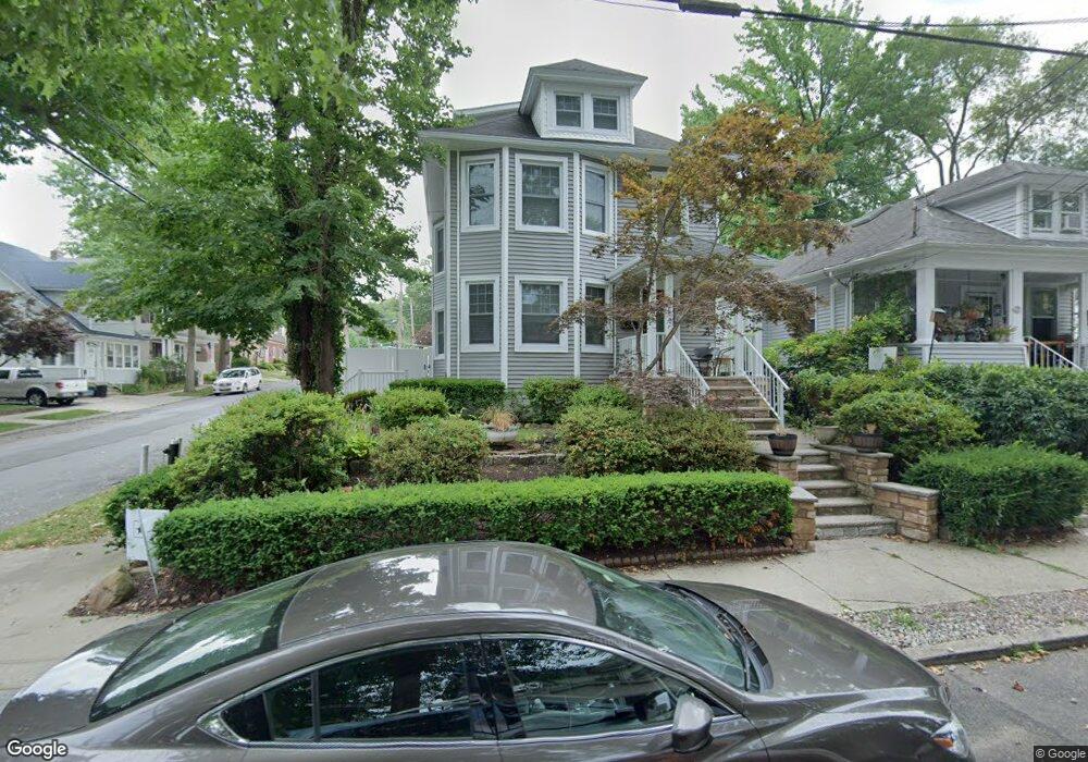
201 Neal Dow Ave Staten Island, NY 10314
Westerleigh NeighborhoodEstimated Value: $653,117 - $742,000
--
Bed
4
Baths
1,240
Sq Ft
$556/Sq Ft
Est. Value
About This Home
This home is located at 201 Neal Dow Ave, Staten Island, NY 10314 and is currently estimated at $689,279, approximately $555 per square foot. 201 Neal Dow Ave is a home located in Richmond County with nearby schools including P.S. 30 Westerleigh, I.S. 51 Edwin Markham, and Port Richmond High School.
Ownership History
Date
Name
Owned For
Owner Type
Purchase Details
Closed on
Mar 8, 2019
Sold by
Dick John R and Estate Of Robert Edward Dicks
Bought by
Warren James and Warren Brienne
Current Estimated Value
Home Financials for this Owner
Home Financials are based on the most recent Mortgage that was taken out on this home.
Original Mortgage
$360,000
Interest Rate
4.3%
Mortgage Type
New Conventional
Purchase Details
Closed on
Oct 2, 2000
Sold by
Dick John
Bought by
Dicks Robert E
Create a Home Valuation Report for This Property
The Home Valuation Report is an in-depth analysis detailing your home's value as well as a comparison with similar homes in the area
Home Values in the Area
Average Home Value in this Area
Purchase History
| Date | Buyer | Sale Price | Title Company |
|---|---|---|---|
| Warren James | $450,000 | Wfg National Title Ins Co | |
| Dicks Robert E | -- | -- |
Source: Public Records
Mortgage History
| Date | Status | Borrower | Loan Amount |
|---|---|---|---|
| Closed | Warren James | $360,000 |
Source: Public Records
Tax History Compared to Growth
Tax History
| Year | Tax Paid | Tax Assessment Tax Assessment Total Assessment is a certain percentage of the fair market value that is determined by local assessors to be the total taxable value of land and additions on the property. | Land | Improvement |
|---|---|---|---|---|
| 2025 | $6,483 | $42,720 | $11,822 | $30,898 |
| 2024 | $6,483 | $41,640 | $11,442 | $30,198 |
| 2023 | $6,185 | $30,456 | $11,670 | $18,786 |
| 2022 | $5,810 | $38,160 | $14,760 | $23,400 |
| 2021 | $6,074 | $35,460 | $14,760 | $20,700 |
| 2020 | $6,035 | $34,560 | $14,760 | $19,800 |
| 2019 | $5,627 | $33,840 | $14,760 | $19,080 |
| 2018 | $4,876 | $25,380 | $12,742 | $12,638 |
| 2017 | $4,644 | $24,252 | $13,258 | $10,994 |
| 2016 | $4,498 | $24,052 | $13,356 | $10,696 |
| 2015 | $3,997 | $23,761 | $11,729 | $12,032 |
| 2014 | $3,997 | $22,417 | $11,685 | $10,732 |
Source: Public Records
Map
Nearby Homes
- 204 Demorest Ave
- 0 Willard Ave
- 251 Saint John Ave
- 249 Dickie Ave
- 279 Saint John Ave
- 282 Willard Ave
- 284 Bidwell Ave
- 116 Bidwell Ave
- 262 Maine Ave
- 14 Leonard Ave
- 307 Clinton B Fiske Ave
- 307 Fiske Ave
- 751 Jewett Ave Unit 17
- 751 Jewett Ave
- 202 Watchogue Rd
- 349 College Ave
- 159 North Ave
- 127 Glascoe Ave
- 63 Avon Ln
- 325 College Ave
- 205 Neal Dow Ave
- 202 Saint John Ave
- 209 Neal Dow Ave
- 206 Saint John Ave
- 133 Lathrop Ave
- 210 Saint John Ave
- 131 Lathrop Ave
- 200 Neal Dow Ave
- 211 Neal Dow Ave
- 123 Lathrop Ave
- 208 Neal Dow Ave
- 141 Lathrop Ave
- 214 Saint John Ave
- 119 Lathrop Ave
- 217 Neal Dow Ave
- 149 Lathrop Ave
- 216 Neal Dow Ave
- 216 Saint John Ave
- 132 Springfield Ave
- 128 Springfield Ave