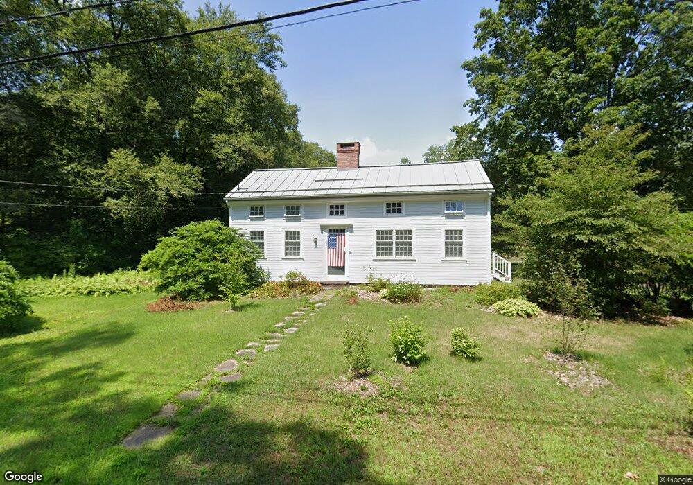
201 Old Sunderland Rd Montague, MA 01351
Estimated Value: $464,000 - $526,000
3
Beds
3
Baths
1,456
Sq Ft
$333/Sq Ft
Est. Value
About This Home
This home is located at 201 Old Sunderland Rd, Montague, MA 01351 and is currently estimated at $484,705, approximately $332 per square foot. 201 Old Sunderland Rd is a home located in Franklin County.
Ownership History
Date
Name
Owned For
Owner Type
Purchase Details
Closed on
Apr 9, 2019
Sold by
Craven Barbara L Est and Sheehan
Bought by
Wright Elinor S
Current Estimated Value
Purchase Details
Closed on
Sep 11, 2013
Sold by
Michael G Schwartz Ret and Schwartz
Bought by
Wright Elinor S
Home Financials for this Owner
Home Financials are based on the most recent Mortgage that was taken out on this home.
Original Mortgage
$231,000
Interest Rate
4.43%
Mortgage Type
New Conventional
Purchase Details
Closed on
Oct 21, 2011
Sold by
Schwartz Michael G
Bought by
Michael G Schwartz Ret and Schwartz
Purchase Details
Closed on
Apr 22, 2003
Sold by
Kornegay William
Bought by
Schwartz Michael G and Kornegay William
Create a Home Valuation Report for This Property
The Home Valuation Report is an in-depth analysis detailing your home's value as well as a comparison with similar homes in the area
Home Values in the Area
Average Home Value in this Area
Purchase History
| Date | Buyer | Sale Price | Title Company |
|---|---|---|---|
| Wright Elinor S | $320,000 | -- | |
| Wright Elinor S | $320,000 | -- | |
| Wright Elinor S | $385,000 | -- | |
| Wright Elinor S | $385,000 | -- | |
| Michael G Schwartz Ret | -- | -- | |
| Michael G Schwartz Ret | -- | -- | |
| Schwartz Michael G | -- | -- | |
| Schwartz Michael G | -- | -- |
Source: Public Records
Mortgage History
| Date | Status | Borrower | Loan Amount |
|---|---|---|---|
| Previous Owner | Wright Elinor S | $231,000 |
Source: Public Records
Tax History Compared to Growth
Tax History
| Year | Tax Paid | Tax Assessment Tax Assessment Total Assessment is a certain percentage of the fair market value that is determined by local assessors to be the total taxable value of land and additions on the property. | Land | Improvement |
|---|---|---|---|---|
| 2025 | $5,387 | $354,200 | $100,700 | $253,500 |
| 2024 | $5,162 | $328,800 | $100,700 | $228,100 |
| 2023 | $5,036 | $321,800 | $100,700 | $221,100 |
| 2022 | $4,929 | $294,100 | $100,700 | $193,400 |
| 2021 | $4,093 | $234,700 | $86,700 | $148,000 |
| 2020 | $67 | $213,400 | $86,700 | $126,700 |
| 2019 | $3,709 | $216,500 | $95,500 | $121,000 |
| 2018 | $3,601 | $210,700 | $95,500 | $115,200 |
| 2017 | $3,512 | $210,700 | $95,500 | $115,200 |
| 2016 | $3,533 | $200,600 | $91,400 | $109,200 |
| 2015 | $3,402 | $200,600 | $91,400 | $109,200 |
| 2014 | $3,278 | $200,600 | $91,400 | $109,200 |
Source: Public Records
Map
Nearby Homes
- 2 Gunn Rd
- 2 Gunn Rd
- 495 Federal St Unit B
- 134 Montague Rd
- 35 A N Leverett Rd
- 0 Pocumtuck Dr Unit 73379330
- 39 N Leverett Rd
- 132 Meadow Rd
- 64 Main St
- 7 Stage Rd
- 238 N Main St
- 345 Greenfield Rd
- 208 Greenfield Rd
- 13 Capt Lathrop Dr
- 10 Hannabrooke Dr
- 40 Eastern Ave
- 33 Eastern Ave
- 15 Crestview Dr
- Lot C Mountain Rd
- Lot A Mountain Rd
- 199 Old Sunderland Rd
- 209 Old Sunderland Rd
- 209 Old Sunderland Rd
- 312 Meadow Rd
- Lot A Meadow Rd
- 336 Falls Rd
- 304 Meadow Rd
- 159 Old Sunderland Rd
- 49 Whitmore Ferry Rd
- 49 Whitmore Ferry Rd
- 43 Whitmore Ferry Rd
- 324 Falls Rd
- 32 Fosters Rd
- 158 Old Sunderland Rd
- 50 Whitmore Ferry Rd
- 151 Old Sunderland Rd
- 152 Old Sunderland Rd
- 293 Meadow Rd
- 312 Falls Rd
- 144 Taylor Hill Rd